

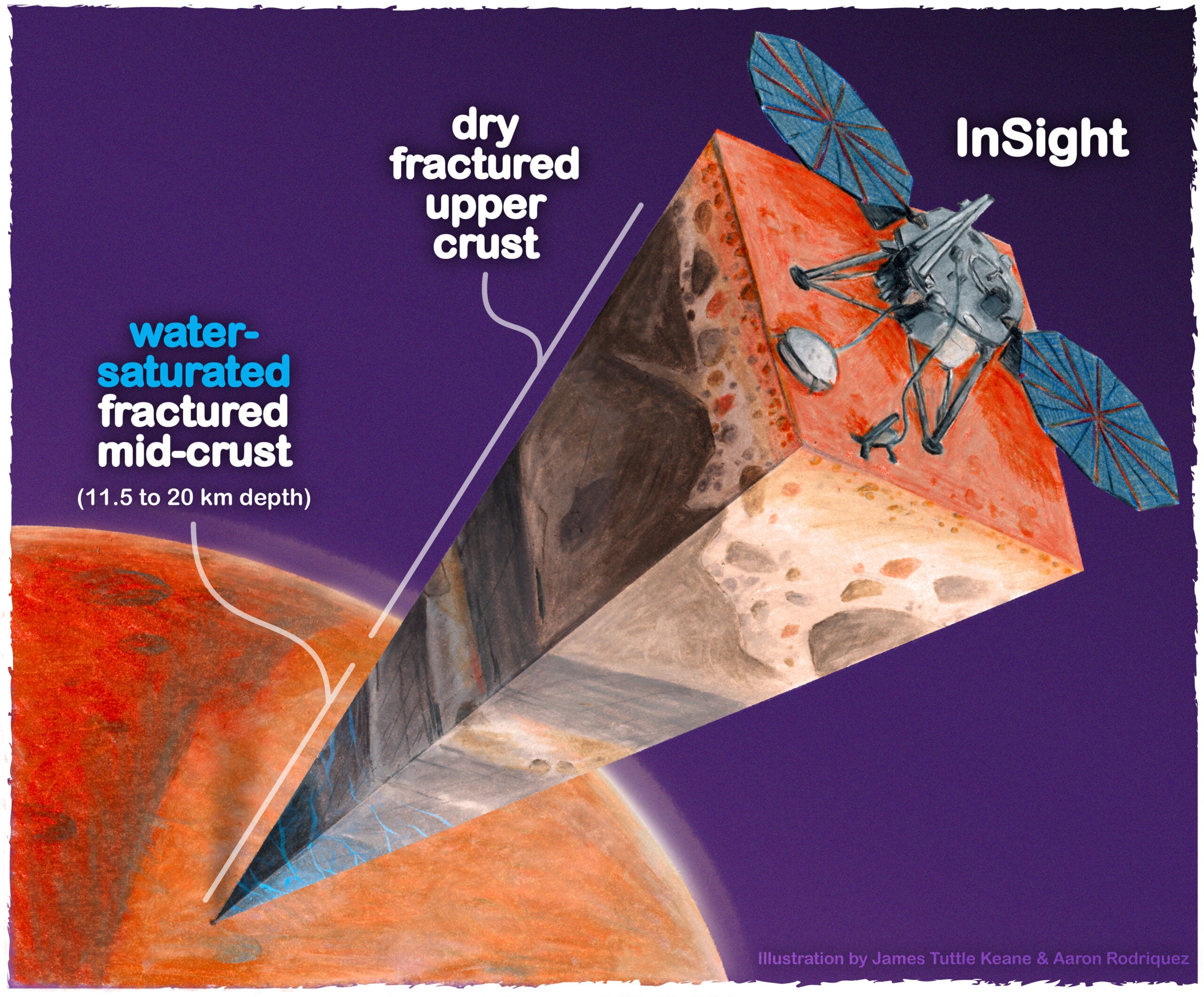
Mars may be hiding a tremendous amount of liquid water, but almost certainly not as a buried sea. A 2024 analysis of NASA’s InSight data found that the measurements were best matched by fractured igneous rock whose tiny cracks and pores were filled with water between roughly 11.5 and 20 kilometres below the surface.
If a similar layer extends around the planet, its water would be sufficient to cover Mars to a depth of about one to two kilometres. That is where the remarkable figure in the headline comes from. It is also where care is needed: InSight listened from one place, and the planet-wide total is an extrapolation from that local result.
InSight heard rock, not water
InSight’s seismometer recorded waves from marsquakes and meteorite impacts. Compressional and shear waves travel at different speeds through materials with different densities, porosities and fluid contents, so the recordings can reveal something about the rock they crossed. The researchers combined seismic constraints with estimates of crustal density, then used a Bayesian inversion to test which mixtures of rock, pore shapes and fluid saturation could reproduce them.
For Vashan Wright, Matthias Morzfeld and Michael Manga, water-saturated fractured igneous rock provided the most plausible fit under the model they selected. Their paper in Proceedings of the National Academy of Sciences is therefore an inference about the Martian mid-crust, not a direct detection. No camera saw the water, no drill reached it and no sample was chemically tested.
How one landing site produced a planet-wide number
The proposed one-to-two-kilometre layer is a bookkeeping device. Imagine extracting water from every microscopic fracture and spreading it evenly over Mars. Under the original team’s assumptions, the resulting layer would be that deep. In reality, any water would be dispersed through solid rock, more like groundwater held in a vast fractured formation than an ocean with an open surface.
Making the calculation global also assumes that the crust under InSight at Elysium Planitia is broadly representative of the rest of Mars. That could be correct, but a single seismic station cannot demonstrate it. The Scripps Institution summary of the work said a water-saturated mid-crust best explained the available data while acknowledging the need for better constraints on Martian mineralogy and crustal composition. The finding is worth taking seriously, but it should not be read as the final word.
A newer analysis shows how uncertain the answer remains
In 2026, a team tested just how much those assumptions matter. Its analysis in Earth and Planetary Science Letters ran eight rock-physics models against three sets of seismic inputs. The inferred global-equivalent water layer ranged from nearly zero to about 3.2 kilometres. The model-data combination the authors considered most parsimonious produced negligible crustal water, although they described even that answer as highly uncertain.
This does not prove that the 2024 interpretation was wrong. It demonstrates that the same broad seismic evidence does not yet identify water uniquely when the rock’s mineral mix, cracks and pore geometry are imperfectly known. A 2021 study of InSight’s shallower crust found a related ambiguity: gas-filled and liquid-filled pores could both match the measured shear-wave speed within its uncertainty.
Mars keeps offering signals rather than samples
That distinction has become a recurring theme in Martian water research. In our recent account of radar observations beneath Mars’s south pole, one orbital instrument recorded an extraordinarily bright reflection while another saw only a faint echo from the same layer. Liquid water remains one candidate, but unusual rock and radar effects have not been excluded.
Near the surface, the quantities and conditions are very different. Our report on Viking 2 frost possibly creating tiny perchlorate brines concerned seasonal films or pools around one lander. The InSight interpretation concerns an immense, persistent reservoir many kilometres down. Both depend on modelling, but they should not be folded into a single claim that Mars has accessible liquid water.
The deeper proposal does fit one possibility raised in our earlier look at where Mars’s ancient water went. Some was stripped into space, while some may remain as ice, water bound into minerals or fluid deeper in the crust. The unanswered part is how much occupies each reservoir and in what form.
Eleven kilometres might as well be another world
The upper edge of the proposed layer is about 11,500 metres down. NASA says the deepest rover drilling on Mars has reached about seven centimetres. InSight itself carried a self-hammering heat probe meant to descend three to five metres, but the soil could not provide the friction it needed and the probe advanced only a few tens of centimetres.
This is why the possible water should not be advertised as a resource for early crews. Near-surface ice could be useful. Water between 11.5 and 20 kilometres down is beyond any drilling system built for Mars, and reaching it would demand heavy equipment, abundant power and repair capacity that no planned mission can deliver.
A liquid reservoir at that depth would also be scientifically compelling because rock would shield it from surface radiation. It could mark a potentially habitable environment, but habitability is not evidence that anything lives there. Researchers would still need to establish that the water exists, determine its chemistry and temperature, and learn whether nutrients and usable energy reach it.
InSight has left planetary science with a serious hypothesis and an enormous conditional number. The 2026 reanalysis has supplied an equally important correction: the water estimate is sensitive to how scientists model an unseen crust. Resolving it will require better seismic coverage, firmer laboratory measurements of Martian rock analogues and, eventually, observations much closer to the source.