On October 24, 1946, a 35mm DeVry motion picture camera bolted into the nose of a captured German V-2 rocket clicked through a single frame every second-and-a-half as the missile arced 105 kilometres above the New Mexico desert. The rocket fell back to Earth and shattered against the gypsum flats of White Sands Missile Range at several times the speed of sound. The camera was pulverised. But the steel film cassette, engineered to survive exactly that kind of impact, was found intact in the wreckage. The black-and-white frames spooled inside it were the first photographs of Earth ever taken from space.
The word “astronaut” existed in 1946. The word “satellite” existed. The phrase “outer space” had been in the language for decades. But there was no agreed altitude at which space began. The Kármán line, the 100-kilometre boundary now used as the conventional edge of space, would not be articulated as a formal threshold until the late 1950s, with the Fédération Aéronautique Internationale adopting it as the working boundary between aeronautics and astronautics in the early 1960s. The engineers at White Sands had built a machine that crossed a frontier their own profession had not yet drawn.
A camera bolted to a weapon
The V-2 in question was one of roughly a hundred rockets the U.S. Army assembled from German parts — components shipped to the United States after the war in some three hundred rail cars and reassembled in New Mexico under a program that brought along many of the engineers who had built them. The Army wanted to learn how to fly long-range ballistic missiles. The scientists who got the spare flights — the ones not needed for guidance or propulsion testing — wanted something else. They wanted to put instruments into a region of the atmosphere no instrument had ever reached.
The Applied Physics Laboratory at Johns Hopkins ran the upper-atmosphere science program. Clyde Holliday, an engineer there, designed the camera mount that would ride in the warhead bay where, a year earlier, an amatol explosive charge would have sat. The camera was a 35mm DeVry — a sturdy newsreel model, the kind of camera a wartime correspondent might have lugged across a beachhead. Holliday’s modification was simple. Shoot one frame every second-and-a-half. Spool the film into a steel cassette built to survive the rocket’s terminal dive.
The rocket did not have to survive. The film did.
What the frames actually showed
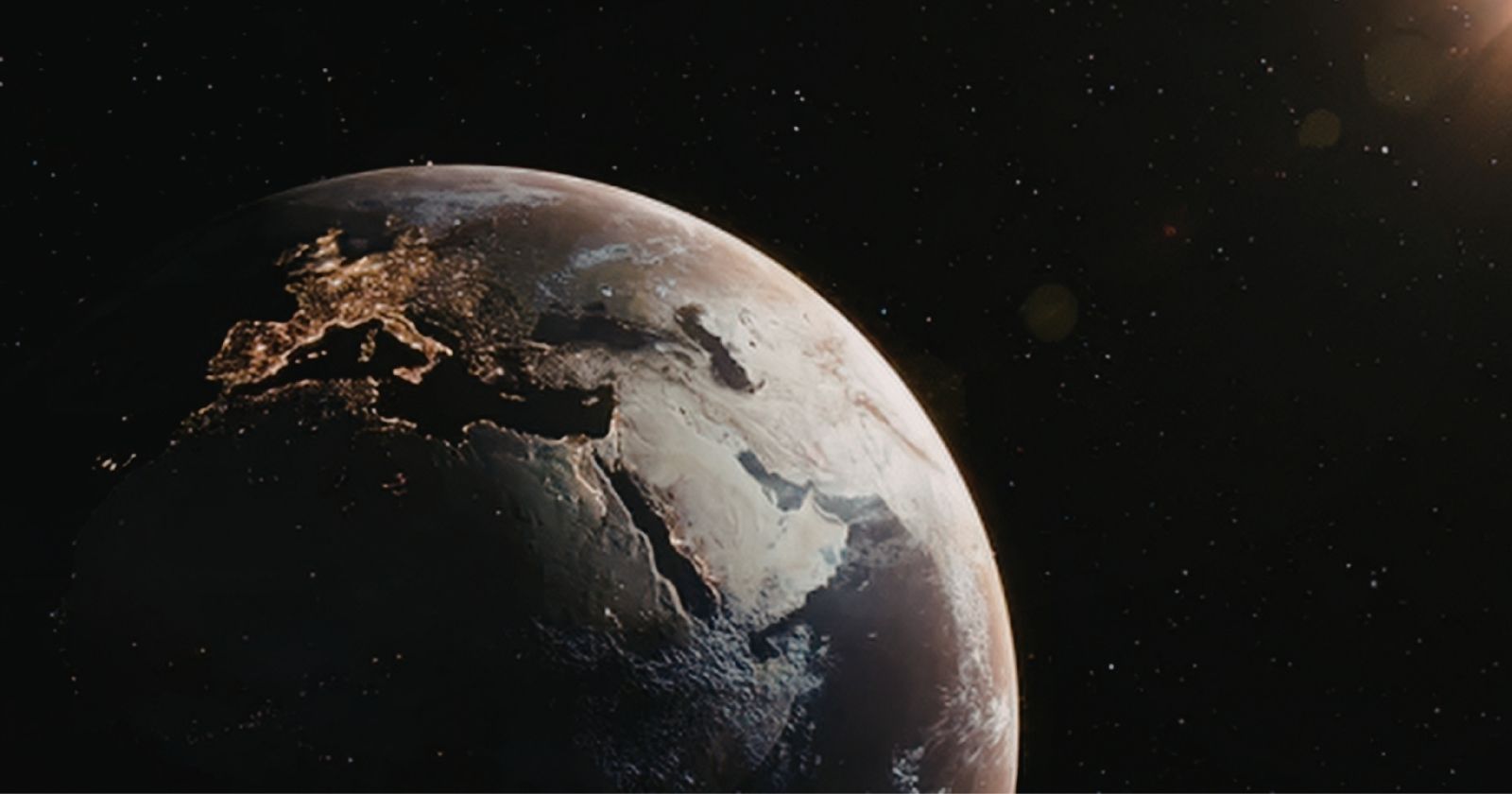
The October 24 launch reached an apogee of 65 miles — about 105 kilometres — over the Tularosa Basin. From that altitude the camera saw roughly 40,000 square miles of Earth at once. The horizon, in the recovered frames, is a clean curve. Cloud banks streak across the southwestern United States. The desert below is a wash of grey-on-grey, with the rugged terrain around El Paso and the dark thread of the Rio Grande just discernible.
The images are not beautiful in any conventional sense. They are grainy, scratched, partly fogged. But they did something no painting, no schematic, no pilot’s anecdotal report had ever done. They showed Earth as a curved body sitting against the blackness above its atmosphere. In a 1950 National Geographic article, quoted years later in Smithsonian’s Air & Space, Holliday described the pictures as showing what Earth would look like to visitors from another planet arriving in a space ship.
That was the language available to him. Visitors. Space ship. The vocabulary of pulp fiction, used because there was not yet a vocabulary of fact.
Why a Nazi rocket took the picture
The V-2 — Vergeltungswaffe 2, “Vengeance Weapon 2” — was the world’s first long-range ballistic missile. Developed at Peenemünde under Wernher von Braun, it was used by Nazi Germany to bomb London, Antwerp, and other Allied cities in the final year of the war. Roughly 3,000 were fired in anger. The forced-labour program that built them at the Mittelwerk facility killed more people in its construction than the rockets killed in flight.
When Germany collapsed in May 1945, the United States, the Soviet Union, and Britain raced to seize the surviving rockets, components, and engineers. The American haul, gathered under Operation Paperclip, included von Braun himself and enough V-2 components to build about a hundred test rockets — enough to support years of flights. The Army selected White Sands Proving Ground, established in July 1945, as the test site because the basin was vast, dry, sparsely populated, and ringed by mountains that contained errant trajectories.
The first American V-2 launch from White Sands had taken place on April 16, 1946. The rocket that carried Holliday’s camera on October 24 was V-2 number 13 — one of more than a dozen the Army would fly from the range before the end of that year.
The man with the film cassette
The recovery team drove out into the gypsum after the impact. They found a crater, mangled metal, and — eventually — the steel cassette. Fred Rulli, a 19-year-old enlisted man on the recovery crew, later recalled that the scientists reacted with great excitement when the film was developed. Rulli described them celebrating enthusiastically, behaving like excited children. The interview, reported by Smithsonian’s Air & Space, captures something about the moment that is easy to lose under decades of accumulated space-program gravitas. The men who did this were not somber pioneers in flight suits. They were engineers and GIs in the desert, watching a slideshow of frames nobody on Earth had ever seen before, and behaving the way anyone would.
Before the boundary had a name
Before October 24, 1946, the highest-altitude photograph of Earth had been taken from a balloon. The Explorer II helium balloon, launched in 1935 by the National Geographic Society and the U.S. Army Air Corps, had photographed the horizon from 22 kilometres. That altitude is in the lower stratosphere — roughly twice the cruising altitude of a modern commercial airliner. A balloon photograph of Earth shows a curved horizon and atmospheric haze and looks, to a modern viewer, like a slightly tilted airline window.
Holliday’s V-2 frames quintupled that altitude in a single afternoon. The improvement was so large it broke the existing scale. A 105-kilometre photograph shows the curvature of the planet against vacuum.
The Kármán line was not invented in 1946. The 100-kilometre threshold grew out of calculations Theodore von Kármán was working through in the 1950s — the altitude at which an aircraft would have to travel faster than orbital velocity to generate aerodynamic lift, meaning, in effect, that above that altitude you are no longer flying, you are orbiting. Andrew Haley, the world’s first space lawyer, formalised the idea in print in the late 1950s and named it the Kármán line. The Fédération Aéronautique Internationale adopted 100 kilometres as the working boundary between aeronautics and astronautics in the early 1960s.
Which means the engineers who watched Holliday’s frames come out of the developer tank in late October 1946 had crossed a line that did not yet exist. They knew the rocket had gone higher than anything ever had. They did not have a word for the side of the line it had reached.
The U.S. Air Force would not award astronaut wings to pilots who crossed 50 miles (80 kilometres) until the X-15 program a decade and a half later. Sputnik was eleven years away. Explorer 1, America’s first satellite, would not orbit until January 1958. The first photograph of the whole Earth from deep space — the “Earthrise” frame from Apollo 8 — was twenty-two years in the future. “The Blue Marble” was twenty-six.
Pointing a weapon at the sky
Almost every early space photograph was taken from a vehicle originally designed to kill people. The V-2 was a terror weapon. The Redstone rocket that put Alan Shepard into space was a nuclear-tipped ballistic missile. The Atlas that launched John Glenn was an ICBM. The Soviet R-7 that lifted Sputnik and Yuri Gagarin was the first intercontinental ballistic missile ever fielded. The hardware of the space age and the hardware of mutual assured destruction were, for the first two decades, literally the same hardware with different payloads bolted to the top.
Space Daily has written about how the American flags planted on the Moon by Apollo astronauts have likely bleached to blank white by now under five decades of unfiltered solar ultraviolet. The first photograph of Earth from space has a similar quality of accidental erasure — not of the image itself, but of who took it. The frames are usually credited to “a V-2 rocket” or to White Sands or to the Applied Physics Laboratory. Clyde Holliday’s name is rarely the headline. The German engineers who designed the airframe go uncredited entirely. The forced labourers at Mittelwerk who died building the V-2 fleet are not in the caption at all.
Holliday’s program ran for several years. Between 1946 and 1950, V-2 rockets and the American-built Aerobee sounding rockets carried roughly a thousand frames of Earth and atmosphere back from altitudes that eventually exceeded 160 kilometres. The Applied Physics Laboratory stitched several of the panoramic sequences into composite images that, for the first time, showed long arcs of the planet’s surface in a single frame. National Geographic published a selection in 1950.
The frames are still archived. The Johns Hopkins APL holds the original negatives. Many of the prints have been digitised and are publicly accessible. They are easy to miss, scrolling past in a search result, because they look like what they are — grainy, monochrome, low-contrast images shot through a cheap lens from a rocket built to deliver explosives. There is no metadata in the image itself that signals first. You have to know.
The altitude reached on October 24, 1946 — 65 miles, 105 kilometres — is roughly the cruising altitude of the International Space Station divided by four. It is about three times higher than the highest a passenger plane has ever flown. From 105 kilometres up, the horizon visibly bends. The sky overhead is black even at noon. You can see weather systems the way meteorologists draw them on whiteboards, as discrete shapes rather than as the texture of a particular afternoon.
Eighty years on, every smartphone weather app pulls satellite imagery that descends, in direct lineage, from that single film cassette pulled out of a crater in New Mexico. The orbital weather constellations, the Earth-observation satellites, the climate-monitoring instruments, the planetary-defence cameras, the missions like NASA’s ESCAPADE twin spacecraft that launched toward Mars in late 2025 — all of them are descendants of a 35mm DeVry strapped into a warhead bay because the engineers running the test had spare flights and were curious about the view.
The frames themselves are approaching their 80th anniversary. The film stock is acetate, slowly decomposing in climate-controlled archive storage. The rocket that carried them is a scatter of fragments in the New Mexico desert, most of it long since buried under the gypsum. The camera is gone. So are most of the men who built it.
What survives is a sequence of grey rectangles showing the curve of a planet, taken from a height the photographer’s own language did not yet know how to describe.