
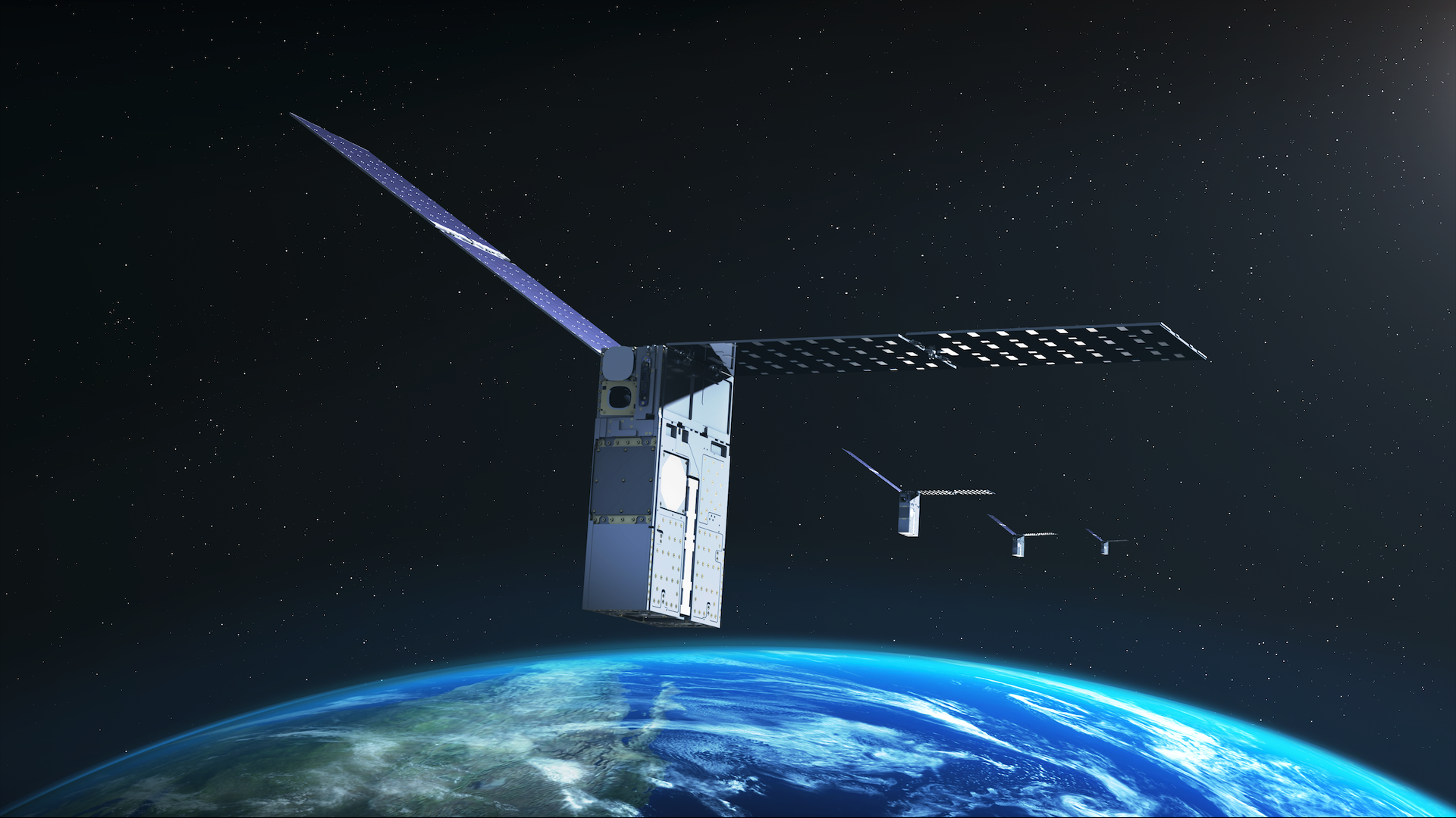
NASA says a spacecraft in its Starling CubeSat swarm has determined its own orbit without GPS by observing other satellites and orbital debris, identifying them in a stored catalogue and treating their predicted positions as reference points.
The flight experiment, announced on 17 August 2026, is called FALCON, short for Fast Autonomous Lost-in-space Catalog-based Optical Navigation. It combined EraDrive’s Era-Core software with cameras already carried by the four-spacecraft Starling mission.
NASA calls the self-orbit determination result a first for optical navigation based on a spacecraft’s relative position to other objects in space. That is a specific first. Spacecraft have navigated without GPS and used cameras for navigation before.
FALCON turned passing objects into reference points
Star trackers normally photograph stars so a spacecraft can work out which way it is pointing. Other spacecraft and debris can also cross the field of view. FALCON retained those detections and compared them with an onboard catalogue containing the predicted orbits of about 20,000 known objects.
According to NASA’s 17 August mission report, matched objects then acted as optical reference points for determining Starling’s orbit. The system did not need a live GPS fix or a ground operator to tell it where the observer spacecraft was.
The catalogue still matters. FALCON was not recognising arbitrary pieces of debris from appearance alone. It was associating measured directions with known objects whose predicted paths had already been established by ground-based tracking.
That makes “moving landmarks” a useful shorthand, but an incomplete one. A landmark is valuable because its position is known. Here, the known position is a time-dependent orbital prediction rather than a fixed point on a surface.
A moving landmark requires orbital mathematics
A mountain remains fixed on a map. A satellite does not. FALCON has to propagate catalogue orbits forward in time, predict which objects should be visible, match measured directions to plausible identities and use the changing geometry to estimate the observer’s own position and velocity.
The Stanford Space Rendezvous Laboratory’s project description says the cameras measure bearing angles to visible resident space objects. Once a detection is matched to an identity, its catalogue orbit supplies geometric information for the observer’s position solution.
A 2025 FALCON technical preprint describes batch and sequential orbit-determination methods. In simulation, the prototype recovered a lost observer’s orbit in less than one revolution with sub-kilometre accuracy when suitable reference objects were available.
The new NASA announcement establishes that the method worked in orbit. It does not publish a numerical error for Starling’s self-position estimate, so the earlier simulated accuracy should not be presented as the measured flight result.
The first-of-its-kind claim is narrow
FALCON is not the first spacecraft to operate without GPS, nor the first to use optical navigation. Deep-space probes have long taken images of planets, moons and stars to refine their trajectories. The novelty NASA identifies is self-orbit determination from the relative positions of other human-made objects seen by an optical camera.
SpaceDaily recently reported how Perseverance now matches surface panoramas to orbital maps to locate itself on Mars. Both systems move localisation work onto the vehicle, but their landmarks differ. Perseverance recognises terrain fixed to a planetary surface; FALCON uses objects following separate orbits.
The distinction matters when projecting the result beyond Earth. The Starling flight demonstrated one navigation architecture in low-Earth orbit, where a dense, mature catalogue already exists. It did not demonstrate the same system operating around the Moon or Mars.
The same observations improved the catalogue
NASA also tested the process in reverse. Once Starling had observed and identified surrounding objects, those measurements were used to refine their predicted paths. Over three days, FALCON improved orbit estimates for more than 200 objects without ground intervention, NASA says.
This does not mean Starling tracked every object in the 20,000-entry onboard catalogue. The catalogue supplied possible identities and predicted positions. The camera observed a much smaller subset selected by geometry, lighting, sensitivity and timing.
It is also only part of the orbital population. SpaceDaily’s recent account of the debris environment notes that about 46,000 objects are now tracked around Earth, while far more smaller fragments remain below routine tracking thresholds. Differences in catalogue date, access and inclusion rules also make 20,000 and 46,000 different measures rather than a contradiction.
Onboard updates could shorten the gap between observation and a revised orbit estimate. That may improve traffic awareness and collision screening, but one optical payload cannot provide continuous coverage of every orbit, and an orbit estimate still carries uncertainty.
The Moon and Mars case still needs infrastructure
GPS coverage is strongest near Earth. Around the Moon or Mars, future spacecraft will need other ways to establish position without waiting for a complete navigation solution from Earth. NASA’s Starling mission overview presents autonomous swarms as one possible basis for navigation services and distributed science beyond low-Earth orbit.
FALCON cannot simply carry Earth’s debris catalogue to the Moon and continue unchanged. A lunar or Martian version would need its own useful population of known spacecraft, shared timing and orbit information, sufficient camera visibility and a method for keeping the local catalogue accurate. A sparse early network may offer fewer useful sight lines than low-Earth orbit.
Later in 2026, NASA plans to extend the experiment so all four Starling spacecraft can share tracking data and refine their positions collectively. That flight result will show whether one satellite’s moving landmarks can become a practical navigation network.