
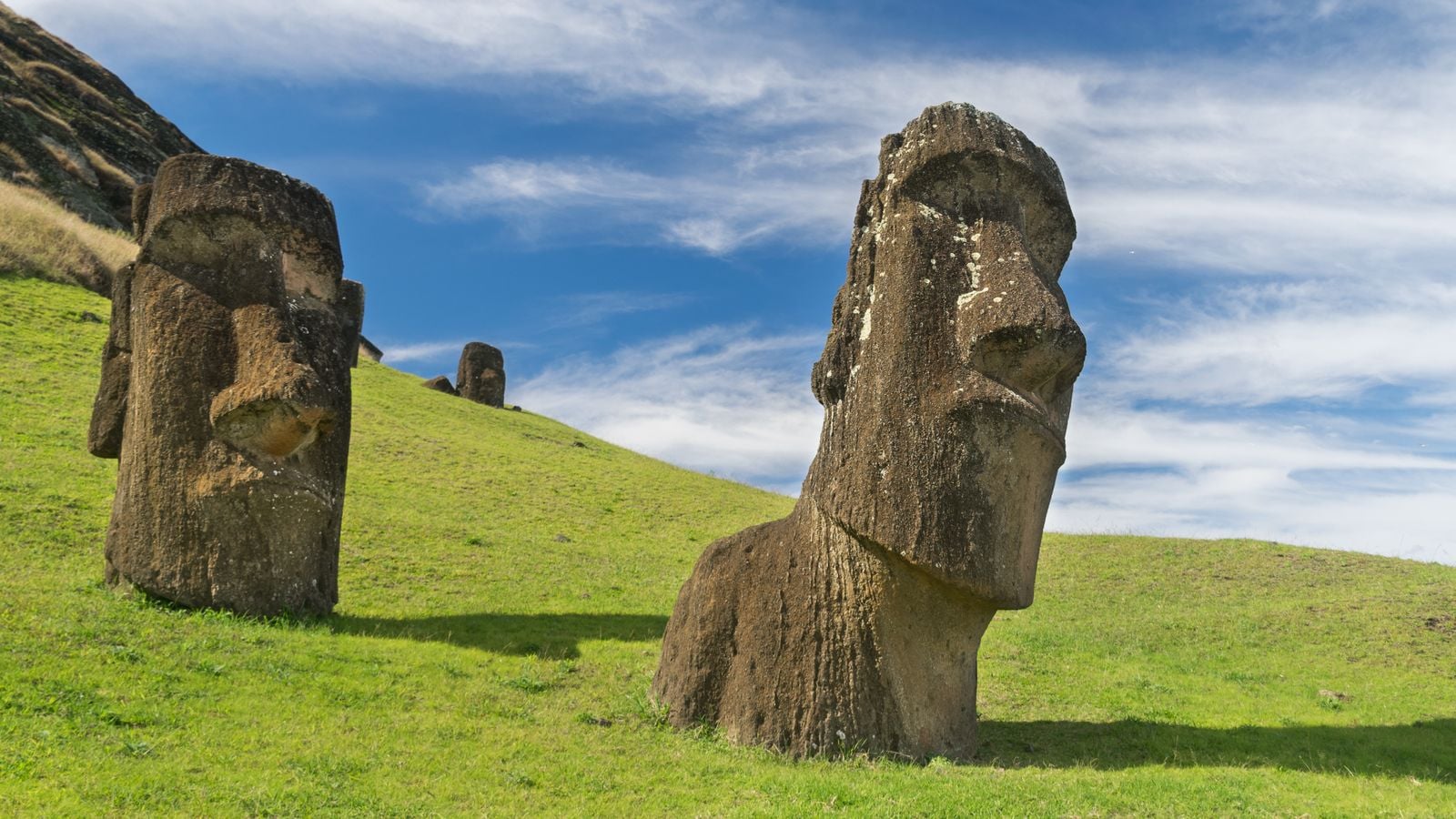
On the afternoon of 5 April 1722, Dutch ships sailing under Admiral Jacob Roggeveen dropped anchor off a treeless volcanic speck in the South Pacific and the crew began to count. They counted people — between 2,000 and 3,000 of them, tall, strong, with what one officer’s log called astonishingly white teeth. They counted statues. Nearly 900 of them, some ten metres tall, some weighing more than 80 tonnes, standing on stone platforms with their backs to the sea. And they counted trees, and found almost none.
It was Easter Sunday. Roggeveen named the place Paasch-Eyland.
The sailors could not explain what they were looking at. Neither, in any complete sense, could the islanders explain it to them.
The most remote landfall in human history
Roggeveen had been looking for a different island. He was hunting Terra Australis, the supposed southern continent, under a charter from the Dutch West India Company. What his three ships found instead was a triangular chunk of basalt roughly 63 square miles across, sitting some 2,200 miles west of the Chilean coast and more than a thousand miles from the nearest inhabited land at Pitcairn.
Nothing in European experience prepared them for the geography. The Pacific between South America and Polynesia is the largest empty space on the planet’s surface. A ship could sail for weeks without sighting so much as a reef. And yet here, at the end of that emptiness, was a settled population with agriculture, chiefs, ceremonial platforms, and a monumental sculpture tradition already centuries old.
The Rapa Nui had arrived by canoe. Archaeological consensus now places their landfall somewhere between 400 CE and 1200 CE, with more recent radiocarbon work favouring the later end of that window. Their ancestors had crossed thousands of kilometres of open ocean guided by star paths, swell patterns and the flight lines of seabirds. Easter Island was the final address on that migration. There was, quite literally, nowhere further to go.
What Roggeveen actually saw
Roggeveen’s officers’ journals — later compiled and partly published in Amsterdam — describe canoes paddling out to greet the fleet, islanders swimming half a league from land to reach the ships, and a coastline lined with figures the Dutchmen at first mistook, in the fading light, for people standing on the shore.
Then they got closer.
The figures were stone. Enormous. Carved from a soft volcanic tuff and hoisted onto rectangular platforms called ahu, their faces turned inland toward the villages they were meant to watch over. Historical accounts describe the islanders lighting fires in front of the statues at dawn and prostrating themselves.
The population estimate — 2,000 to 3,000 — comes from Roggeveen’s own log. It is almost certainly low. The Dutch saw only the coast facing their anchorage. Later demographic reconstructions from house-foundation surveys suggest the island may have supported several times that number at its peak a century or two earlier.
What matters is the ratio the Dutch recorded. Roughly one standing statue for every three living people. And nobody the sailors met claimed personal knowledge of how the largest ones had been raised.
The quarry that made them
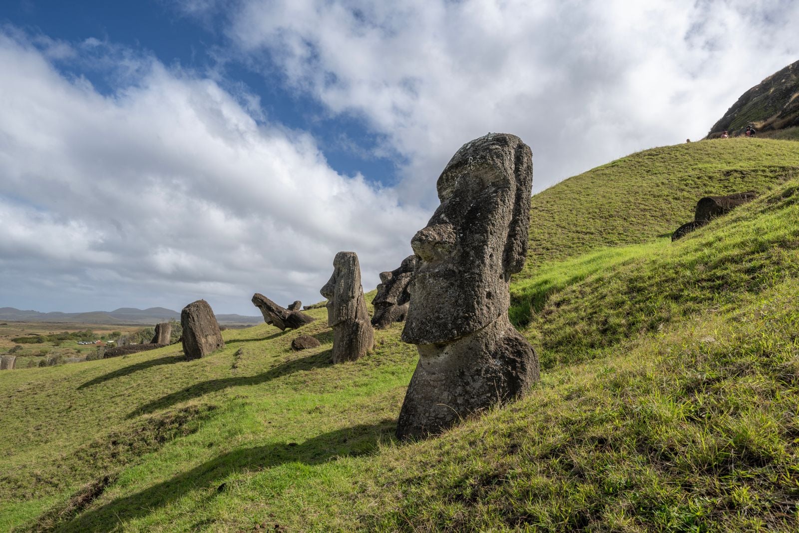
Every one of the nearly 900 moai came from a single place: the Rano Raraku quarry on the island’s eastern flank, an extinct volcanic cone whose slopes are still littered with unfinished figures, some half-carved out of the bedrock, some abandoned mid-transport along the island’s ancient roads. The largest completed moai stands about ten metres tall. The largest one still attached to the quarry wall, unfinished, would have topped 21 metres and weighed close to 270 tonnes.
Each figure, according to Rapa Nui oral tradition, was carved as a portrait of a deceased ancestor — a vessel for their mana, the spiritual force believed to protect their descendants. Carving one took a team roughly a year.
Then it had to walk to the coast.
The walking statues
For most of the three centuries after Roggeveen’s landfall, European visitors assumed the moai had been dragged. Captain James Cook, who arrived in 1774, recorded his amazement at how the islanders could raise such stupendous figures. The default theory involved wooden rollers and sleds, which had the tidy side benefit of explaining why the island Cook saw was almost entirely deforested.
When Europeans asked the Rapa Nui themselves how their ancestors had moved the statues, the answer was always the same. The moai walked.
The sailors filed this under folklore. It took decades for the archaeology to catch up. Experimental reconstructions have shown that teams of as few as 18 people, working ropes in a coordinated rocking rhythm, can move a full-scale moai replica upright across rough terrain — because the statues were carved with a deliberate forward lean and a wide, curved base. Every step is a controlled fall. The islanders, it turned out, had been telling the literal truth for 250 years.
Why the deforestation story is not what it looks like
The old narrative — the one that filled popular books for decades — went like this. The Rapa Nui cut down every tree to move their statues, exhausted their soil, collapsed into famine and warfare, and were reduced to a starving remnant by the time Roggeveen arrived.
That story is now under sustained challenge. A 2016 study covered by Ars Technica examined more than 400 obsidian tools long assumed to be weapons and found their wear patterns were consistent with agriculture, not combat. The thousands of sharpened mata’a that generations of archaeologists had catalogued as spear points look, on closer inspection, like gardening implements.
The deforestation happened. That much is clear from pollen cores. But the walking-statue evidence removes the requirement for enormous quantities of felled timber, and the Polynesian rat, which arrived with the settlers, likely contributed by eating the palm nuts before they could germinate. The forest didn’t fall to axes so much as fail to reproduce.
The population Roggeveen counted in 1722 was not a broken remnant of a collapsed civilisation. It was a society that had adapted to a treeless island with rock gardens, wind-sheltered planting pits and an intensive fishing economy — the same society that, within a century of European contact, would be devastated by imported disease and slave raids that carried off a substantial portion of its people in the 1860s.
The statues fell after the Dutch left
One detail from Roggeveen’s log matters enormously for what came later. In April 1722, the moai were standing. All of the coastal ones the Dutch saw were upright on their ahu, facing inland.
By the time Captain Cook arrived 52 years later, some had fallen. By the mid-19th century, when missionaries began keeping systematic records, nearly every moai on the island had been toppled — pushed forward off its platform, often with a stone deliberately placed where the statue’s neck would strike, snapping the head from the body.
The Rapa Nui had done this themselves. The dominant interpretation, held by most archaeologists working on the island today, is that the islanders lost faith in the statues’ protective power sometime after European contact introduced diseases, kidnappings and social collapse that no ancestor’s mana could stop. The moai standing today were re-erected in the 20th century, most of them by archaeological teams working with the Rapa Nui community from the 1950s onward.
The Dutch saw the last generation of standing statues. Nobody in Europe would ever see that sight again.
What the island looks like now
Today about 7,000 people live on Rapa Nui, most of them in the town of Hanga Roa on the southwest coast. The island is a Chilean territory, annexed in 1888, and 28 of its 63 square miles are protected as Rapa Nui National Park and a UNESCO World Heritage Site. A recent high-resolution 3D mapping project has documented the archaeological sites at a level of detail that lets researchers examine areas closed to visitors, catching erosion and damage that would otherwise go unrecorded.
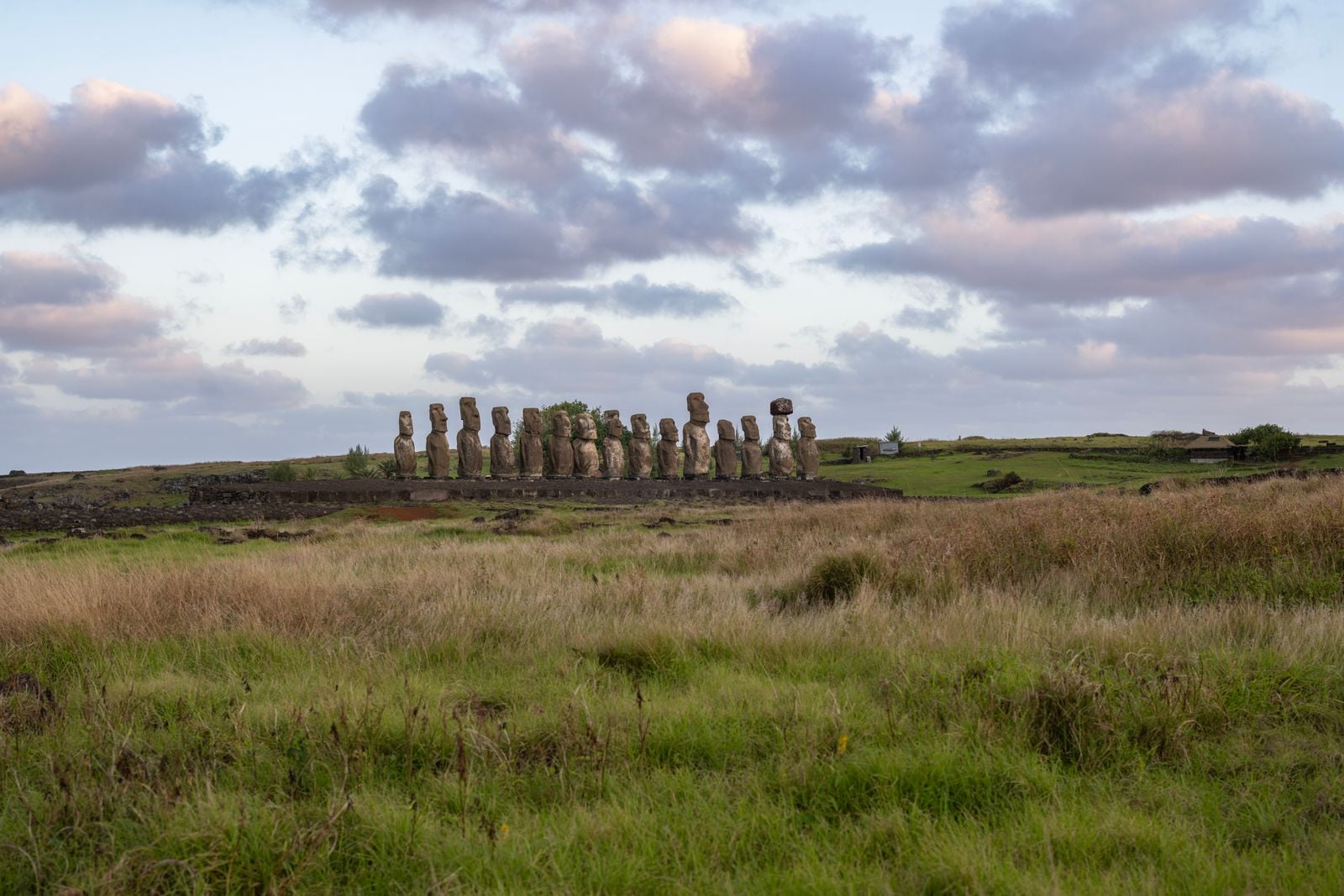
The most iconic ceremonial platform, Ahu Tongariki, holds 15 re-erected moai standing shoulder to shoulder along a bay on the southeast coast. It is also the platform most at risk. A study published in 2025 in the Journal of Cultural Heritage, led by University of Hawaii earth scientist Noah Paoa, modelled seasonal wave dynamics against sea-level projections and concluded that storm waves could begin reaching the base of Ahu Tongariki as soon as 2080. Petroglyphs, house foundations and burial sites along the same coastline would go first.
The moai have already outlasted the civilisation that built them, the sailors who first documented them, and every European theory about how they got there. The next threat to them is not axes or ropes or lost faith. It is water.
What the encounter actually was
Read Roggeveen’s log in isolation and it sounds like a mystery — a small crew stumbling across an impossible monument in the middle of an ocean. Read it against three hundred years of subsequent archaeology and it becomes something stranger. The Dutch had not found a lost civilisation. They had found a living one, at a specific moment, doing specific things, telling a coherent story about its own past that the sailors declined to believe.
The islanders said their ancestors had walked the statues into place. They were right.
The islanders showed the sailors ancestors carved in stone, standing watch over villages, backs to the sea. Within a lifetime those statues would be face-down in the turf, and within two lifetimes the population that raised them would be cut in half by kidnappings and smallpox brought in by ships flying flags the 1722 crowd on the beach had never seen.
The wonder of the encounter is not that the Dutch could not explain what they saw. It is how much of the explanation the islanders were already offering, in plain language, to men who had crossed an ocean to hear it and could not.
Three hundred and four years later, dawn still breaks over Ahu Tongariki the same way it did on the morning of 6 April 1722. Fifteen figures, backs to the Pacific, waiting.
