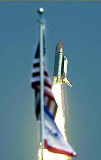
The space shuttle Endeavour blasted off here Friday, with six astronauts on board, on an 11-day mission to create a three-dimensional map of the Earth’s surface.
The spacecraft lifted off at 12:43 p.m. (1743 GMT), surging into the cloudless blue Florida sky as hundreds of spectators cheered.
Ten minutes after liftoff, Endeavour reached the altitude of 233 kilometers (144 miles), according to the US space agency NASA.
The launch was delayed 13 minutes to fix what US space officials say were three “minor technical problems” that surfaced during the countdown.
Today’s launch was the second launch attempt after a first one on January 31 failed 20 minutes before liftoff because of an onboard computer malfunction.
The Endeavour’s six astronauts, including one German and one Japanese, will use sophisticated radar technology to help produce the most detailed three-dimensional maps ever made of the Earth’s surface, for both military and civilian uses.
As the shuttle orbits at 235 kilometers (146 miles), two radar antennas — one in the hold of Endeavour, the other at the end of 60-meter (yard) telescopic mast — will gather radar signals bounced off the Earth’s surface, recording variations in the altitude of the Earth’s crust.
Using radar interferometry technology, which combines two radar images taken at different locations, scientists hope to draw a high-resolution topographical map of the Earth.
“We’ll see the Earth as we’ve never seen it before. It will be like rediscovering our own planet,” said Diane Evans, chief scientist at the Jet Propulsion Laboratory in Pasadena, California.
Radar has one major advantage over traditional camera-equipped satellites, she said: it can “see” through clouds and at night.
The Shuttle Radar Topography Mission (SRTM) will record measurements from space for nine days, collecting data between the latitudes of 60 degrees north and 56 degrees south — stretching from Greenland to the tip of South America.
That will cover about 80 percent of the earth’s surface, home to 95 percent of its population. It will take about one year to produce maps from the data.
The program manager for the mission is Thomas Hennig at the National Imagery and Mapping Agency (NIMA), which is part of the Department of Defense and has contributed 200 million dollars to the mission. The publication of the data will be controlled by the Pentagon.
The availability of the data will have numerous non-military applications, according to NIMA.
It can be used to observe seismic faults, model potential lava flows, landslides and floods, plan for the construction of bridges, dams, and pipelines, improve flight planning, navigation and the placement of communication towers used by cell phones, even assist backpackers.
But the military will applaud loudest the availability of a nearly complete map of the Earth that is not only extremely precise and entirely digital, allowing it to be used over the computer, but also uniform and coherent, as opposed to the patchwork of data currently available from various disparate sources.
But experts point to possible applications in flight simulation, logistical planning, air traffic control, guided missile systems, tactical operations and the low-altitude penetration of enemy airspace.
This will be the 97th shuttle mission and the 14th for Endeavour, which is the newest in the fleet.