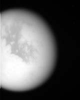
For the fourth time in seven months, NASA’s Cassini spacecraft has flown by Saturn’s moon Titan. Cassini’s radar instrument, which can peer through Titan’s haze, was switched on, with new areas of Titan imaged, as well as previous ones. This raw, unprocessed image was taken yesterday, on approach to Titan.
The site where the Huygens probe landed in mid-January was also imaged at lower resolution during the flyby, having been within the extreme western part of the coverage area. Coverage, this flyby, extended farther east than the previous two in October and December 2004.
This map of Titan’s surface illustrates the regions that were imaged by Cassini during this fourth (and third very close) flyby of the smoggy moon. At closest approach, Cassini was expected to pass approximately 1,580 kilometers (982 miles) above the moon’s surface.
The colored lines delineate the regions that were imaged at differing resolutions. The lower resolution imaging sequences (outlined in blue) are designed to study the atmosphere, clouds and surface in a variety of spectral filters.
Two small areas (outlined in yellow) were seen at high resolution by Cassini’s narrow angle camera, and were jointly covered by the visual and mapping spectrometer experiment. These high resolution targets also overlapped areas covered by the Cassini radar altimetry and synthetic aperture radar experiments.
Other areas were specifically targeted for creation of mosaics based on moderate resolution images of surface features.
Some areas covered at moderate resolution during previous flybys were targeted again to allow Cassini scientists to look for changes.
The map shows only brightness variations on Titan’s surface (the illumination is such that there are no shadows and no shading due to topographic variations).
Previous observations indicate that, due to Titan’s thick, hazy atmosphere, the sizes of surface features that can be resolved are a few to five times larger than the actual pixel scale labeled on the map.
The map was made from global images taken in June 2004, at image scales of 35 to 88 kilometers (22 to 55 miles) per pixel, and south polar coverage from July 2004, at an image scale of 2 kilometers (1.3 miles) per pixel.
The images were obtained using a narrow band filter centered at 938 nanometers – a near-infrared wavelength (invisible to the human eye) at which light can penetrate Titan’s atmosphere to reach the surface and return through the atmosphere to be detected by the camera. The images have been processed to enhance surface details.
It is currently northern winter on Titan, so the moon’s high northern latitudes are not illuminated, resulting in the lack of coverage north of 45 degrees north latitude. Clouds near the south pole (see http://photojournal.jpl.nasa.gov/catalog/PIA06110) have also been removed (south of -75 degrees).
At 5,150 kilometers (3,200 miles) across, Titan is one of the solar system’s largest moons.