

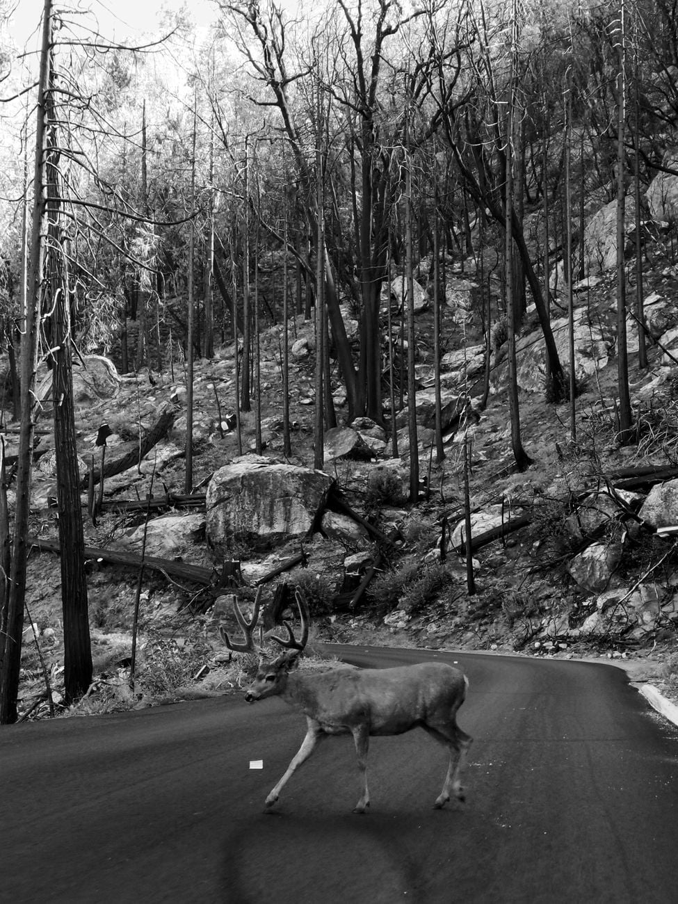
A puma does not need to kill a deer to change whether that deer meets a car.
The possibility of an ambush can alter which forest edge a deer approaches, how close it remains to development and whether it moves in daylight or darkness. Across Washington’s Olympic Peninsula, researchers have now connected those behavioral changes to a measurable difference in road safety.
They combined wildlife detections from 503 camera sites, movement records from 59 GPS-collared pumas and five years of state collision data. Where puma use became most intense, deer appeared less often in road-dense habitat, moved towards more remote areas and shifted activity towards daylight. In a modelled landscape cell, the probability of at least one deer-vehicle collision fell from 64% to 21%, a 67% reduction.
The Current Biology study, published online on August 5, 2026, calls the effect a predation service. The cats may be making roads safer not only by consuming prey, but by changing the decisions of deer that remain alive.
That conclusion is persuasive but not experimental. Pumas were not assigned to otherwise identical pieces of habitat, and the 67% figure comes from the upper end of a nonlinear statistical curve. The result is an association supported by several independent measurements, not a guarantee that placing pumas in another landscape would reproduce the same percentage.
The dataset began with Tribal wildlife programs
Justin Suraci of Conservation Science Partners and his colleagues assembled camera-trap data from seven recent or continuing projects conducted by biologists working with the Lower Elwha Klallam Tribe, Makah Tribe, Point No Point Treaty Council, Quinault Indian Nation and Skokomish Indian Tribe.
The 503 unique sites were arranged on grids across the peninsula, with most neighboring cameras about 2.5 kilometres apart and no pair closer than 1.1 kilometres. Mounted about 46 centimetres above the ground, each unit was positioned to detect medium-to-large mammals rather than to target one species.
The collar records supplied a separate view of the predators. Fifty-nine adult and independent subadult pumas were tracked between January 2020 and September 2022. Their GPS units recorded a location every one or two hours. Six cats were collared during both life stages, giving the analysis 65 tracks and allowing the team to build a map of how intensely pumas used different areas.
These sensitive location and camera data belong to Panthera and the participating Tribal organizations. They are not deposited publicly, an important distinction from the study’s non-sensitive collision data and analysis code.
Deer, not elk, drove the road pattern
Black-tailed deer are primary puma prey on the Olympic Peninsula. They were also by far the most common animals in the relevant crash records. Within the mapped study area, deer and Roosevelt elk accounted for 97% of 953 wildlife-vehicle collisions between July 2020 and June 2025; deer alone accounted for 92%.
The paper reports two human deaths and more than 80 injuries associated with ungulate collisions during those five years. Using national estimates of direct cost per deer or elk crash, the authors placed the combined burden of vehicle repairs and human health expenses at about $14.7 million.
Elk showed much weaker responses to puma presence in the camera analysis, with no clear pathway linking the cats to elk-vehicle crashes. The researchers therefore focused their road-safety models on deer.
They overlaid the road and camera network with cells about 2.25 kilometres wide, an area of roughly five square kilometres each. After retaining cells that contained a camera, paved road and estimated deer use, the collision model covered 247 cells in which 146 deer-vehicle crashes had been recorded.
The cameras measured habitat use, not population size
The researchers used continuous-time occupancy models to interpret the camera detections. Occupancy in this context is the estimated probability that a species used a site during the sampling period after imperfect detection is considered. It is not a direct census and does not mean that every occupied cell contained the same number of animals.
Road density produced a revealing interaction. Where pumas were absent, deer use increased as road density rose. Where pumas were present, it declined. At the upper end of observed road density, 2.5 kilometres of road per square kilometre, predicted deer occupancy was 0.85 in the presence of pumas and 0.99 without them, a 15% difference.
Development showed another change. In places used by pumas, deer were 86% more likely to occupy remote habitat away from built areas and the traffic associated with them.
The behavioral explanation begins at the forest edge. Deer often use edges for forage, but pumas also hunt effectively where dense cover meets an opening. A road can create exactly that transition. When a cat is likely to be nearby, entering an edge may become more dangerous than remaining in less developed terrain.
This is a landscape of fear in the technical ecological sense: the geography of perceived predation risk changes how prey use space. It does not require deer to identify a road as a human hazard. Avoiding a puma’s preferred hunting terrain can incidentally reduce contact with vehicles.
The 67% decline begins partway up the curve
The headline number needs a careful denominator. Collision probability did not simply fall by 67% whenever a camera detected a puma.
At lower values, deer and puma occupancy rose together because predators seek places containing prey. A site with few deer is unlikely to support many pumas and also unlikely to record a deer crash. The modelled probability of at least one collision therefore increased at first, reaching a peak when puma occupancy probability was 0.67.
For a grid cell that was 19% developed, the land-cover value associated with the largest observed crash count, the predicted probability of a deer collision over five years was 64% at that peak. When puma occupancy reached the maximum observed value of 0.98, predicted collision probability was 21%. Moving from 64 to 21 is the reported 67% reduction.
A different model examined the number rather than the mere occurrence of crashes. It estimated a 76% reduction in the total expected number of deer collisions over five years where puma occupancy was high. The GPS data provided a valuable check: collision counts were also significantly lower in cells where the 59 collared pumas collectively used the landscape more intensely.
Those are related but distinct outcomes. Sixty-seven percent refers to the modelled probability of any collision in a cell. Seventy-six percent refers to the modelled collision count. Neither means that researchers watched two matching roads and counted exactly two-thirds fewer wrecks beside one of them.
The predators changed the clock as well as the map
Deer detected at sites with pumas shifted more activity into daylight hours. The GPS-based collision analysis found a corresponding temporal change: in areas of intense puma use, a larger share of deer crashes occurred during the day and a smaller share at night.
The timing result based only on camera-derived puma occupancy was marginal and did not significantly outperform a null model. The version based on collar-derived puma use did. Reporting both matters because it shows where the evidence is strongest and where sample size still limits confidence.
Daylight does not prevent a collision, but it gives a driver more opportunity to see an animal and brake. Combined with reduced deer use of road-heavy areas, the temporal shift supplies a second plausible pathway from predator presence to fewer or less hidden encounters.
SpaceDaily covered an almost mirror-image experiment in 2019, when Suraci and colleagues played human voices to pumas and other carnivores. Predators reduced or shifted their activity, while smaller animals became bolder. The two studies together show that fear can move through a food web in both directions: humans alter predators, and predators alter prey.
The road controls help, but this remains observational
Traffic volume is an obvious alternative explanation for crash patterns. Yet full traffic counts were available only for state highways, covering 34% of the analytical cells with paved roads. The team used the proportion of developed land as a broader proxy because, where both were available, development and traffic volume were strongly correlated.
They then repeated restricted analyses in the cells with direct traffic data. The negative association between high puma use and deer collisions remained after traffic volume was included.
The models also considered road density, slope, forest edge and other habitat features. Still, an observational map cannot make every cell equivalent. Development affects deer, pumas, drivers and camera access at once. Collision reports can miss animals that leave the road or incidents that are never reported. Puma occupancy is itself partly driven by deer distribution.
The paper’s wording reflects that boundary: predator-related changes were associated with lower collision risk. The multiple datasets make a behavioral mechanism more credible, but they do not prove causality in the way a controlled predator manipulation could.
A useful ecosystem service is not a simple predator policy
The broader idea is that large carnivores provide services through behavior as well as through the prey they consume. In a system where pumas and deer are both already established, fear-driven changes in space use may affect people more immediately than a slow change in deer abundance.
That does not make pumas cost-free. Large cats can kill livestock and pets, create management conflicts and occasionally threaten people. Nor does this one peninsula establish that restoring a predator will automatically lower road deaths elsewhere. Deer species, hunting behavior, road design, traffic, land cover and human responses all vary.
The caution is familiar from SpaceDaily’s examination of the claim that wolves changed Yellowstone’s rivers. Predator effects can be real without reducing a complex landscape to one elegant cascade. The Olympic Peninsula study is strongest because it identifies measurable steps rather than stopping at a story: puma use, deer space use, deer timing and collision records.
The research team frames safer roads as an overlooked benefit of coexistence. That is a reasonable conclusion within the study area. Its next test is whether comparable data from other landscapes reveal the same curve.
On the Olympic Peninsula, the road was not outside the food web. A cat changed a deer without touching it, the deer changed its route and the consequence appeared in a human crash record.