

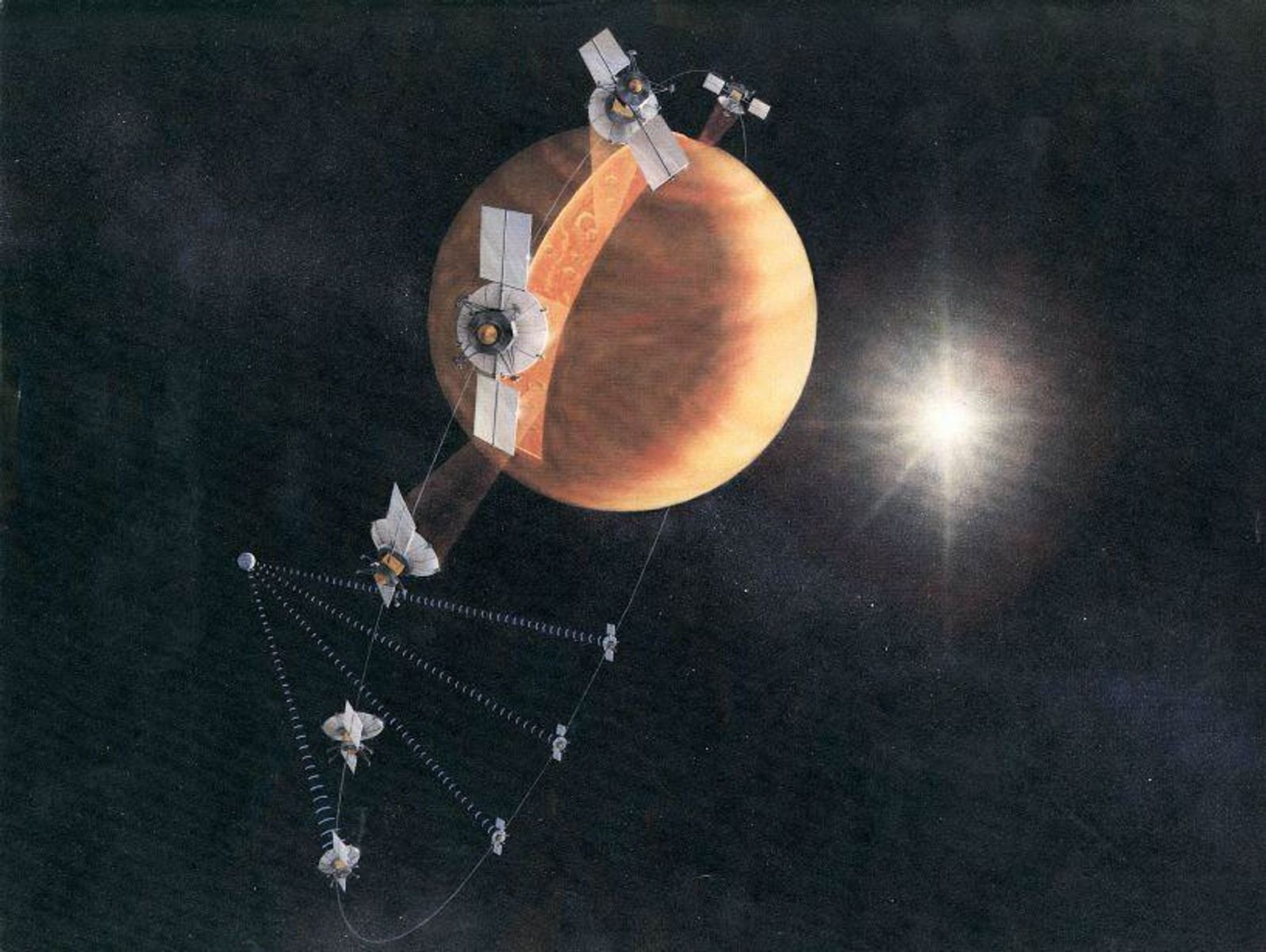
NASA’s Magellan spacecraft did not simply go silent at the end of its mission. Controllers deliberately sent it down.
On 12 and 13 October 1994, after a sequence of orbit-lowering manoeuvres, the orbiter entered Venus’s atmosphere as part of a final aerodynamic experiment. Contact was lost, and the spacecraft is believed to have burned up. Magellan had completed more than 15,000 orbits and mapped 98 percent of a planet hidden beneath clouds.
The machine was gone. Its radar record remained.
More than three decades later, Leonardo Carrer, Elena Diana and Lorenzo Bruzzone of the University of Trento applied a newer processing method to one small part of that archive. Their peer-reviewed Nature Communications paper, published on 9 February 2026, describes the first radar-based detection of an empty subsurface cavity on Venus.
The result is persuasive, but more specific than the phrase “a kilometre-wide lava tube” can sound. The visible pit is larger than a kilometre. The underground conduit inferred beside it averages just under a kilometre wide in the section the radar could illuminate. Its interpretation as a lava tube is the best fit to the available evidence, not a direct image of an entire cave network.
Magellan was deliberately spent after finishing the map
Venus’s dense atmosphere and sulfuric-acid clouds block ordinary cameras from mapping its surface from orbit. Magellan instead transmitted microwave pulses and measured the echoes. Synthetic-aperture processing combined returns gathered along the spacecraft’s path, producing images with a resolution of roughly 100 to 150 metres over most of the planet.
The mission’s first 243-day mapping cycle ended in May 1991 with 83.7 percent coverage. A second cycle lifted that to 96 percent. A third, completed in September 1992, finished the radar map at 98 percent and added stereo views of selected terrain.
Magellan then became an experimental spacecraft. In 1993, it repeatedly skimmed the upper atmosphere, using drag rather than propellant alone to circularise its orbit. The manoeuvre, called aerobraking, made higher-latitude gravity measurements possible and helped establish a technique later used at Mars.
At the end, controllers lowered the orbit again and placed Magellan in a windmill-like attitude so its solar panels could measure atmospheric forces. NASA’s mission history dates the loss of contact to October 1994. The destruction was planned, but it did not make the data scientifically final.
The pit was known; the meaning of its echo was not
The 2026 team studied pit A on the western flank of Nyx Mons, a shield volcano about 362 kilometres in diameter. Magellan had imaged this region from west to east at an incidence angle of approximately 42.4 degrees and a look angle near 40 degrees.
Several pits appear in the frame. Ordinary steep-walled depressions produce a dark radar shadow paired with a bright return along the radar-facing rim. Pit A behaves differently. Its shadow is sharply defined, but the bright return is asymmetric and extends well beyond the eastern margin.
That extension is the crucial observation. The authors argue that Magellan’s side-looking radar passed through a roof opening, struck surfaces inside a horizontally continuing cavity and returned through the same opening. A purely surface feature would not readily produce the same geometry.
The team compared the signal with synthetic-aperture radar observations of Jameo Agujerado, an accessible skylight in the Corona lava-tube system on Lanzarote. There, radar measurements can be checked against lidar scans, drone mapping and the cave itself. Its combination of shadow and elongated bright return resembles pit A, although the Venusian structure is vastly larger.
Space Daily’s earlier report on the finding introduced that evidence. What becomes clearer in the paper is that the detection is not radar sounding through solid rock. The opening lets an ordinary imaging radar briefly behave as though part of the subsurface were exposed.
The skylight is not the same size as the conduit
Three related measurements are easy to collapse into one.
First, the surface opening measures approximately 1,545 by 1,070 metres. Each dimension carries an uncertainty of about 75 metres, corresponding to the Magellan data’s pixel size in the slant-range direction.
Second, the inferred underground conduit varies in width. It is about 1,350 metres wide near the skylight and narrows to roughly 525 metres at the farthest point reached by a recognisable interior echo. The arithmetic mean of those endpoints is 937.5 metres, which is the basis for describing the tube as approximately one kilometre wide.
Third, the surrounding line of collapse pits may trace a much longer system. Terrain slopes down towards the southeast, and the pits form a sinuous chain compatible with the course of a lava tube. On that interpretation, the underground structure could extend for at least 45 kilometres. One 13-kilometre section between pits has no visible roof collapse.
The 45-kilometre figure does not mean Magellan imaged an open cave for 45 kilometres. Radar directly sampled only the neighbourhood of pit A. The wider length follows from surface morphology, elevation and the arrangement of other pits, some of which may have entrances blocked by collapsed material.
The echo offers a partial cross-section
The researchers inverted the lengths of the radar shadow and bright interior return to estimate a cross-section. The collapse is about 450 metres deep. Their model assigns roughly 150 metres to the surviving roof and about 375 metres to the open cavity below it.
Those two numbers do not simply add because the cave floor is unlikely to be flat. A pile of fallen roof material probably rises beneath the opening and slopes down into the conduit at about 14 degrees. Measured from the top of that pile, the remaining cavity height is approximately 300 metres.
The radar signal propagated at least 300 metres into the eastern side of the void before it became indistinguishable from clutter. That is a minimum illuminated distance, not necessarily the physical end of the conduit. Magellan did not acquire the corresponding east-to-west view, leaving the space below the western wall unresolved.
Radar interpretation also depends on assumptions about wall geometry, curvature and scattering. The reported widths may underestimate the true conduit where the beam intersects curved surfaces obliquely. Conversely, dashed portions of the paper’s geometric model are hypotheses based on familiar conduit shapes rather than directly observed boundaries.
This is why “appears to open into” is the right wording. The authors find that a lava-tube skylight best explains the signal, and they rule out several simpler alternatives. They do not claim that every wall and passage has been mapped.
A lava tube is the best explanation, with one live alternative
An impact origin is unlikely because the pit lacks the surrounding ejecta pattern expected in Magellan radar images. A volcanic vent or a simple steep-walled collapse tends to produce a strong rim return without the same horizontally extended asymmetry. Surface roughness is also an inadequate explanation because the surrounding terrain appears smooth at Magellan’s wavelength and scale.
The more serious alternative is a cavity associated with a laterally moving magmatic dyke. A dyke can separate rock layers, create a horizontal void and cause the ground above to collapse. Some Venusian pit chains have long been interpreted as expressions of subsurface dykes rather than drained lava conduits.
Earth analogues of dyke-related pits generally lack pit A’s strong horizontal interior signature, which favours the lava-tube interpretation. Yet the terrestrial comparison set is small. The paper explicitly says that dyke intrusion cannot be completely ruled out.
That restraint does not erase the main result. Whether a drained lava tube or a dyke-related pathway, the radar return indicates an empty cavity continuing laterally from the pit. This is the first time such a subsurface void has been identified on Venus from orbital observations.
Venus can preserve caves on a scale Earth rarely approaches
Lava tubes form when the surface of a flowing lava channel cools into an insulating roof while molten rock continues moving below. If the supply stops and the interior drains, a tunnel remains. Later roof failures can create skylights that expose it.
Venus offers conditions that may favour very large tubes. Its surface gravity is lower than Earth’s, while its dense atmosphere can reduce cooling at an exposed flow surface and encourage the development of a thick crust. The planet also preserves lava channels longer than those known elsewhere in the Solar System.
The inferred Nyx Mons conduit is wider and taller than terrestrial examples and theoretical Martian tubes. Its dimensions sit near the upper end of lunar proposals. A tube this broad raises questions about roof strength under Venusian temperatures and pressures, but the estimated 150-metre roof is comparable with modelled thicknesses capable of supporting kilometre-scale lunar cavities.
The cave does not establish recent activity. Magellan’s single view cannot date the collapse, say when lava last occupied the conduit or show whether Nyx Mons remains active. It adds structural evidence to a separate body of research suggesting that Venus has remained geologically active.
That wider picture also owes much to Magellan. Comparisons of repeated passes revealed a vent at Maat Mons changing shape between 1991 observations. Later work found probable fresh lava flows at Sif Mons and Niobe Planitia. As Space Daily reported when the additional flows were identified, the archive contains time as well as terrain.
A dead spacecraft can acquire new instruments in software
Magellan’s 75-metre slant-range pixels are large enough for pit A, but they probably conceal smaller skylights. Detection also requires a favourable look angle. An intact roof remains opaque to the imaging radar, and a blocked or badly oriented entrance may return no recognisable interior signal.
These selection effects mean pit A is not necessarily Venus’s only cave, its largest cave or even the easiest one for a future mission to understand. It is the one whose scale and geometry allowed a 1990s instrument to leave a readable clue.
NASA’s VERITAS and ESA’s EnVision are intended to return much sharper radar views, with planned surface resolutions around 15 to 30 metres in relevant modes. EnVision is also designed to carry a subsurface radar sounder capable of probing hundreds of metres beneath Venus. Space Daily has previously covered the role of its VenSAR imaging system, whose repeated observations should make change detection and structural interpretation less dependent on one old viewing geometry.
Those missions can test whether the inferred conduit continues, whether other pits expose connected passages and whether similar cavities lie beneath apparently unbroken ground. They may also show that the 2026 model needs revision.
For now, Magellan’s afterlife is the quieter part of the story. NASA intentionally destroyed the spacecraft after it completed its work, but not the scientific possibilities in what it sent home. Three decades of better methods turned a peculiar bright smear beside a known pit into the first evidence that Venus contains an accessible empty space below its surface.