
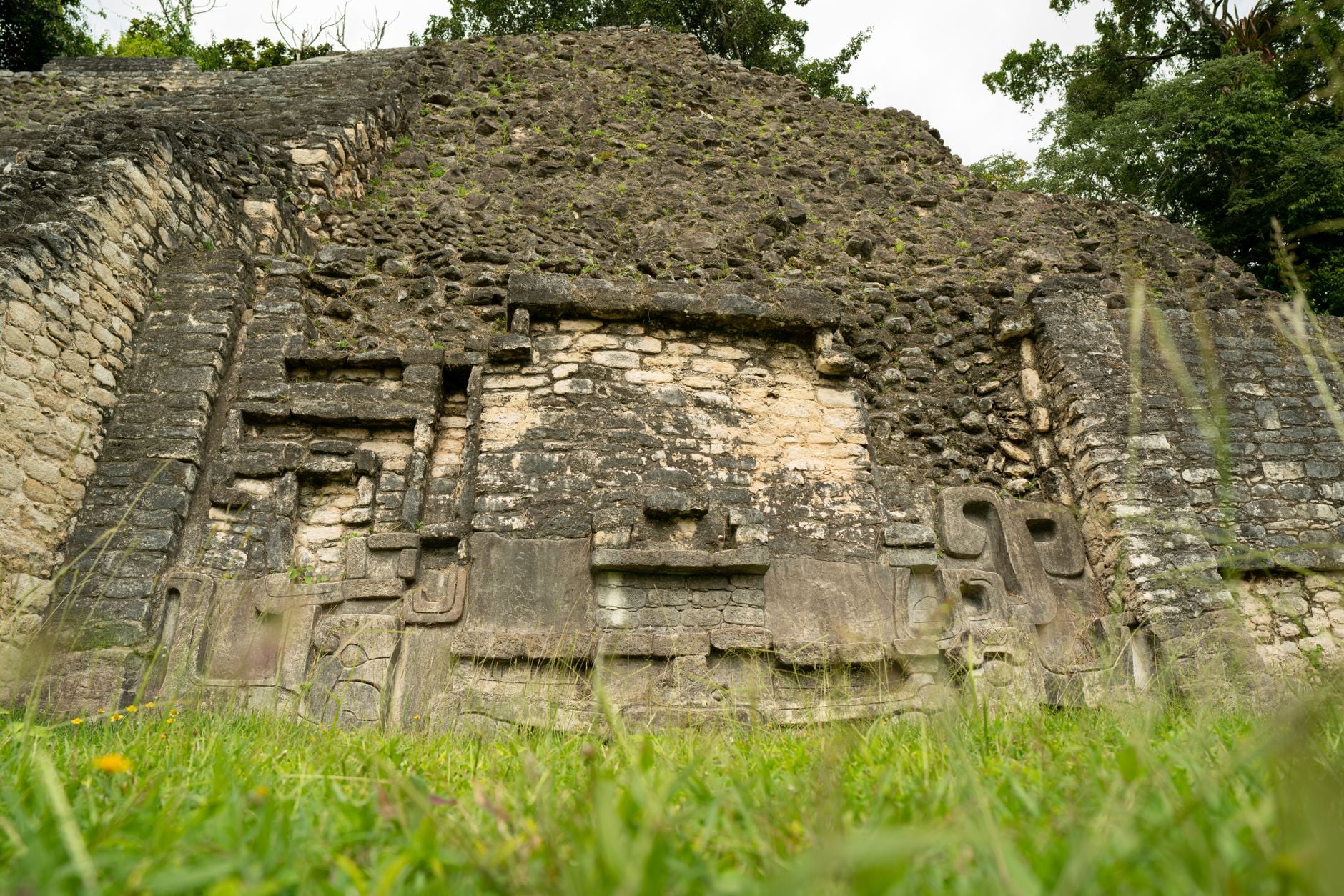
The discovery being described is Ocomtún, the Maya city announced after fieldwork in May and June 2023 in the Balamkú Ecological Conservation Zone of Campeche, Mexico.
According to the Institute of Anthropological and Spatial Studies at ZRC SAZU, the expedition was led by archaeologist Ivan Šprajc and located the remains of an ancient Maya city in a remote, heavily overgrown part of the central Yucatán Peninsula. The institute’s 30 June 2023 announcement described Ocomtún as an important regional hub more than 1,000 years ago.
The more interesting point is not simply that another Maya site was found under forest. It is that the city survived outside modern attention partly because the landscape still resisted easy entry. In BBC Travel’s account, Šprajc described the region as a major blank space on the archaeological map of the central Maya Lowlands. The area was not empty in the ancient past. It was empty on modern maps.
What the expedition reached
Ocomtún lies inside the Balamkú reserve, in a part of Campeche that is difficult to cross on foot. BBC Travel reported that the area has almost no roads, and that the team travelled roughly 60 kilometres through dense vegetation after lidar images showed human-made changes to the landscape.
Lidar matters here because it can measure the ground surface from the air even when forest canopy hides the terrain below. In recent Maya archaeology, that has changed the scale of the question. Instead of finding only the structures visible from a path or from local knowledge, researchers can detect platforms, causeways, plazas and building mounds across large areas before field teams arrive.
That does not remove the need for ground work. A lidar pattern is not the same as an excavated site. But it can tell archaeologists where to look in a landscape where ordinary visibility is poor and access is limited.
In Ocomtún’s case, the aerial signal led to something large.
The city under the trees
The site was named Ocomtún, meaning “stone column” in Yucatec Maya, because of the cylindrical stone columns found across the settlement. The city was not a small scatter of ruins. BBC Travel reported that the monumental core covers more than 50 hectares and includes pyramids, stone columns, altars, three plazas and a ball court.
The largest architectural complex described in the early reports is an acropolis about 80 metres across, topped by a pyramid rising 25 metres above the natural terrain. Nearby, the team also identified two more pyramids about 15 metres high.
These numbers matter because they place Ocomtún in the category of a political and ceremonial centre, not merely a rural settlement. Šprajc told BBC Travel that the architecture was massive enough to suggest an important centre. That is an interpretation from the field team, not a completed history of the city, but it fits the scale of the visible remains.
What can be dated so far
The early dating is cautious. Pottery examined from the site suggests occupation during the Late Classic period, roughly 600 to 800 CE. The wider Maya Classic period is usually placed between about 250 and 1000 CE, though local histories vary from site to site.
That means the city was active during the centuries when many Maya centres across the lowlands built monumental architecture, recorded dynastic histories, organised trade and ritual, and managed complex relationships with surrounding settlements.
It also means Ocomtún sits near the long-running question of what happened around the ninth and tenth centuries, when many central and southern lowland Maya cities experienced political breakdown, demographic decline or abandonment. Šprajc has suggested that later changes at Ocomtún may reflect ideological and population shifts during that broader period of crisis.
The safe version is narrower: the site’s pottery and architecture indicate a major Maya settlement, likely active more than a thousand years ago, whose later phases may help researchers understand regional change around the end of the Classic period.
Why a roadless place matters
The absence of modern roads is not just a romantic detail. It shaped what archaeologists knew.
For more than a century, Maya archaeology has been unevenly distributed by access. Sites near roads, towns, fields or known trails were more likely to be recorded, excavated or looted. Dense forest and wetlands did not preserve ruins in the sense of freezing them untouched. They limited which ruins entered the modern record.
Ocomtún shows the difference between an unknown city and an unimportant one. The site may have mattered regionally in the Classic period, yet remained effectively absent from modern archaeological mapping because the present-day terrain made survey difficult.
That distinction is important. Discovery headlines often imply that the past itself was hidden. More precisely, the modern record was incomplete.
The wider map is changing
The central Maya Lowlands are no longer being understood as a landscape of a few famous cities separated by empty jungle. Lidar surveys in Mexico, Guatemala and Belize have shown denser settlement patterns, more extensive infrastructure and more complicated land use than older maps suggested.
Ocomtún belongs to that wider revision. It adds another major centre to a region where the distribution of cities, wetlands, causeways, agricultural zones and ceremonial architecture is still being reconstructed.
It also shows the limits of remote sensing. Lidar can reveal shape, but it cannot tell the whole story of use, political identity, language, ritual sequence or abandonment. Those questions require excavation, ceramic analysis, epigraphy where inscriptions survive, environmental work and time.
The city has now entered the map. Its history has not yet been fully written.
What remains to be learned
The first reports from Ocomtún are enough to show that the site was substantial. They are not enough to settle its place in Maya political history.
Future work may clarify whether the carved monuments preserve names, dates or dynastic links. It may show how the city related to other known centres in Campeche and the wider central lowlands. It may also explain how people managed water, agriculture and movement in a landscape of high ground and wetlands.
For now, Ocomtún is a reminder that archaeology still depends on both instruments and endurance: aircraft-mounted lasers above the forest, and people below it, cutting through heat, vegetation and distance to check what the machines have seen.
The road was not there. The city was.
