Space Imaging announced Monday that it was awarded an indefinite delivery indefinite quantity (IDIQ) contract by the United States Geological Survey (USGS) for the acquisition of commercial satellite imagery.
The industry contracts are for one year with two additional one-year options and have a threshold of $5 million dollars per year with a potential value of $15 million.
Managed by the USGS Land Remote Sensing program, the contracts consolidate pricing and licensing under a lead civilian agency and are intended to be the baseline purchasing vehicle for federal, state and local government customers – much like the Pentagon’s National Geospatial-Intelligence Agency’s (NGA) ClearView contract.
The federal, state and local geospatial community can use this contract for building a consistent, seamless geographic land base of the United States. The data will be used to support natural hazards and disasters response, homeland security, land and resource management, infrastructure planning and management, policy decision-making, and scientific study.
Specifically, Space Imaging is providing the USGS unrestricted licensing and redistribution options with aggressive, annual volume discounts under this IDIQ contract.
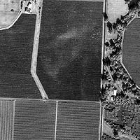
Any product in Space Imaging’s catalog can be purchased including data products from its IKONOS satellite, and the Indian Remote Sensing (IRS) satellites including the recently launched RESOURCESAT-1 satellite. Both new collection and archive imagery can be purchased.
With more than 200 million sq. km. of customer-ready imagery, Space Imaging’s IKONOS archive is the industry’s most comprehensive global archive of high-resolution satellite imagery.
“These contracts directly support the President’s Commercial Remote Sensing Space Policy, signed in 2003, by providing a centralized mechanism for civil agencies to acquire commercial remote sensing products to support their mission needs in an efficient and coordinated way,” said Barbara Ryan, USGS associate director for Geography.
“This innovative USGS offering encourages wide use within the federal government of commercial remote sensing imagery and products. All federal agencies can now have easy access to satellite imagery at very reasonable cost,” said Gene Colabatistto, Space Imaging’s executive vice president of Solutions.
“Space Imaging’s unmatched capacity, proven technical performance, unsurpassed value and excellence in program management all help to ensure that we will provide the best available data products to support the geospatial mapping community’s requirements.”
Chris Hill, Space Imaging’s manager of Federal Civil Programs, said, “This contract demonstrates our desire to work with the geospatial community by providing federal, state and local users with unprecedented discounts and licensing flexibility. Experience has shown that centralized procurement leads to considerable cost savings to the government because of volume discounts, reduction of administrative costs and the avoidance of duplicate purchases.”