The Center for Remote Imaging, Sensing and Processing (CRISP) at the National University of Singapore has begun direct tasking and data collection of high-resolution imagery from Space Imaging’s Ikonos satellite.
As Ikonos passes through a 4,600 km diameter communications circle around Singapore, CRISP is now able to task, collect, download and process the imagery, all in a short amount of time.
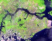
CRISP will use the high-resolution imagery for: project planning and monitoring, seaport and airport management, insurance and risk management, disaster assessment, forestry management and environmental monitoring, coastal zone mapping, urban planning, and tropical vegetation studies.
“Singapore is proud that it can now task the world’s highest resolution commercial satellite from our own ground station. We will be able to receive the best commercially available imagery in the world in a very timely fashion,” said Professor Bernard Tan, chairman of CRISP Management Board.
“Our partnership with Space Imaging ensures that we are able to make use of state-of-the-art satellite technology to maintain our leadership position in remote sensing research and offer our expertise in this region.”
During the grand opening on Aug. 30 at the National University of Singapore, John Copple CEO of Space Imaging said, “We are very pleased that CRISP is now able to directly task, download, process and create image-based products from Ikonos.
“This operations center provides researchers with leading-edge, geospatial information technology in order to develop new products and services.”
“Countries are driven by their need for accurate visual information. The quality of our high-resolution imagery, coupled with CRISP’s international reputation for research excellence, should provide Singapore tools never before available to this region,” said Conrad Mueller, vice president of Global Alliances for Space Imaging.