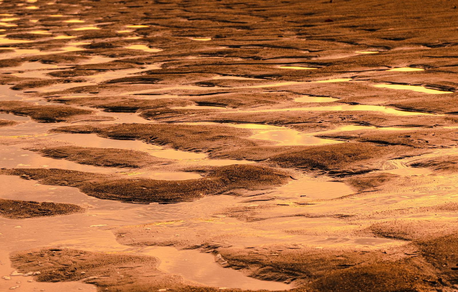
The European Space Agency’s Mars Express orbiter has returned a fresh portrait of one of the Red Planet’s most dramatic flood-carved regions, revealing a sprawling network of collapsed terrain, sediment-choked valleys and impact scars that record a violent chapter in Martian history.
But the more consequential story sits in the channel’s destination. Shalbatana Vallis drains north toward Chryse Planitia, one of the lowest-lying basins on Mars and a leading candidate for the shoreline of an ancient northern ocean. The new mosaic, released by ESA, sharpens the topographic case that this channel was part of the plumbing feeding that sea.
The ocean hypothesis has gathered weight over the past decade as orbital and rover data have turned up features consistent with shorelines, tsunami deposits and sediment fans at Chryse’s edges. What Shalbatana Vallis adds is a clean, measurable conduit: a channel near the Martian equator that stretches hundreds of miles, runs several miles wide, plunges well over a thousand feet deep, and grades directly downhill into the candidate ocean basin.
The terrain documented in the new mosaic is the kind planetary scientists call “chaotic” — jumbled blocks of fractured rock that collapsed when subsurface ice melted out from underneath them. Catastrophic floods then surged through the resulting depressions billions of years ago, when vast groundwater reserves are thought to have burst onto the surface.
What the orbiter saw
The data come from Mars Express’s High Resolution Stereo Camera, or HRSC. The new release pairs nadir-view imagery with 3D anaglyphs that expose the vertical structure of the valley floor, including layered deposits of volcanic ash, wind-blown sediment and debris from later impacts. The DLR team behind the camera describes the area as a record of repeated cycles of flooding, erosion and volcanism stacked one atop the other.
The geometry matters. Shalbatana Vallis is not a meandering river valley shaped by gentle, sustained flow. Its steep walls, abrupt origin points and scoured floor are consistent with short-lived megafloods — water released suddenly and in volumes orders of magnitude larger than any flood recorded on Earth.
ESA officials have noted that Mars Express has previously documented similar terrain features across Mars during its two decades of operations.
A planet that once held an ocean
If Chryse Planitia did hold standing water, channels like Shalbatana Vallis would have been the plumbing — episodic conduits delivering catastrophic pulses of groundwater into a larger sea. That model implies a Mars warm enough, at least intermittently, to keep liquid water stable at the surface long enough to leave a geological signature.
The HRSC topography tightens that argument in a specific way. The continuous downhill grade from the chaos source regions through the channel and out onto the Chryse floor means the floodwaters had somewhere to pool. Without a standing body of water at the receiving end, the volumes implied by the channel’s dimensions would have had to vanish — refrozen, infiltrated or sublimated — on timescales that strain most current climate models.
Reading 3.5 billion years of erosion
The dating is anchored to the late Noachian and early Hesperian periods, when Mars transitioned from a wetter, more active world to the cold desert it is today. Layered deposits inside Shalbatana Vallis preserve that transition in cross-section. Volcanic ash sits on top of flood-scoured bedrock. Impact craters punch through both, providing chronometric markers that planetary geologists use to bracket the timing of each event.
Independent work in other Martian basins supports the broad timeline, reinforcing the picture of a planet that experienced repeated, geologically brief episodes of surface water before drying out.
Chaos terrain as a clue, not a curiosity
The blocks scattered across Shalbatana Vallis’s floor are not just visually striking. They are direct evidence that significant quantities of water ice were stored beneath the Martian crust within the last few billion years, and that something — likely volcanic heat or impact-driven melting — released that ice in catastrophic bursts.
Understanding where subsurface water existed, and in what quantities, has implications well beyond geology. It shapes where future missions look for biosignatures. It shapes where human missions might eventually source water. And it shapes the broader question of whether Mars ever sustained the conditions for life long enough for biology to take hold.
Other ESA imagery has captured the planet’s continuing volcanic and atmospheric activity, including views of Martian volcanoes emerging above morning cloud tops. Those phenomena belong to a different Mars — colder, drier, geologically quieter — but they share a landscape shaped by the events Shalbatana Vallis records.
What the channel does to existing ocean models
Two competing versions of the northern ocean hypothesis have dominated the literature. One posits a long-lived, relatively stable Oceanus Borealis filling the northern lowlands for tens of millions of years. The other argues for a series of transient seas, each filled by catastrophic outflow events and each drying out within geologically short windows. Shalbatana Vallis fits the second model more comfortably than the first. The channel’s morphology — episodic, violent, sourced from collapsing chaos terrain rather than from sustained precipitation — describes pulses of water, not a steady hydrological cycle.
That distinction matters for shoreline studies. The proposed shorelines around Chryse have long been criticized for their inconsistent elevations, a problem for any model assuming a single stable sea level. A pulsed-ocean scenario, repeatedly refilled by outflow channels like Shalbatana Vallis and then partially lost to freezing or infiltration, predicts exactly the kind of vertically scattered shoreline traces orbiters have found. The new HRSC mosaic does not settle the debate, but it strengthens the side of it that treats the northern lowlands as a basin that held water in episodes rather than continuously.
For now, the new images offer a reminder that Mars’s quietest-looking ground often carries the loudest geological story. An 800-mile scar near the equator, carved in a geological instant and frozen in place for three and a half billion years, is one of the clearest things the planet has to say about its own past.