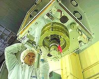
AlSAT-1, the first satellite launched for the international Disaster Monitoring Constellation (DMC), has completed one year of orbital operations. The satellite, built under a know-how transfer programme at Surrey Satellite Technology Ltd (SSTL), was launched on 28 November 2002 for Centre Nationale Techniques Spatiales in Algeria.
The first 12-months of satellite operations has seen the successful exploitation of imagery by a wide variety of end users within Algeria, with demand far exceeding expectations. For the first time, engineers at CNTS were unable to take their annual leave month of August, so high was the level of imaging requests from the Algerian forest services in their efforts to estimate burn scars from recent fires.
Previously, the only way to access this information was to send teams into remote and often difficult to reach areas of the country. Subsequent ground verification by the forestry services has demonstrated the accuracy of the satellite’s remote sensing data.
Imagery from AlSAT-1 has also been used for soil and land classification, watershed and other hydrological mapping. By laying LANDSAT data over digital elevation models and creating Geographical Information Systems (GIS) for managing hydrological resources, it has been concluded that AlSAT-1 data is virtually indistinguishable from that provided by LANDSAT.
The Algerian Government is currently using data from the satellite to counter the threat of locust plagues. With the onset of rain there are serious problems in monitoring breeding areas of desert locusts. AlSAT-1 imagery has highlighted new flushes of vegetation across a very wide area, assisting teams on the ground to target these potential breeding grounds using topographical information available from the DMC satellites. Imagery has also been used for identifying iron mineralisation.
AlSAT-1 was joined in orbit in September by a further three satellites: NigeriaSat-1 for the Nigerian Space Agency, BILSAT-1 for Tubitak-Bilten in Turkey and the UK-DMC. In 2005 a fifth satellite, for China, will be launched into the constellation.
The DMC’s Earth imaging data is already attracting considerable commercial interest that will lead to the generation of income from each satellite — an important element of any sustainable space programme.