In September 2023, seismometers across the globe began picking up a signal no one recognised. It arrived every 90 seconds, like a slow mechanical pulse, and it continued for nine days. Then, roughly a month later, it happened again. The recordings looked nothing like an earthquake: no broadband rumble, no frequency-rich overtones, just a single, sustained oscillation travelling through the Earth’s crust from pole to pole. Seismologists tagged it a “USO” — unidentified seismic object — and began looking for a cause.
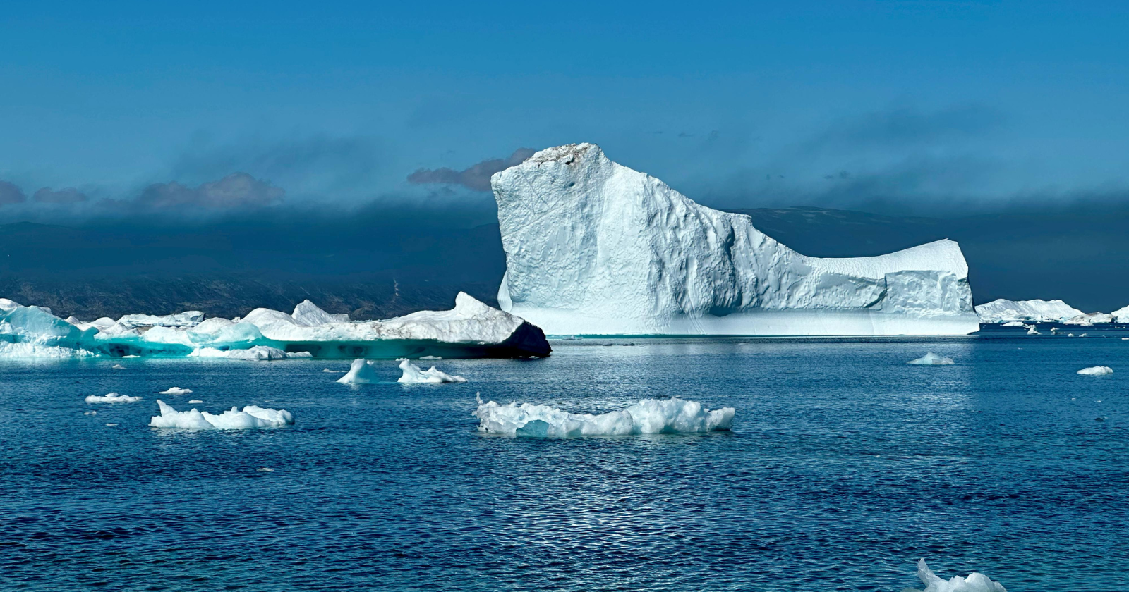
Almost a year later, in September 2024, a large collaborative study published in the journal Science and involving 68 researchers from 40 institutions proposed an answer. A mountaintop had collapsed into the remote Dickson Fjord in East Greenland, triggering a mega-tsunami roughly 200 metres high at its peak. The wave became trapped inside the fjord system, sloshing back and forth in a standing wave — technically a seiche — that had nowhere to go. The fjord’s narrow geometry and sharp bends meant little energy could escape. That sloshing, according to the model, was the source of the planetary hum.
The theory was compelling. It also had no direct observational support. No instrument had actually seen the wave.
What the theory required
A seiche is not a travelling wave. It is a standing oscillation, water rocking between two ends of an enclosed or semi-enclosed basin the way liquid moves in a tilted container. The 2024 modelling work reconstructed the Dickson Fjord geometry, calculated the expected oscillation period, and found it matched the 90-second seismic signal closely. The researchers also confirmed, through imagery from the Danish military, which sailed into the fjord three days into the first event, that a landslide had occurred. The collapsed mountain face was visible. The glacier at its base had thinned enough to release the rock above it.
What the Danish vessel did not observe was the wave itself. Three days in, the surface was calm enough to look ordinary. The seiche was, by that point, a matter of centimetres. The Earth was still trembling, but the water showed nothing that an observer on deck would have noticed.
To confirm the seiche theory required a measurement of the wave while it was still active: direct evidence of water height varying across the channel, oscillating in opposite directions at different times. This is what was missing from the 2024 accounts, and what a new study from the University of Oxford’s Department of Engineering Science has now provided.
The instrument that changed what was possible
The new paper, led by DPhil student Thomas Monahan and co-authored by Professor Thomas Adcock, was published on 3 June 2025 in Nature Communications. Its title is straightforwardly named: “Observations of the seiche that shook the world.”
The Oxford team used data from the Surface Water Ocean Topography (SWOT) satellite, launched in December 2022 by NASA and the French space agency CNES to map water heights across 90% of the Earth’s surface. At the centre of SWOT is the Ka-band Radar Interferometer, known as KaRIn: two antennas mounted on a 10-metre boom on either side of the satellite, working together to triangulate radar return signals and measure water surface height across two 50-kilometre swaths — one on each side of the satellite — at a resolution fine enough to detect height differences of a few centimetres when measurements are averaged, a capability conventional nadir altimeters cannot match in confined coastal geometries.
Conventional satellite altimeters measure in a single track directly beneath the spacecraft, producing a one-dimensional profile. That is sufficient for open-ocean monitoring. It is not sufficient for a narrow fjord with a wave oscillating across its width. KaRIn produces two-dimensional surface maps. That capability, applied to the Dickson Fjord, is what made the observation possible.
What the data showed
Using KaRIn data, the Oxford team constructed elevation maps of the fjord at multiple points following both tsunami events. The maps showed clear cross-channel slopes, with water height differences of up to two metres between one side of the channel and the other. Critically, when the researchers compared maps taken at different times, the slopes ran in opposite directions: water that had banked against the northern wall was later found elevated against the southern wall. The seiche was directly visible in the data.
This alone established what the 2024 model had predicted but could not prove. The team then went further. They connected the satellite measurements to the seismic records: the crust displacements detected thousands of kilometres away. That linkage let them reconstruct the wave’s characteristics across the full duration of the event, including periods when SWOT did not pass over the fjord. They also ran reconstructions of tidal and weather conditions during the same windows, ruling out wind and tidal forcing as alternative explanations for the observed slopes.
The second seismic event, roughly a month after the first, had the same signature. A second landslide, the evidence suggests, triggered a second seiche in the same fjord system. Both events are now accounted for by the same mechanism, now observationally confirmed.
What this is, and what it is not
The Nature Communications paper is the first direct observational confirmation of the seiche hypothesis. It is not the last word on the event’s full dynamics. The satellite passed over the fjord at a limited number of times; the reconstruction between passes relies on modelling informed by the seismic record. There remain uncertainties in the precise energy distribution and in the detailed geometry of how the wave interacted with the fjord’s branching channels.
The climate context matters and the authors do not understate it. The glacier at the base of the collapsed mountain had thinned due to warming, destabilising the rock above. The September 2024 Science paper had noted that the landslide and the tsunamis it triggered were the first of their kind observed in eastern Greenland. What is happening in remote Arctic fjords, where no permanent measurement infrastructure exists, has now been shown to produce signals detectable at every seismometer on the planet. The argument for better remote monitoring is implicit in the finding itself.
Thomas Monahan, lead author, noted in the University of Oxford’s press release that extremes are changing fastest in the regions hardest to measure, and that this study demonstrates how the next generation of satellite instruments can reach into those gaps. Professor Adcock pointed toward the broader application: storm surges, freak waves, tsunamis elsewhere, phenomena that conventional altimetry has struggled to characterise in confined coastal geometries.
What to watch next
SWOT’s KaRIn instrument is still relatively new. The Dickson Fjord study is the first time it has been used to confirm a geophysical hypothesis of this kind, and the team’s methodology — linking satellite water-height maps to distant seismic records — is itself novel. Whether the approach can be extended to other fjord systems, or applied in near-real-time during active events, is an open question. The instrument exists; the analytical framework is now published. The 2026 SWOT study of the Kamchatka tsunami, also using KaRIn data, suggests the approach is already being extended.
For the Greenland events specifically, the open questions are primarily about frequency and trend. The 2023 events were the first observed in this region. Whether the conditions that produced them — a thinning glacier, an unstable rock face, a particular fjord geometry — are likely to recur, and where, is a question for the glaciologists and geomorphologists, not this paper. What this paper establishes is the mechanism, precisely, for the first time.