A Suezmax tanker loaded with crude, sliding through the Phillips Channel south of Singapore at around eight knots, displaces close to 150,000 tonnes of water. The channel’s navigable depth is limited, and the largest Very Large Crude Carriers (VLCCs) that pass through here operate with minimal under-keel clearance when fully laden. The Strait of Malacca and the Singapore Strait, the two-stage maritime corridor that links the Indian Ocean to the South China Sea, carries roughly a quarter of all seaborne oil and a third of global trade. And it does so over a seabed that, in stretches, the largest ships clear by only a few metres.
This is not an engineering quirk. It is the central physical fact of the busiest shipping lane on Earth.
The Phillips Channel bottleneck
The strait narrows in stages as a ship moves east from the Andaman Sea. North of Sumatra it is broad and forgiving, more than 200 nautical miles across. By the time a vessel reaches the One Fathom Bank off Port Klang, the navigable width has collapsed to a few miles of dredged water flanked by shoals. By the Phillips Channel, just southwest of Singapore, the usable shipping lane is narrow and the controlling depth limited at chart datum.
A fully laden VLCC has substantial draft requirements, and the arithmetic is tight. The rules governing the straits require deep-draught vessels and the largest tankers to keep at least three and a half metres of clearance beneath the keel at all times. Pilots time transits to high tide, watch swell forecasts obsessively, and accept that for several hours of a voyage worth hundreds of millions of dollars the ship is gliding over the bottom on a cushion of water about as deep as a one-storey room is tall.
Why the depth defines a class of ship
The strait is so shallow, and so commercially essential, that the global tanker industry built a ship class around it. “Malaccamax” is the largest size of vessel that can transit the strait fully loaded. Anything larger — the ultra-large crude carriers of the 1970s — has to go the long way around, south of Sumatra and through the Lombok or Sunda Straits, adding significant distance and days of steaming.
The economics of that detour are brutal. A Malaccamax burning substantial fuel oil daily pays for the convenience of the shortcut many times over. So shipowners design to the strait’s controlling depth, and the strait, in turn, shapes the global oil fleet.
One ship every few minutes
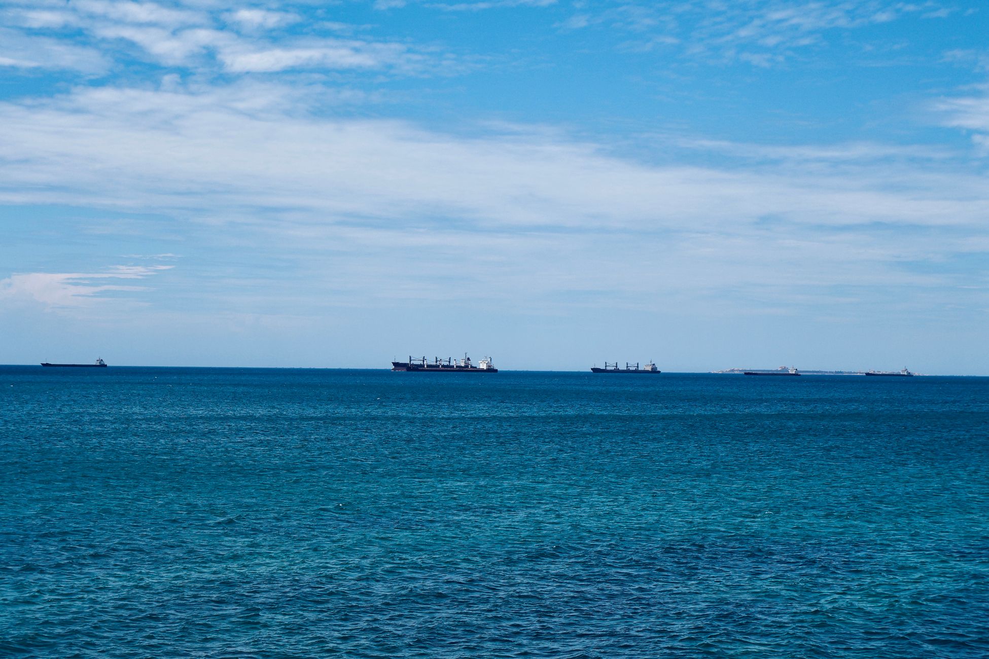
About 90,000 vessels transit the Strait of Malacca each year, according to data cited by analysts at The Conversation. That is one ship roughly every six minutes, around the clock, every day. On a clear morning from the observation deck of Marina Bay Sands in Singapore, the anchorage off the southern coast looks like a parking lot of steel — bulk carriers, container ships, LNG tankers, crude carriers, all queueing for berths, bunkers, or the next slot through the traffic separation scheme.
The Singapore Strait operates a one-way traffic system run jointly by Singapore, Malaysia and Indonesia, with eastbound and westbound lanes separated by a buffer zone and policed by VTIS, the Vessel Traffic Information Service. Pilots speak to controllers in clipped English. A deviation of a few hundred metres can put a laden VLCC on a reef.
The cargo riding on a few metres of water
The numbers behind what moves through here are difficult to picture. Around 16 million barrels of oil a day pass through the strait, along with most of the liquefied natural gas bound for Japan, South Korea, and China. A substantial portion of China’s crude oil imports cross the strait at some point in their journey. For Beijing, this is the basis of what has been called the “Malacca dilemma” — the strategic vulnerability of having the nation’s energy lifeline pinched into a corridor a few kilometres wide.
A new analysis from the International Institute for Strategic Studies, summarised by TradeWinds, argues that China’s energy supply is in fact more exposed at the Strait of Hormuz than at Malacca, because crude that has already cleared Hormuz has many possible routes east. The Malacca route is the cheapest. It is also the shallowest.
Squat, swell, and the physics of near-bottom sailing
When a large ship moves through shallow water, it sinks. The phenomenon is called squat: water accelerating under the hull drops in pressure, the stern settles, and a VLCC at speed in shallow water can squat significantly. Pilots compensate by reducing speed, which reduces squat but increases transit time and fuel burn. They watch the tide tables for the extra clearance a spring tide gives them. They watch the wake of the ship ahead, because a passing vessel can lower the water level behind it by tens of centimetres.
A long swell rolling up from the Indian Ocean, combined with squat, can eat into that required margin — which is why the regulations cap speed at 12 knots through the tightest stretches and pilots routinely run well below it. The combination of draft, squat and swell is exactly the variable a transit is planned around, hour by hour, so that the three-and-a-half-metre minimum is preserved even when conditions conspire against it.
Why the strait is so shallow in the first place
The Malacca Strait sits on the Sunda Shelf, a drowned continental platform that, during the last glacial maximum some 20,000 years ago, was dry land. Sumatra, the Malay Peninsula, Borneo and Java were joined into a single landmass called Sundaland. As sea levels rose roughly 120 metres after the last ice age, the lowlands flooded but the underlying geology remained: a broad, shallow shelf rather than a deep marine channel.
Sediment from the great rivers of Sumatra and the Malay Peninsula continues to fill the strait. Without continuous dredging of the main channels and the Phillips Channel approaches, depths would shoal further. The three littoral states — Indonesia, Malaysia and Singapore — coordinate hydrographic surveys and channel maintenance under longstanding arrangements.
A chokepoint with no easy bypass
Strategists in Washington, Beijing and New Delhi keep returning to the same map. A blockade or major incident in the strait — a collision, a grounding, a deliberate act — would ripple through global energy markets within hours. Writing in Foreign Affairs, analysts have drawn the comparison to the 1984 “tanker war” in the Persian Gulf, when Iran laid mines in the Strait of Hormuz but the chokepoint nonetheless remained in use because alternatives were so costly.
Alternatives to Malacca exist but they are slower, deeper, and harder to police. The Sunda Strait between Java and Sumatra is shorter for some routes but treacherous, with active volcanism around Anak Krakatau. The Lombok Strait, between Bali and Lombok, is deep enough for ultra-large crude carriers but adds days to a voyage. Proposals for a canal across the Kra Isthmus in Thailand have circulated for centuries and never been built. Pipelines across the Malay Peninsula have been discussed and shelved.
Southeast Asian governments have begun openly discussing whether the strait should be tolled, particularly after disruptions elsewhere. The Council on Foreign Relations notes that the conversation has shifted from “freedom of navigation” purism toward serious consideration of user fees to fund safety, anti-piracy and environmental work.
Piracy, accidents, and the human scale
Piracy in the strait, once one of the world’s worst hotspots, has fallen sharply after coordinated patrols by the littoral states. Reporting on the decline credits the Malacca Strait Patrol, a joint sea and air operation, with much of the change.
Collisions remain the bigger risk. Most incidents involve smaller craft cutting across the traffic separation lanes — fishing boats, sand barges, ferries. A laden VLCC at speed needs significant distance to stop. The pilots know it. So does the VTIS controller in Singapore who sees a fishing skiff drift across a tanker’s track on radar and has perhaps 90 seconds to do something about it.
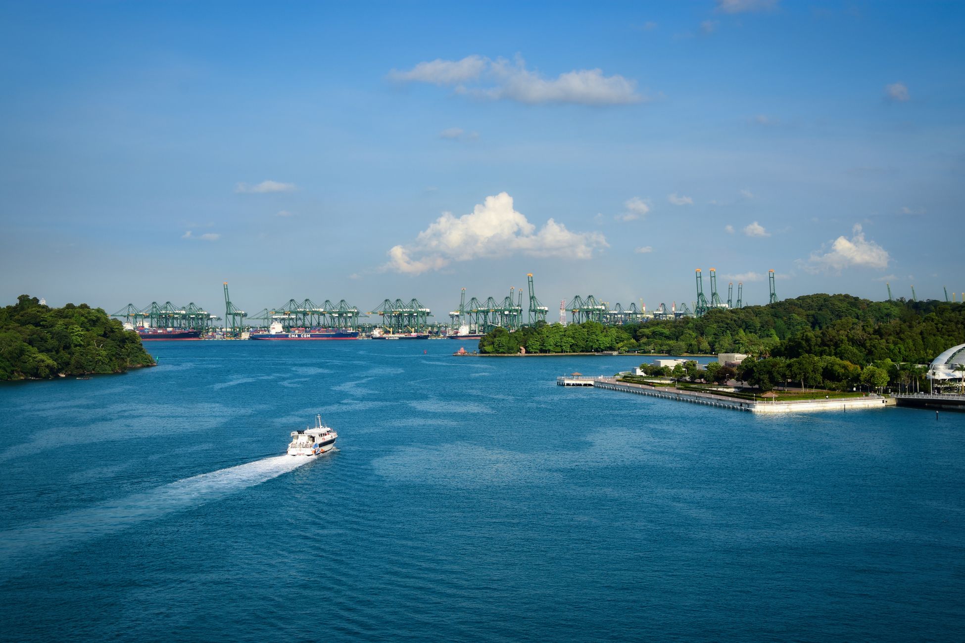
Singapore’s bet on the strait’s future
Singapore, which sits at the strait’s eastern hinge, has built its economy on this geography. The Port of Singapore handled around 39 million TEU of containers in 2023 and remains the world’s largest bunkering port, refuelling the ships that move global trade. The city-state is now positioning itself to supply green methanol and ammonia to the next generation of tankers, betting that whatever fuel ships burn in 2050, they will still come through this channel to take it on board.
Indonesia, on the southern shore, has pushed in a different direction, courting Chinese investment for ports and industrial corridors along the Sumatran and Riau coasts. Some of those projects have collided with local communities being asked to make way for the wharves and refineries the new traffic will demand.
The margin of water, hour by hour
At any given moment, somewhere in the Phillips Channel, a tanker pilot is staring at an echo sounder display. The number on the screen shows the gap between the bottom of the ship and the bottom of the sea. In the worst minutes of a transit, with squat and swell working against the pilot, it can press down toward the three-and-a-half-metre floor the rules will not let it cross — a thin band of water under a hull that can run the length of three football pitches. Above the pilot’s head, on the bridge wing, a quarter of the world’s oil moves past Singapore’s skyline at the speed of a brisk jog. Below, mud and shells. The space between them is the margin the modern economy lives on.