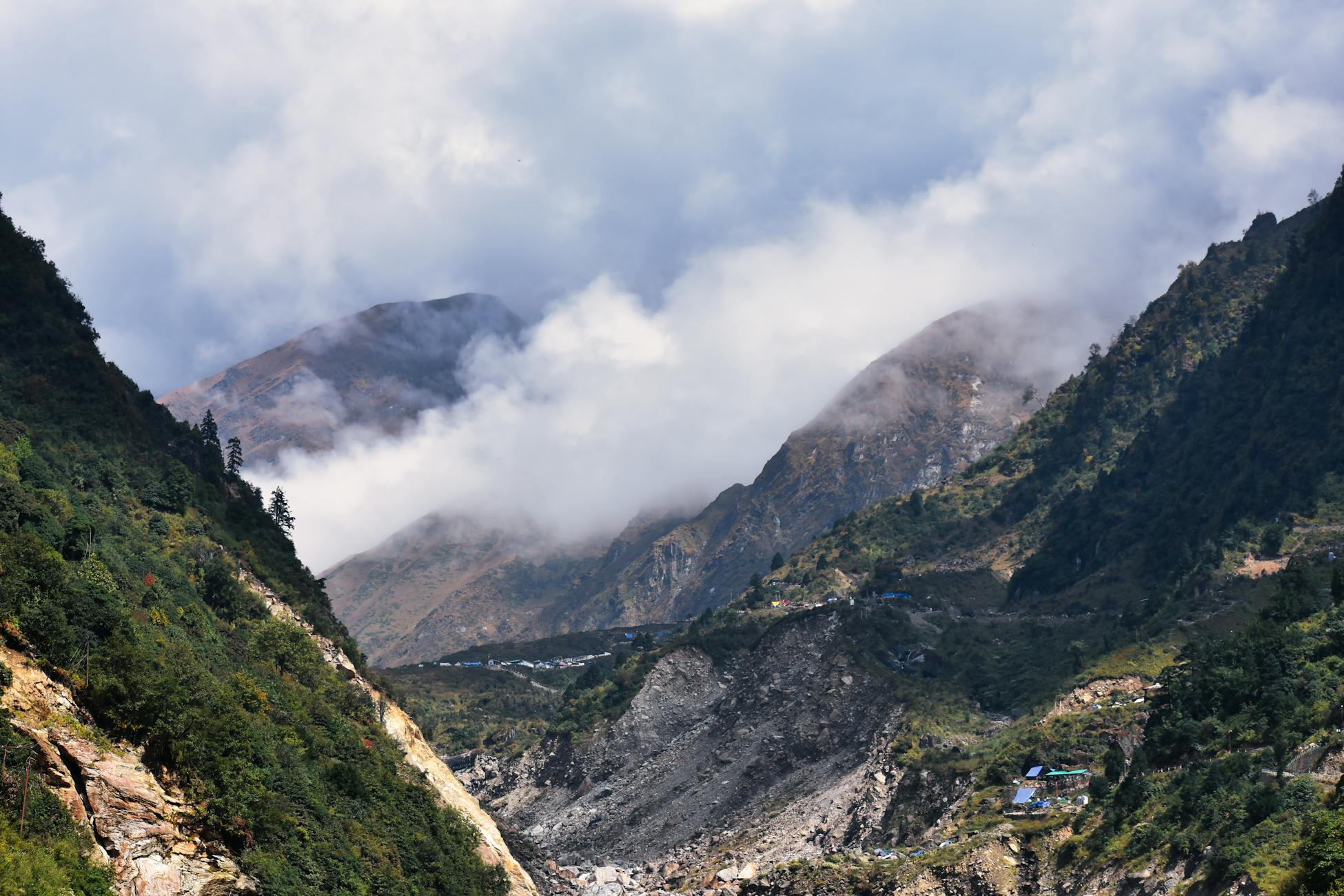
The tallest mountains on Earth are not finished. They are not eroded relics, not frozen monuments to some ancient event, not the settled wreckage of a collision that happened and ended. The Himalayas are an active wound. India is still driving north into Asia at roughly 4 to 5 centimetres per year, which is approximately the rate at which a human fingernail grows, and that absurdly patient shove is the reason Everest gets a little taller every time anyone bothers to measure it carefully.
Most popular accounts of the Himalayas treat the collision in the past tense. India hit Asia, the story goes, and the mountains went up. The implication is that the event is over, that what remains is a slow downhill story of weather grinding the peaks back into sand. That story is wrong in a specific and interesting way. The collision did not happen. The collision is happening. The plates have not stopped, the suture is not cold, and the orogeny — the technical word for mountain building — is in roughly the same active phase it has been in for the past several tens of millions of years.
The number that sounds too small to matter
Four to five centimetres per year. Stated like that, the rate sounds trivial. It is not. Over a single human lifetime, that adds up to roughly three to four metres of continental shortening — enough that the India-Asia boundary today sits several metres closer than it did when a reader in their seventies was born. Over a million years, it is forty to fifty kilometres. Over the roughly fifty million years since initial contact, it is enough to have shoved a section of the Indian plate the length of France underneath Asia.
That last part is the geometry most people miss. India did not crumple against a wall and stop. It slid under. The crust of the Indian plate is partially subducted beneath the Tibetan Plateau, doubling the crustal thickness in the region to roughly 70 kilometres, which is about twice the global average for continental crust. The Himalayas are the leading edge of that pileup, lifted by the buoyancy of all that thickened rock trying to find equilibrium with the mantle beneath it.
A recent synthesis of the tectonic evolution of the Himalaya and Greater India describes this as a continuous sequence — rifting, oceanic subduction, then collisional orogeny — that has never actually concluded. The third phase is the one currently in progress. It is the phase that lifts the peaks faster than weather can wear them down.
Why erosion is not the story
There is a popular intuition that mountains grow taller when erosion slows or new rock forms beneath them. Neither describes the Himalayas. Erosion in the Himalayan range is, if anything, ferocious — among the most aggressive on the planet. Monsoon rains, glacial scouring, and steep gradients strip material off the slopes at rates that would flatten most mountain ranges in tens of millions of years. The reason the peaks keep rising anyway is that the uplift rate is winning. Just barely, in some places. Decisively, in others.
Estimates for net uplift in the central Himalayas hover around 5 to 10 millimetres per year, with erosion clawing back a substantial fraction of that. Everest gains perhaps a few millimetres per year on balance — small enough that earthquakes can erase or accelerate a decade of net growth in a single afternoon. The 2015 Gorkha earthquake in Nepal, for example, caused substantial vertical displacement across the region, with some areas subsiding and others experiencing uplift.

The clock that started fifty-something million years ago
The question of exactly when India first touched Asia is one of the more contested numbers in geology, and the answer keeps drifting older as the rocks get more carefully interrogated. A 2025 study using pressure-temperature-time constraints from eastern Himalayan syntaxis eclogite-facies metamorphic rocks pushed back the initial collision timing by examining minerals that record the precise depths and temperatures at which they crystallised. Eclogites are the diagnostic rock here — they form when continental crust gets shoved to extreme depths, typically more than 50 kilometres down, and the minerals inside them preserve a chemical fingerprint of that descent.
What those rocks reveal is a continental margin being dragged into a subduction zone, heated, pressurised, and then later exhumed back toward the surface as the orogeny progressed. The timing recorded in the eclogites pins down when India’s leading edge first encountered Asian crust in a meaningful structural sense, and the answer keeps coming back somewhere in the range of 50 to 60 million years ago, depending on which section of the suture is being examined.
The relevant detail for the present argument is that the convergence rate has slowed since initial contact — India was moving north at something closer to 15 centimetres per year before the collision, and the deceleration to today’s 4 to 5 centimetres is itself evidence of the resistance the continent is now meeting. Slower, yes. Stopped, no.
What GPS actually sees
The clearest modern evidence that the collision is ongoing comes from satellite geodesy. GPS stations bolted to bedrock across India, Nepal, Tibet, and Bhutan measure their positions to within a few millimetres. Over years, those measurements trace out vectors. India’s vectors point north. Tibet’s vectors point north too, but more slowly. The difference between them — the rate at which the surface of India is closing on the surface of Tibet — is the present-day convergence, and it lands consistently in the 4 to 5 centimetre range across most of the Himalayan arc.
A portion of that convergence is absorbed in the deep crust as ductile deformation. A portion is taken up by the gradual thickening of the Tibetan Plateau, which is itself rising and spreading laterally. A portion accumulates as elastic strain along the Main Himalayan Thrust, the great fault that runs beneath the range. That stored strain is what releases catastrophically in earthquakes like Gorkha. The energy is being deposited continuously, in fingernail-sized increments, and withdrawn periodically in violent ones.
The frame that gets in the way
Part of what makes Himalayan tectonics hard to communicate is that the timescales involved bracket human intuition on both sides. Five centimetres a year is too slow to feel in the body, too slow to see in a satellite photo from one year to the next. Fifty million years of continuous shortening is too long to picture meaningfully. The story that tends to survive translation is the cartoon: two plates collided, mountains formed, the end. The cartoon is wrong in the specific direction that matters. The plates are colliding. Mountains are forming. There is no end yet.
Science communicators have written at length about how fact-bombing audiences with numbers rarely shifts intuition, and the Himalayan case is a good example of why. The number itself — 4 to 5 centimetres per year — does not feel like an explanation for the tallest mountains on Earth. The relationship between the rate and the result only becomes intelligible when the timescale is held in mind alongside it, which the human brain is not particularly built to do.
What the fingernail comparison is actually doing
The fingernail comparison is not a coincidence of phrasing. It is a deliberate scaling trick, used by geophysicists for decades, to make a number that feels meaningless feel embodied. A fingernail growing is something a person has watched happen. It is slow enough to require trimming only occasionally, fast enough that the trimming is unmistakably necessary. That is the right intuition for plate motion. It is slow enough to be invisible day to day. It is fast enough that, given geological time, it builds the largest topographic features on the planet.
The comparison also quietly conveys something else, which is that the process is not exotic. Continental drift is not a strange or unstable behaviour of the planet. It is the steady state. Every continent on Earth is in motion, in some direction, at roughly the rate at which a person’s fingernails or hair grow. The Himalayas are unusual not because the rate is unusual but because the geometry happens to be one in which two continents are converging head-on rather than sliding past each other or pulling apart. The collision is the rare configuration. The motion itself is ordinary.
What the mountains have not finished doing
Projecting forward is genuinely difficult. The convergence rate has slowed over the collision’s history and may continue to slow as more Indian crust is consumed and the resistance increases. At some point, the geometry will change — India will exhaust the part of itself that can subduct, or the suture will lock, or a new boundary will develop somewhere else in the system. None of these things appears to be close. For the foreseeable geological future, which is the only useful timescale here, the Himalayas will keep being pushed up by the same mechanism that has been pushing them up for the last fifty million years.
Earlier coverage on this site has examined related cases of geological records that overturn assumed timelines by tens of millions of years, and the eastern Himalayan eclogite work fits the same pattern: rocks asked the right questions yield older, more complicated answers than the textbook version. The Himalayas, in that sense, are not just still rising. They are still being understood.
The number to hold onto is the slow one. Four to five centimetres a year. The rate at which a fingernail grows. The rate at which a subcontinent is driving itself into another one, kilometre by patient kilometre, with no indication that it intends to stop.