For the first time in the Chinese meteorological satellite program, a metsat functions beyond its design life expectancy. The official Xinhua News Agency reported the milestone that Fengyun 1-C reached on May 10.
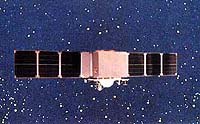
Launched from the Taiyuan Satellite Launch Centre (TSLC) in the northern Shanxi Province on May 10, 1999 aboard a Changzheng-4B (LM-4B) rocket, Fengyun 1-C (FY-1C, Fengyun means “Wind and Cloud”) operates from a sunsynchronous polar-orbit at an average altitude of 858km. At this orbit FY-1C crosses the Chinese landmass at about 8:30 a.m. Beijing Time (00:30 UTC) everyday.
FY-1C is China’s first operational polar-orbiting meteorological satellite. Two previous experimental satellites, FY-1A and -1B, went into orbit in 1988 and 1990 respectively.
The domestic metsat is developed and built by the Shanghai Academy of Spaceflight Technology (formerly known as the Shanghai Bureau of Astronautics), which gives FY-1C a two-year design lifetime.
When FY-1C reachs its second anniversary, the satellite remains healthy and operates nominally. FY-1C thus becomes the longest serving metsat in the program.
Dong Chaohua, Manager of the National Satellite Meteorological Center (NSMC), said: “FY-1C maintains a stable attitude with good electrical power supply and returns clear imagery. The overall quality is excellent.”
NSMC, a scientific research and operational facility which is affiliated with the China Meteorological Administration (CMA) receives, processes and distributes data to users.
A major sensor on FY-1C is the Multichannel Visible and Infrared Scan Radiometer (MVISR) which has ten channels: four in visible wavebands, three in near-infrared, one in short-wave infrared, and two in long-wave infrared. The image resolution in the visible channels is 1.1km at the sub-satellite point.
In addition to the primary use in weather forecasting, imagery and data transmitted from FY-1C has been used in monitoring natural disasters such as flood, drought, forest fire, snow and ice accumulation, and sandstorm.
For example on April 7, FY-1C transmitted clear images of the sandstorm that blew northeastward from Inner Mongolia.
The metsat has also collected large quantity of remote sensing data that various departments and businesses use in meteorology, agriculture, forestry, hydrology and oil exploration.
Last Autumn the World Meteorological Organization (WMO) added FY-1C to the list of world operational application weather satellites, which included satellites from U.S., Russia, Europe and Japan.