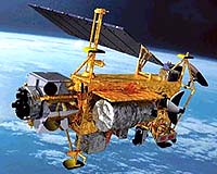
The Calipso (Cloud-Aerosol Lidar and Infra-Red Pathfinder Satellite Observations) satellite is a collaborative effort between CNES (French Space Agency) and NASA. It will take measurements of the vertical distribution of the clouds and the aerosols to provide a better understanding of the climate system and global climate forecasting.
NASA is responsible for the overall mission and system as well as the facilities for operations. It provides the payload and the launch as well. One of the 3 instruments within the payload is a 3-channel thermal imager developed by CNES.
CNES is responsible for the satellite, navigation and guidance tools and the facility to process data from the thermal imager. CNES also provides a PROTEUS microsat bus. The payload arrived at Alcatel Space in Cannes, France, last month where it is being integrated to the bus and will than go through integration and qualification tests.
Ground facilities are almost ready. Testing of the entire system and preparation of the operations should start at the end of April. Calipso is set to launch in March 2005. Calipso will be teamed with the American missions AQUA and CLOUDSAT, and the French micro satellite PARASOL.
Orbiting at an altitude of 705 km, the group of 4 satellites will be nicknamed “Aqua-train”. AQUA was placed in orbit in April 2002. PARASOL is set to launch at the end of 2004 and Calipso and CLOUDSAT beginning 2005.