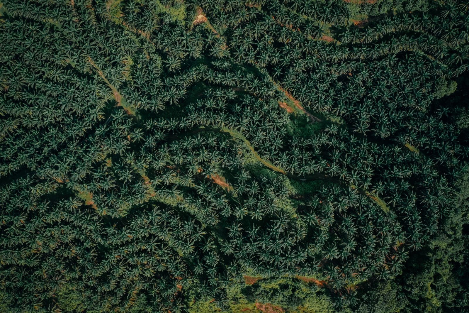
From 700 kilometres up, an oil palm plantation looks almost nothing like the rainforest it replaced — and the difference is not just colour or texture, but the precise angle at which sunlight bounces off each frond. Mature oil palms grow in a near-perfect lattice, planted nine metres apart in triangular grids, their long pinnate leaves arching outward in a predictable geometry. Native lowland forest in Borneo or Sumatra, by contrast, scatters light through a chaos of canopy layers, lianas and emergent dipterocarps reaching sixty metres into the air. Modern Earth-observation satellites can read that difference in milliseconds, and the European Union’s deforestation regulation now rests on their ability to do so.
The fact at the centre of this story is simple. Palm oil has a spectral signature. So does primary forest. And a regulation that took effect in 2023 — the EU Deforestation Regulation, or EUDR — has turned that signature into a legal instrument.
A regulation that runs on pixels
The EUDR, which entered into force in June 2023, requires that seven commodities — palm oil, soy, beef, cocoa, coffee, rubber and wood — entering the European market must be proven not to have come from land deforested after 31 December 2020. Importers have to submit geolocation coordinates for every plot of land their product was grown on. Enforcement agencies then cross-check those coordinates against satellite imagery to verify the land was not forest five years ago.
This is the part that quietly depends on physics. A coordinate without a way to verify what is actually growing there is just a number. The regulation only works because remote sensing has reached the point where a satellite can distinguish a young palm plantation from regenerating secondary forest with high confidence — and do it at continental scale, every few days.
Palm oil sits inside roughly half of all packaged supermarket products, according to WWF’s consumer briefing on the commodity. It is in shampoo, ice cream, instant noodles, lipstick, biscuits, soap. It rarely appears on a label under its own name, hiding instead behind more than 200 derivative ingredient names. The crop yields more oil per hectare than any other vegetable source, which is exactly why it has displaced so much of the oldest rainforest on Earth.
Why fronds reflect light differently
An oil palm leaf is a pinnate frond — a long central rachis with leaflets running down both sides like a feather. Mature palms grow these fronds in a spiral crown, with each new frond pushing the older ones outward and downward at a roughly predictable angle. From above, the canopy reads as a regular circular star pattern, repeated across the grid of planted trees.
Native rainforest does not do this. A primary lowland forest in Sumatra contains hundreds of tree species in a single hectare, each with its own leaf shape, canopy height and light-scattering behaviour. The result, in remote-sensing terms, is high textural variance. Plantations show low variance and strong periodicity. The Fourier transform of a plantation image has sharp peaks at the planting frequency. The transform of a rainforest is a smear.
Optical sensors capture this in several bands at once. Healthy palm fronds reflect strongly in the near-infrared — wavelengths between roughly 700 and 1,300 nanometres — because the spongy mesophyll inside the leaf scatters that light. The exact ratio of near-infrared to red reflectance, combined with the geometric texture, gives palm a fingerprint that classifiers can pick out with accuracy rates above 90 percent in published studies of Indonesian and Malaysian plantations.
Optical satellites have one chronic enemy in the equatorial belt: clouds. Borneo and Sumatra are among the cloudiest places on the planet, and on any given day a Sentinel-2 pass over Riau or Kalimantan may return imagery that is 80 percent obscured. This is the gap that synthetic aperture radar fills.
SAR sends a microwave pulse down through the atmosphere and measures what bounces back. Clouds are transparent at those wavelengths. The Japanese startup Synspective, founded in 2018, has been building a constellation specifically aimed at this problem. In a 2024 interview with JETRO, founder Motoyuki Arai described the company’s focus on the Asia-Pacific region precisely because optical systems struggle there. Synspective’s SAR data can detect the geometric signature of plantation rows even through dense cloud cover, and pick up forest disturbance within days of it happening.
The combination matters. Optical imagery gives you spectral information about leaf chemistry. Radar gives you structural information about canopy height and roughness. Stacking them produces a classifier that is hard to fool.
What the buyers are actually doing
Compliance with the EUDR is not a matter of one agency checking imagery. It is a supply chain problem that runs through every trader, refiner and consumer-goods company that touches palm oil. Mongabay’s December 2024 reporting on EUDR readiness found that major commodity firms have been racing to integrate satellite-based monitoring services into their procurement systems, often using third-party platforms that ingest plot coordinates from smallholder suppliers and run them against deforestation alerts derived from Sentinel-1, Sentinel-2 and Landsat archives.
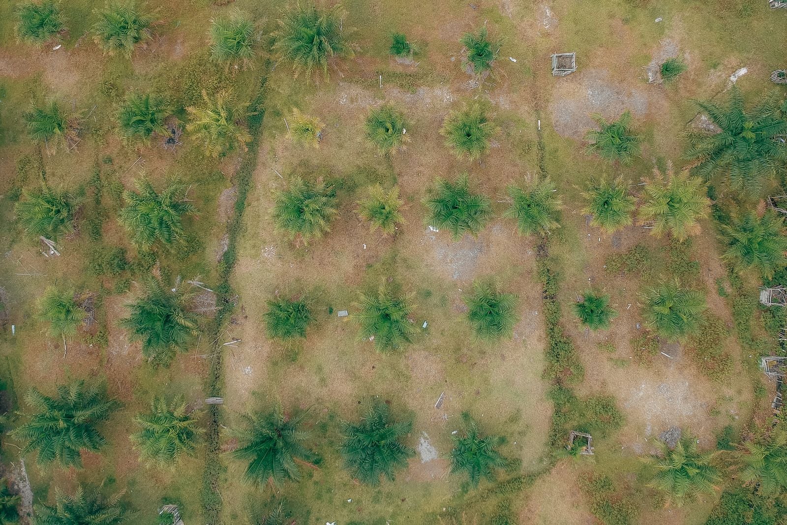
The hard part is not the satellites. The hard part is the smallholder. Roughly 40 percent of Indonesia’s palm oil comes from independent small farmers, many of whom have never registered the exact GPS boundary of their plot. A trader buying fresh fruit bunches at a collection point in Riau needs to know not just that the bunches arrived in a truck, but which two-hectare parcel they grew on. Without that traceability, the spectral signature is useless — there is nothing to compare it to.
Even where the imagery is clean and the coordinates are precise, interpretation is contested. A Straits Times investigation documented a striking gap: in 2023, the monitoring group Global Forest Watch estimated Indonesia lost an area of primary forest roughly four times the size of Singapore, while the Indonesian government’s own figures put the loss at about half that. The disagreement comes down to definitions — what counts as primary forest, what counts as degradation versus deforestation, and how to treat plantations that were cleared and replanted.
This is the awkward truth behind the regulation. The satellites can see the geometry. They cannot, on their own, settle the political question of what counts as forest. The EUDR’s reference date of 31 December 2020 was chosen partly to sidestep this — the question becomes binary: was this pixel forested on that date, yes or no? — but the underlying classification still depends on which dataset you trust.
Fires, drought, and the enforcement window
The other variable is fire. Indonesia’s dry season, amplified by El Niño cycles, regularly produces the haze that blankets Singapore and Kuala Lumpur. Indonesia’s meteorological agency, BMKG, has warned of a 50 to 80 percent chance of a weak-to-moderate El Niño developing in the second half of 2026, while the World Meteorological Organization puts the likelihood of an El Niño through mid-2026 at around 80 percent, with the odds of it persisting toward the end of the year near or above 90 percent and most models pointing to at least moderate intensity. In a June 2026 feature, The Jakarta Post profiled palm oil producer Asian Agri, which has run a zero-burning policy since 1994 and whose Fire Free Village Program now covers 16 villages and more than 343,000 hectares across Riau and Jambi.
Fire matters to the satellite story because burned land is the easiest thing in the world to detect from orbit. Thermal anomalies show up on MODIS and VIIRS within hours. The harder case is slow, quiet conversion — a hectare here, a hectare there, cleared with chainsaws and herbicide rather than fire. That is what the high-resolution optical and radar systems are now trained to catch.
The EUDR was originally meant to apply from 30 December 2024, but enforcement was delayed by a year after pushback from trading partners. Forbes reported in April 2026 that the European Commission was looking to further simplify the regulation amid pressure from the United States and several producer countries, who argued that the documentation burden on smallholders was disproportionate. The compliance architecture — coordinates, plot polygons, satellite cross-checks — has not changed. The thresholds for who has to file what, and how often, are still being negotiated.
What is striking is how much of the political fight is now downstream of a technical capability that did not really exist a decade ago. Without sub-10-metre optical imagery refreshed every five days, and without cloud-piercing radar to fill the gaps, the EUDR would be unenforceable in exactly the geographies where it matters most. The regulation assumes a level of orbital surveillance that the satellite industry has only just delivered.
The plant-disease feedback loop
One of the more unexpected consequences of all this monitoring is that the same techniques developed to police plantations are now being used to manage them. Ground-based LiDAR studies have measured oil palm canopy geometry in detail to detect basal stem rot, a fungal disease caused by Ganoderma boninense that kills mature palms from the inside — as the disease advances, the crown flattens, the fronds shorten and droop, and the canopy shrinks in ways a laser scanner can quantify tree by tree. The same airborne and drone-mounted hyperspectral methods that map whole plantations are now being turned inward, building a pipeline from satellite-scale frond geometry down to the individual diseased tree.
The same spectral signature that lets a regulator distinguish plantation from forest also lets a plantation manager spot which rows are sick. The technology is dual-use in the most literal sense.
From orbit to ingredient
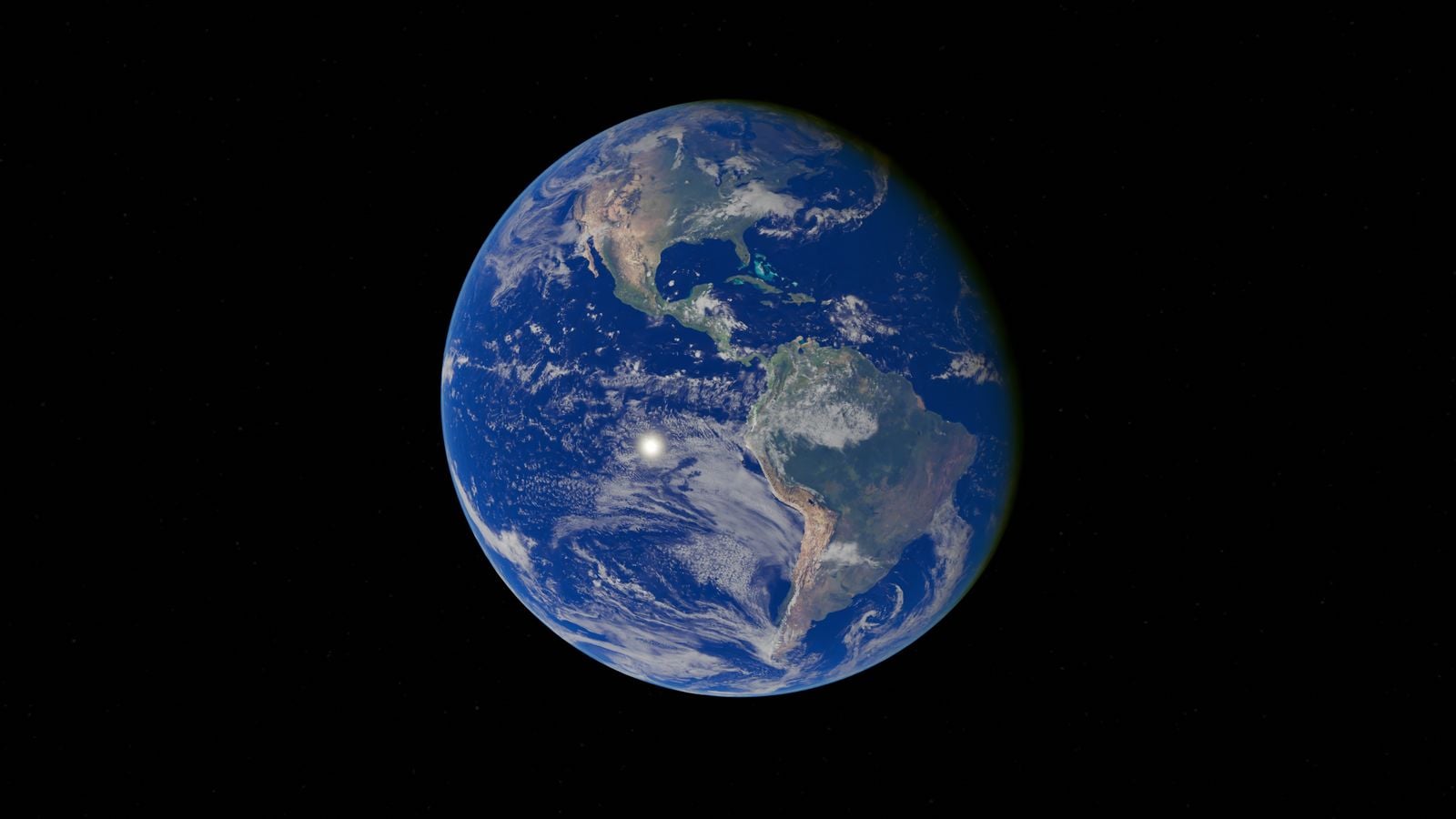
Carbon and forest monitoring from space is one of the fastest-expanding corners of the Earth-observation industry. Space Daily has covered how the MicroCarb satellite is opening a new era in urban carbon tracking, and the trajectory in vegetation monitoring is similar: more spectral bands, finer resolution, faster revisit times. The European Space Agency’s Sentinel programme alone produces several terabytes of free, open-access imagery every day. Commercial operators like Planet now image the entire land surface daily at three-metre resolution. The constraint is no longer pixels. It is interpretation.
The arc connecting a Sumatran peatland to a bar of European chocolate now runs, in part, through a sun-synchronous orbit. A satellite passes overhead. Its sensors record how the canopy bends light. An algorithm trained on millions of labelled hectares decides whether what it sees is forest or palm. A coordinate gets a green check or a red flag. Months later, somewhere in Rotterdam or Hamburg, a customs officer looks at a shipping manifest and knows — with a confidence that would have been impossible in 2015 — whether to wave the cargo through.
The fronds, meanwhile, keep doing what fronds do. They open. They catch the sun. They reflect a fraction of it back into space, at the precise angle that gives them away.