
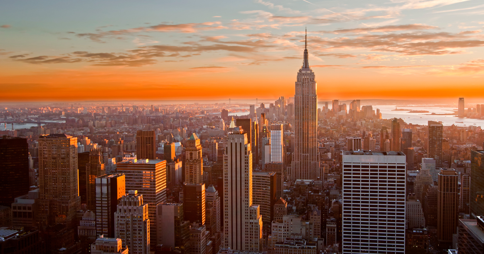
For a few minutes on four evenings each year, the setting sun falls into perfect alignment with the east-west cross streets of Manhattan, throwing a low golden corridor of light from river to river through the canyons of midtown. The grid was not designed for this. Nobody in 1811 was thinking about astronomy. The commissioners who laid out Manhattan’s streets were trying to make a marketable real estate map, and the alignment that has come to be called Manhattanhenge is a byproduct of decisions made for entirely terrestrial reasons. According to the American Museum of Natural History’s Hayden Planetarium, the term was coined by Neil deGrasse Tyson, the planetarium’s longtime director, who first published photographs and an account of the phenomenon in October 2002, in a special “City of Stars” issue of Natural History magazine.
The headline framing of Manhattanhenge as “one of the largest sun-aligned monuments in the world” is a useful piece of writing rather than a literal claim. The Manhattan grid is not a monument and was not aligned to anything in the sky. What it is, on the right evenings, is a very long, very high, very narrow set of urban corridors that happen to point toward the horizon at the same compass bearing as the sun on its way down in late spring and mid-summer. The result has the visual force of an intentional alignment without any of the intention.
What the 1811 commissioners actually did
The Commissioners’ Plan of 1811 was a real estate document. New York State had appointed Gouverneur Morris, John Rutherfurd and Simeon De Witt in 1807 to impose order on Manhattan’s largely undeveloped land north of Houston Street, and after four years of surveying carried out by a young engineer named John Randel Jr., they delivered a rectilinear grid extending from Houston up to what is now 155th Street. The plan called for twelve numbered avenues running roughly north to south and 155 cross streets running roughly east to west, intersecting at right angles to produce about two thousand long, narrow blocks.
The “roughly” matters. The commissioners did not align their grid to true north. They aligned it to the long axis of Manhattan Island itself, which runs at an angle. The result is a grid rotated about 29 degrees east of true north, so the cross streets do not point due east and due west but slightly north of those directions on the western end. If the grid had been laid out on a strict compass alignment, Manhattanhenge would occur on the spring and autumn equinoxes, the two days a year when the sun rises due east and sets due west anywhere on Earth. Because of the tilt, the event drifts.
The plan was driven by the commission’s stated goals of “regularity and order with the public convenience and benefit”. It was also, as the historian Hendrik Hartog has argued, a particular kind of post-revolutionary statement: the rectilinear grid was the antithesis of grand baroque planning. It was meant to encourage equal-sized lots, uniform construction and what the commissioners thought of as practical, republican land.
Why the dates fall where they fall
The sun rises and sets at the same compass bearing twice a year for any given location. Because Manhattan’s grid is offset roughly 29 degrees from true north, the relevant compass bearing for the setting sun aligning with the cross streets is not due west but a few degrees north of west. The sun reaches that bearing on its way to the summer solstice and again on its way back, which is why the sunset version of Manhattanhenge appears as a pair of dates roughly equidistant from 21 June. In 2026, according to the Hayden Planetarium’s calculations, the half-sun alignments fall on Thursday 28 May and Sunday 12 July, with the full-disc versions on Friday 29 May and Saturday 11 July.
There are also two sunrise alignments each year, on the other side of the solar calendar. These occur in late November or early December and again in early January, when the rising sun lines up with the eastward view down the cross streets. The sunrise versions get less attention than the sunsets, partly because of the hour, partly because the west side of Manhattan has clearer river views than the east, where industrial Queens often gets in the way of a clean horizon. Together, the four annual alignments produce what the Hayden Planetarium describes as Manhattanhenge in the strict sense: four moments a year when the geometry of the city and the geometry of Earth’s orbit briefly agree.
Jackie Faherty, the astrophysicist at the American Museum of Natural History who now calculates the dates each year, gives the working azimuth as 299.1 degrees, with an altitude of about half a degree above the horizon as seen from 42nd Street and Fifth Avenue. The numbers vary slightly depending on where in Manhattan an observer stands, and the actual visible moment depends on the height of buildings and trees on the New Jersey horizon, which is why the published times do not match the astronomical definition of sunset.
Where the name came from
Tyson has said in multiple interviews that the idea came from a teenage visit to Stonehenge. The astronomer Gerald S. Hawkins, who in 1965 published Stonehenge Decoded, the book that popularised the argument that the Salisbury Plain monument was deliberately aligned with the midsummer sunrise, led an expedition that Tyson joined at the age of 15. In a 2013 interview with The Phoblographer, Tyson said he first wrote about the Manhattan version in 1996, photographed it the following summer, and ran the material in the 2002 Natural History issue, noting that his first published image was “not until 2002.”
In one of his more frequently quoted formulations, available on the Hayden Planetarium’s video archive, Tyson asks what future civilisations digging up Manhattan would make of its grid. “Surely they will presume the grid had astronomical significance,” he says, “just as we have done in the case of that prehistoric circle of large vertical rocks.” The joke is precise. There is nothing in the geometry of the Manhattan grid that would tell an archaeologist it had no astronomical purpose. The alignment is just as real, and very nearly as repeatable, as Stonehenge’s. The intent simply isn’t there.
How big the effect actually is, and where to see it
The places where the Manhattanhenge alignment is genuinely visible are limited by the geography of the island. According to Scientific American’s explainer, Tyson has recommended the wider two-way cross streets, which give the best view toward the New Jersey horizon: 14th, 23rd, 34th, 42nd and 57th. The 34th Street and 42nd Street vantages are particularly photographed because the Empire State Building and the Chrysler Building frame them. Streets further north and south of midtown produce the same alignment in principle, but tall buildings, river-edge interruptions and tree cover often obscure the actual sun. The phenomenon is fragile. A cloudy evening over the Hudson is enough to cancel it.
The viewing dates have become a recurring feature of New York life, with photographers and tourists treating the listed evenings as a soft civic holiday. Sites like Space.com publish updated guides each spring and summer. The Hayden Planetarium’s calculations have become the reference times, though the precise moment of “perfect” alignment is a bit of a fiction, since the sun moves continuously and the grid’s orientation varies fractionally between blocks.
What the coincidence is and isn’t
Any city with a long, straight, rectilinear grid produces some version of this effect. Faherty and Tyson have both pointed out that Chicago, Toronto, Baltimore and others all have their own dates when the sun lines up with east-west streets. New York is unusually well suited to the phenomenon for several reasons: the grid is consistently maintained across a long stretch of the island, the streets are wide enough for the sun to be visible at street level, and the view westward toward New Jersey is uninterrupted by significant terrain. The combination is rare, not unique.
What gives Manhattanhenge its specific cultural weight is that it pairs a familiar urban setting with a genuinely astronomical event. The grid is a piece of bureaucratic infrastructure most New Yorkers stop noticing within a week of arriving. For a few minutes, twice in spring and twice in winter, the street that is otherwise just a route between places becomes briefly a line drawn between the city and the sun.
