
The satellites that helped map where 170 trillion pieces of plastic are concentrated in our oceans weren’t built to look for plastic at all. They were built to measure wind speed inside tropical cyclones. The plastic signal is an inference drawn from anomalies in how radar signals scatter off a roughened ocean surface — a side effect of sensors designed for an entirely different question.
The 170 trillion figure has traveled farther than almost any other number in ocean-plastic coverage. It comes from a synthesis estimating plastic particles afloat on the world’s ocean surface, and it has anchored dozens of headlines. The procedural detail that almost never travels with it is where the satellite evidence actually came from — and that repurposing is the part of the story worth slowing down on.
What the 170 trillion figure actually is
The widely cited estimate comes from Eriksen and colleagues, published in PLOS ONE in 2023. It synthesises 11,777 ocean stations sampled between 1979 and 2019 and produces a modeled mean from a wide range: 82 to 358 trillion plastic particles, with a central estimate of 171 trillion. The popular version has flattened that uncertainty into a single round figure, which is how science reporting typically handles confidence intervals.
The analysis warns that surface plastic loads have grown rapidly in recent decades, and that without intervention the trajectory continues upward. A separate analysis covered by reporting on long residence times of surface plastics notes that even if all input stopped immediately, existing fragments could remain on the ocean surface for more than a century before sinking, degrading, or being ingested into the food web.
The reasonable reading is that 171 trillion is a defensible central estimate within a wide envelope, drawn primarily from net-tow sampling and continuous seawater intake across six marine regions. The estimate is not a count. It is a model.
The satellites were looking for something else
NASA’s Cyclone Global Navigation Satellite System — CYGNSS — was built to measure ocean surface wind speeds inside tropical cyclones. It does this by reading GPS signals that have reflected off the sea surface and inferring roughness from the scatter. Rougher seas mean stronger winds. The same bistatic radar approach turns out to be sensitive to anything that changes the surface tension and damping behavior of the upper millimeters of seawater.
Researchers at the University of Michigan, led by Chris Ruf, reported that CYGNSS data showed unexplained smoothing in regions where ocean-circulation models predicted high concentrations of microplastic. The smoothing was not a wind artifact. The leading hypothesis, supported by wave-tank experiments, is that surfactants — oils, detergents, and organic films associated with concentrated plastic debris — dampen the small capillary waves that CYGNSS reads. The satellites cannot see the plastic. They can see the slick that travels with it.
The CYGNSS observations cannot directly detect plastic; what they detect is surfactant-induced surface smoothing that correlates with plastic accumulation zones. NASA released a CYGNSS ocean microplastic concentration dataset for research use in 2021, with explicit caveats that the signal can be confounded by algal blooms, oil spills, and unusual atmospheric conditions. The instruments that produced the most striking spatial confirmation of where ocean plastic concentrates were, in this case, repurposed from a mission chartered for hurricane forecasting.
An instrument problem solved by accident
The pattern of repurposed instrumentation answering questions it was not commissioned to answer is one we’ve examined before in other domains — in our recent piece on a binary system upending dwarf nova theory, the data that mattered came from survey infrastructure built for unrelated questions. The economics are the tell. Building a dedicated ocean-plastic satellite would require a mission proposal, a decadal-survey ranking, a procurement cycle, and a launch slot. CYGNSS was funded for hurricane science, launched in 2016, and redirected through software and reanalysis rather than new hardware.
The procedural framing matters. The 170 trillion figure is often presented as a confident inventory, the product of a coordinated global survey. It is closer to the opposite: a synthesis of decades of disparate sampling, modeled forward, and cross-checked against a satellite system that happens to be sensitive to surface anomalies it was never tasked with finding.
The missing plastic the satellites cannot see
A long-standing accounting problem sits underneath the 170 trillion figure, and it sharpens the limits of what the repurposed satellites can do. Between 9 and 14 million metric tons of plastic enter the ocean annually, according to recent work on microplastic transport from the surface to the deep sea, yet the mass found floating at the surface accounts for only a small fraction of what models predict should be there. The discrepancy has occupied marine scientists for over a decade, and it has a name: the missing-plastic paradox.
The emerging answer is that much of the plastic is no longer at the surface or in any size range that conventional net surveys can capture. Recent work covered in a Science Daily summary of Atlantic nanoplastic sampling estimated 27 million tons of nanoplastics afloat in the North Atlantic alone — particles smaller than one micron, well below the resolution of standard sampling nets. Those particles are dispersed throughout the water column, suspended in deep-ocean sediments, and present in marine organisms. The 170 trillion count refers to detectable fragments at the surface. If the nanoplastic estimates hold up under further sampling, the surface count is a small visible fraction of a much larger inventory.
This is where the limits of the accidental discovery come into focus. CYGNSS can only register surface-layer phenomena. Whatever is suspended deeper, or has fragmented below the optical and microwave detection floor, is invisible to it. The satellite that helped confirm the geography of ocean plastic by accident also, by accident, defines the ceiling of what is currently knowable from orbit: surface, slick-forming, large enough to alter capillary waves. Everything beneath is silent.
What gets lost in the headline
The popular framing of 170 trillion treats the figure as a count. The underlying analysis treats it as a midpoint of a distribution that spans uncertainty. The popular framing treats the satellite confirmation as direct imaging. The actual satellite evidence is a roughness anomaly interpreted through a surfactant-damping hypothesis that remains an active area of research. The popular framing treats the surface number as the total. The emerging nanoplastic literature suggests the surface number is the smaller share of a much larger problem hidden in the water column and sediments.
None of this undermines the central claim that ocean plastic concentrations are large, growing, and worth attention. It does mean that the confidence implied by the round number 170 trillion is partly an artifact of how the figure has been retold. The original estimate carried its uncertainties on its face. The headline does not.
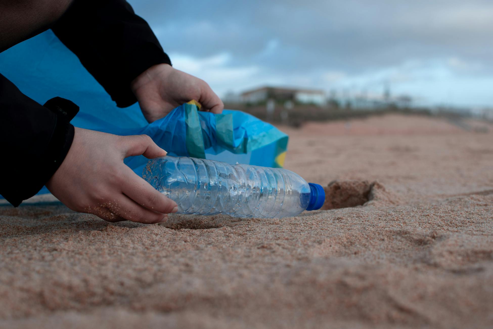
Cleanup efforts have responded to the visible surface fraction. Operations targeting the Great Pacific Garbage Patch, summarized in technical overviews of large-scale ocean cleanup projects, focus on macroplastic and larger microplastic that can be physically intercepted. The nanoplastic fraction, by definition, cannot be netted. The instruments that can see distribution at scale are not designed to see size. The instruments that can resolve size are not designed for scale. The accounting problem persists because the measurement architecture is fragmented across missions, agencies, and physical regimes that were never assembled around the question.
What the repurposing actually reveals
The story is not that satellites confirmed 170 trillion pieces of plastic in the ocean. The story is that the global instrumentation we have for monitoring the ocean surface was built for weather and climate, and that one of its incidental capabilities is a partial, indirect view of the plastic that happens to alter surface tension where it accumulates. The 170 trillion figure is the model output. The satellite signal is corroboration that the model’s geography is correct. Neither answers the question of total inventory, and the missing-plastic problem indicates that the question itself remains open.
What modern reporting on the figure misses is the procedural reality underneath it: that the most visible number in ocean-plastic discourse rests on a coincidence of instrument sensitivity, that the satellites were built for other missions, and that the surface count is a fraction of a larger inventory the existing instruments cannot resolve. The figure is right. The certainty it carries in retelling is not something the original data ever claimed.