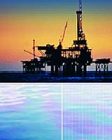
Hyperdynamics’ SCS Corporation announced Monday it has contracted Infoterra, a leading European-based geospatial information company, to provide a complete satellite image based Global Seeps Study over its entire 16 million acre concession.
According to SCS’ Vice President, Robert Bearnth, the main purpose of the satellite contract is to identify and locate oil seeps throughout the entire block.
He said, “Finding all 40 carbon indicators in 55 of the 57 cores during our coring program gave us the knowledge base for us to confidently pursue up to date satellite imaging. We are looking to correlate oil slicks where the largest seeps have been pinpointed. This will help us focus in on the most prominent drilling sites.”
The satellite imaging process will produce digital data, which will provide scene interpretation, source points for seeps, probable seep types, digital geo coded data and images of the concession seep formations. The process is slated to begin immediately.