DigitalGlobe announced Monday its collection of high- resolution satellite imagery depicting newsworthy events and locations from around the world is now available to editorial customers via Getty Images.
By providing access to its imagery through gettyimages.com, DigitalGlobe is improving its services to the media with timely and affordably priced imagery, easy and immediate access, and a centralized online location, the company said in a statement.
“With gettyimages.com serving an average of 3.5 million unique visitors each month, more and more media around the world will be aware of the availability of DigitalGlobe imagery, said Jill Smith, president and chief executive officer of DigitalGlobe. That can only be a positive force as we educate audiences about the value of satellite imagery for illustrating, mapping and preparing for important events.”
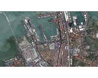
Members of the media use DigitalGlobe imagery to illustrate news-breaking events such as natural and man-made disasters, sporting venues and cultural events, as well as areas of global interest. DigitalGlobe imagery has, in some cases, been the first source of visual information about an event. For instance, imagery collected just moments after the Southeast Asian tsunami struck land on Dec. 26, 2004, offered the first glimpses of the devastation for many news consumers.
DigitalGlobe’s archive of satellite imagery is updated on a daily basis for all editorial customers. Additional distribution of this content also will be offered via a DigitalGlobe-branded Web site, built and maintained by Getty Images, the company said.