The climatology satellite Calipso (Cloud-Aerosol Lidar and Infrared Pathfinder Satellite Observations) left Alcatel Space, a subsidiary of Alcatel, plant in Cannes (southern France) during the night of May 18 for transport to the Vandenberg Air Force Base and spaceport in California.
Launch is scheduled for this summer on a Delta 2 launcher, along with the Cloudsat satellite.
Calipso will help scientists understand the Earth’s climatic system and predict global changes, an ability limited until now by uncertainty about the radiation impact of clouds and aerosols.
It will supply a unique set of data on vertical atmosphere profiles, using the first satellite-mounted backscatter lidar (LIght Detection And Ranging).
This climatology mission, designed to support the sustainable development of our planet, is a joint program of NASA and French space agency CNES, with Alcatel Space and Ball Aerospace as the main industry partners.
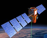
Calipso is part of a global climate study program and will be flying in formation with two American missions, Aqua and Cloudsat, along with the French microsatellite, Parasol.
This will form an exceptional space observatory, the “A-train”, combining all active and passive measurement techniques and positioned in sun-synchronous orbit at an altitude of 705 kilometers.
Aqua was launched in April 2002 and has a design life of five years. Parasol was launched on December 18, 2004.
Calipso is the second application for the Proteus platform developed by Alcatel in conjunction with CNES.
Following the Jason-1 oceanographic altimetry satellite, which celebrated the third anniversary of a very successful mission last December.
The Poseidon altimeter on the Jason-1 satellite delivers a constant stream of essential oceanography data.