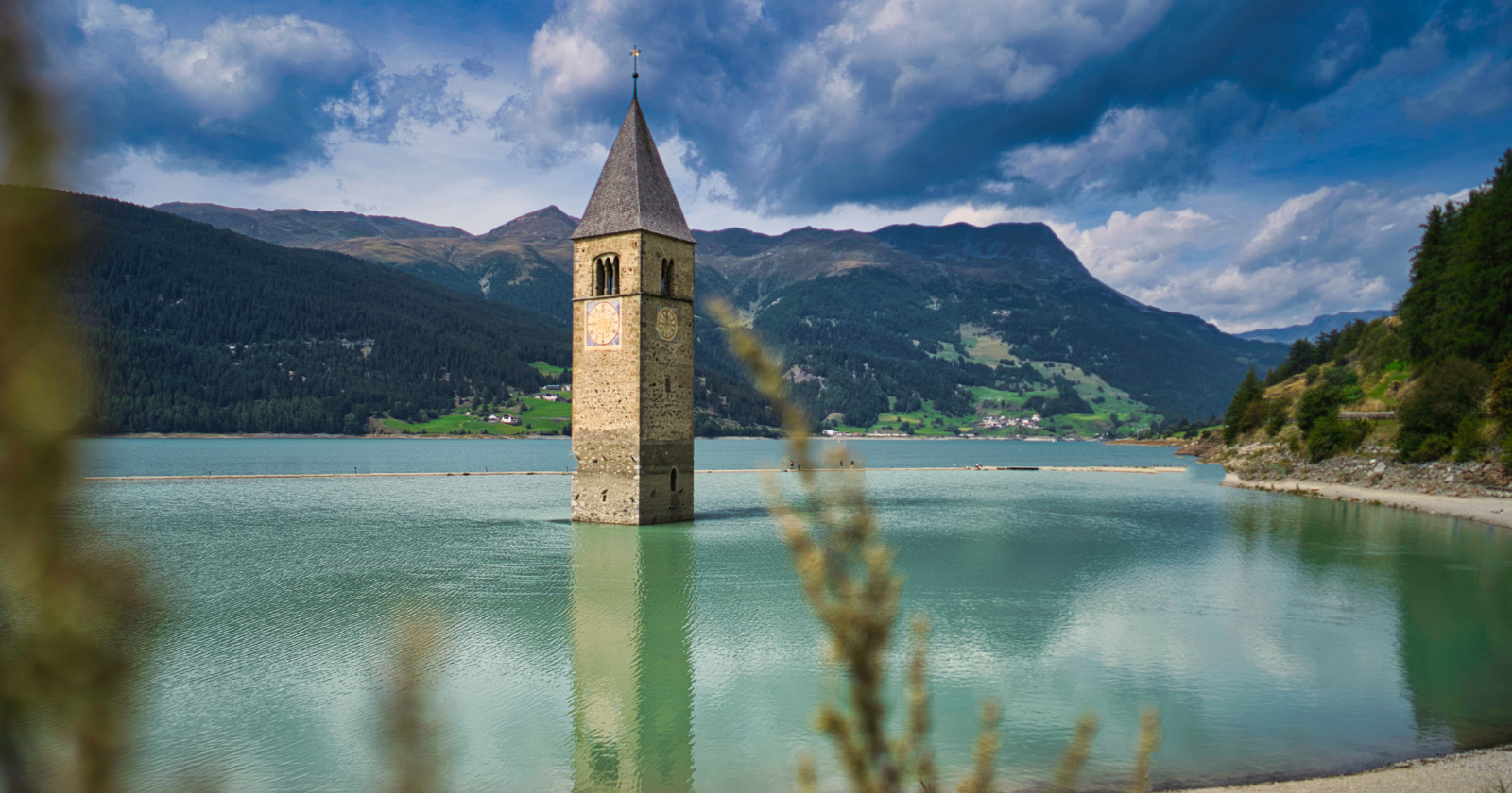
In the alpine region of South Tyrol in northern Italy, where the country meets the borders of Austria and Switzerland at a high mountain pass, there is a large blue lake called Lago di Resia in Italian and Reschensee in German. It sits at about 1,500 metres altitude, surrounded by snow-capped peaks, and is fed by streams draining out of the surrounding Alps. It is a striking place. The tourist coach parks along the road on the western shore are usually full.
What draws the visitors is not really the lake itself, however picturesque, but a single feature poking out of the middle of it. A stone bell tower, Romanesque in style, dating originally from the fourteenth century, rises about ten metres above the surface of the water. There is nothing else visible around it. No church. No village. No path leading to it. Just the tower, standing alone in the middle of a body of water that shouldn’t be there, marking the spot where the village of Curon Venosta used to be before the Italian government decided in 1950 that a hydroelectric reservoir was more important than the town.
The village they drowned
The plan to flood the valley had originated in the 1930s under Mussolini’s Fascist government. The two natural lakes that already existed in the area, Mittersee and Reschensee, were relatively small and shallow, and Italian hydroelectric engineers proposed merging them into a single much larger artificial lake by damming the drainage at the southern end of the valley. The rising water would then power a hydroelectric plant downstream. It was a straightforward piece of infrastructure engineering that made economic sense on paper. What it required in practice was drowning the village of Curon, along with the neighbouring hamlet of Reschen and around 1,300 acres of surrounding farmland, all of which sat in the low point of the valley that would become the new lake bed.
According to Smithsonian Magazine’s May 2021 reporting by Nora McGreevy, drawing on BBC News coverage and reporting for The Times of London by Philip Willan, Curon was at that point a small mostly German-speaking farming community that had existed at the site since at least the twelfth century. Italy had annexed the wider South Tyrol region from the Austro-Hungarian Empire in 1919 following the end of the First World War, but the linguistic and cultural character of the villages within it remained overwhelmingly Austrian rather than Italian. The residents of Curon spoke German at home, attended German-language mass, farmed the valley floor much as their ancestors had for centuries, and had almost no dealings with the distant Italian state bureaucracy in Rome. When the Fascist authorities began publishing planning documents about the proposed reservoir in the 1930s, the documents were exclusively in Italian, which most of the villagers could not read. By the time the residents fully understood what was being proposed and organised any effective resistance, the decision had already been made and the war had intervened to delay the actual construction.
Work on the dam had begun in April 1940. The war paused it for most of the next five years. When construction resumed in the late 1940s under the postwar Italian democratic government, the villagers hoped that the new political system might reverse the earlier Fascist decision. It did not. The Montecatini energy company, which had been contracted to complete the project, proceeded with the demolition of buildings on the edge of what would become the new lake shore in 1949. In the summer of 1950, the reservoir began to fill. Over roughly the following weeks, the water rose steadily up the valley walls, submerging fields, farmhouses, roads, cemeteries, the local school, the village square, and eventually the last remaining buildings in the town itself. According to the Italian government tourism board, approximately 150 families totalling nearly 1,000 people were displaced by the flooding, of whom nearly half chose to emigrate from the region entirely rather than accept the modest compensation the state was offering to relocate them to the new higher-altitude village that was being built to replace the drowned one.
What’s still there today
The bells of the fourteenth-century church were formally removed on 18 July 1950, a few days before the water reached the church itself. According to the Italian national tourism board’s own article on the sunken village of Curon, which draws on interviews with residents including Theresa Theiner, whose family had owned an inn called the Traube Post in the drowned town, the actual disappearance of the village underneath the rising water was witnessed by the residents themselves from the surrounding hillsides. Everything went under. The houses. The barns. The schoolhouse. The main street. The Traube Post inn. The Theiner family’s St. Bernard, according to the family’s own subsequent account, refused for years afterwards to accept that the inn had ceased to exist and continued to swim out over the water to the specific spot where the building had once stood. The village of Curon was gone. Everyone who had lived in it was, in the Italian phrase that later attached itself to the story, an emigrant at home.
What was not demolished before the flooding was the stone bell tower of the old parish church. Its foundations had been considered too solid to knock down efficiently, and its height meant that the top of it would remain above the eventual water line of the reservoir anyway. So the demolition crews left it standing. When the water finished rising in the late summer of 1950, the tower was still there, rising out of the middle of the newly created lake exactly where it had always stood, now surrounded on all sides by the twenty-two metres of water that covered everything else. It