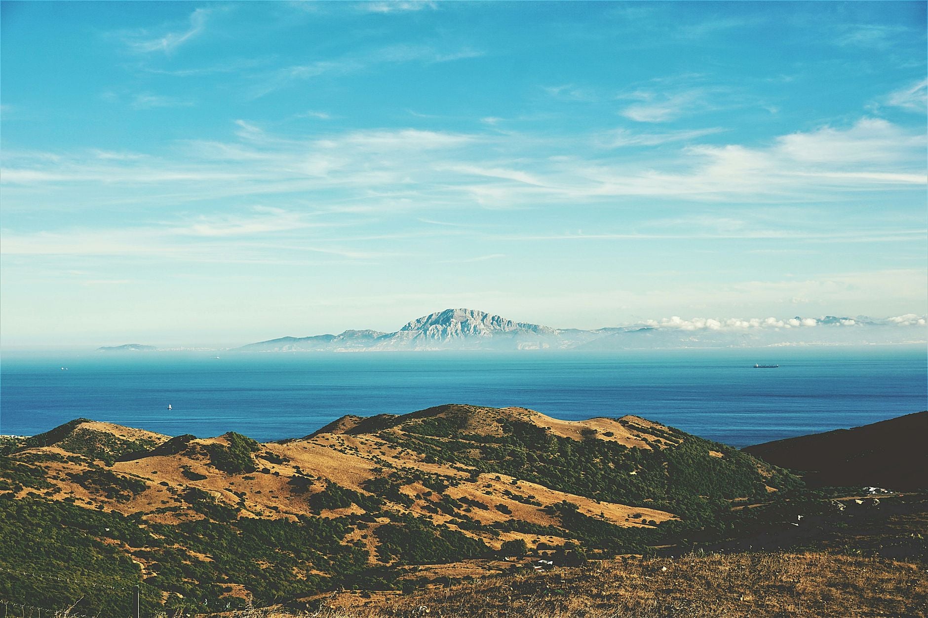
Stand on the floor of the Mediterranean 5.6 million years ago and the map of southern Europe would become almost unrecognisable.
Sicily and Malta would be high ground. The continental shelves around Spain, France, Italy and North Africa would be exposed. Rivers reaching the basin would not meet the sea at their present mouths. They would continue across the former seabed and, in the deepest-drawdown reconstruction, descend through canyons towards scattered lakes of concentrated brine.
Where blue water now separates three continents, there may have been immense salt flats under a hot sky.
Then the Atlantic found a way back in.
Water spilling across the barrier near Gibraltar cut into the rock beneath it. The deeper the channel became, the more water it could carry. The greater the flow, the faster it eroded. What began as an overspill may have turned into a self-amplifying flood that raised the Mediterranean by metres each day and transferred most of the missing water in somewhere between a few months and two years.
That is the arresting version of the Messinian Salinity Crisis and the Zanclean flood that ended it. The underlying event is real: the Mediterranean became severely restricted, accumulated an extraordinary mass of salt, and was abruptly reconnected to the Atlantic about 5.33 million years ago. But the simple picture of one entirely dry basin waiting to be filled is still debated.
The fuller story is more interesting. It involves moving tectonic gateways, changes in sea level, repeated doses of Atlantic water, kilometres of buried salt, and a flood whose evidence is now being traced from Gibraltar to Sicily.
The Mediterranean survives by borrowing water from the Atlantic
The modern Mediterranean looks self-contained on a map, but its water balance says otherwise.
More water evaporates from its surface than rain and rivers return. That deficit is made good at the Strait of Gibraltar, where relatively fresh Atlantic water flows east near the surface. Denser, saltier Mediterranean water moves west below it. A detailed analysis of the modern exchange places the outflow at roughly 0.8 million cubic metres per second, with a slightly larger inflow replacing evaporation.
Take away the Atlantic connection and the sea begins to shrink. Yet the connection 6 million years ago was not simply the present Strait with a door across it. Water passed through a changing set of corridors around southern Spain and northern Morocco. Africa was moving towards Eurasia, tectonic uplift was reshaping the region, and global sea level rose and fell with climate.
Those effects gradually restricted the gateways. At the same time, variations in Earth’s orbit changed the rhythm of wet and dry conditions across the Mediterranean. The current geological synthesis in Nature Reviews Earth & Environment treats the crisis as an interaction between tectonics, climate, sea level and the geometry of the basin, not as a single plug inserted on one date.
By about 5.97 million years ago, the exchange had weakened enough for evaporite minerals to begin accumulating on a vast scale. The Messinian Salinity Crisis had started.
It was a changing crisis, not one static salt desert
The crisis lasted until 5.33 million years ago, a span of roughly 640,000 years. Calling that entire interval a dry Mediterranean would be misleading.
At first, gypsum accumulated in shallow areas around the margins. Later came the main phase of halite deposition, the mineral we ordinarily call rock salt. Conditions varied between the western and eastern basins and between their margins and depths. There were intervals of brine, hypersaline water and, towards the end, lakes influenced by river water. Geologists call some of those late deposits Lago Mare, meaning lake-sea.
The main fall in water level is generally placed around 5.6 million years ago. In the classic deep-drawdown model, the surface dropped by more than a kilometre and perhaps closer to two in the deepest basins. The exposed floor was not a flat white plate. The Mediterranean is a series of basins divided by ridges and sills, so falling water would have left a broken landscape of salt pans, isolated lakes and deep depressions.
Brine changes the intuitive rules of water. As evaporation removes water and leaves dissolved minerals behind, the remaining liquid becomes denser and its freezing and boiling behaviour changes. I explored a tiny modern example in my article on how Antarctica’s Don Juan Pond remains liquid near minus 50 degrees. The Messinian Mediterranean was enormously larger and chemically different, but the same basic concentration process pushed water and salt into states that an ordinary coastline never displays.
There is also a useful paradox here. The Mediterranean contains too much Messinian salt to have been produced by evaporating one basinful of seawater. Forming it required the equivalent of many Mediterranean volumes. Atlantic water must therefore have entered repeatedly, even while the exit of concentrated water was limited and evaporation remained intense.
The “salt desert” was not a motionless endpoint. It was part of a long, uneven system in which water arrived, evaporated, concentrated and sometimes withdrew again.
The proof lies beneath the younger seafloor
Geologists had long noticed deep river canyons around the Mediterranean, but the scale of the salt crisis only became clear when researchers drilled beneath the sea.
In 1970, the research vessel Glomar Challenger crossed the Mediterranean on Leg 13 of the Deep Sea Drilling Project. Cores recovered gypsum, anhydrite and salt from below younger marine sediments. The resulting scientific reports established that Messinian evaporites were not merely local deposits around a few dried lagoons. They extended across the basin beneath the seabed.
Seismic surveys have since mapped great bodies of salt under the western and eastern Mediterranean. The total volume is commonly estimated at more than one million cubic kilometres. An International Ocean Discovery Program prospectus describes deposits more than a kilometre thick and explains why their removal from seawater mattered beyond the basin itself.
Salt is unusually mobile under pressure. Over millions of years it deforms, flows and pushes up into domes, disturbing the layers above it. That makes it valuable to geologists and troublesome to interpret. It can also hide the older surfaces and sediments that would reveal exactly how much water remained at the height of the crisis.
Around the margins, rivers left another line of evidence. When sea level falls, a river’s destination falls with it, so the river cuts downwards to establish a new path. Messinian erosion carved or enlarged deep canyons beneath what are now the Nile, Rhône and other river systems. Later sediment buried many of them when the water returned.
These deposits and landforms tell us that the Mediterranean underwent an extreme loss of water and a radical change in salinity. What they do not settle by themselves is whether every deep basin was exposed, or whether some retained a substantial hypersaline sea.
A small Atlantic spill could have become a runaway torrent
At 5.33 million years ago, marine conditions returned with extraordinary speed. The boundary is so sharp in many sediment sequences that it demands an abrupt explanation.
The likely entry point was close to the present Strait of Gibraltar. Once Atlantic water began crossing the divide, gravity did the rest. The Mediterranean surface lay far below the Atlantic in the deep-drawdown scenario, giving the water an enormous downhill gradient.
The crucial process was positive feedback. An initial flow eroded the sill. That made the connecting channel deeper. A deeper channel admitted more water, which increased the erosive force and cut the channel faster still. The system could move from a modest spill to a torrent without any second trigger.
In 2009, Daniel García-Castellanos and colleagues modelled that process using the buried channel and erosional features around Gibraltar. Their paper in Nature described a channel roughly 200 kilometres long, with some incisions exceeding 250 metres, and calculated a peak discharge on the order of 100 million cubic metres per second.
For scale, that is roughly a thousand times the average discharge of the Amazon. At the peak, the model produced erosion of more than 40 centimetres a day and a Mediterranean water-level rise above 10 metres a day.
The familiar “two years” figure needs to be stated precisely. The model did not say the first drop crossed Gibraltar and the basin was full exactly two years later. An early phase of relatively low flow could have lasted for thousands of years. But once the feedback took hold, the model transferred 90 per cent of the required water in a period ranging from a few months to about two years.
Even that would not resemble a vertical wall of water crossing the entire basin. It was a sustained, rapidly enlarging current pouring through a rock gateway, carrying sediment, cutting channels and drowning low ground as the Mediterranean surface climbed.
The water probably crossed the basin in stages
The western Mediterranean would have received the Atlantic first. Before the water could occupy the deepest eastern basins, it had to pass the high ground around Sicily and Malta.
That second stage has become important because a flood should leave more than a computer result. It should shape the landscape in the direction it moved.
In a 2025 study in Communications Earth & Environment, Aaron Micallef and colleagues reported more than 300 asymmetric ridges in south-eastern Sicily. The ridges are streamlined in a consistent direction and associated with poorly sorted rock debris, disturbed sediment and a broad channel leading towards the Noto Canyon offshore. Their modelling showed that a large eastward flood could produce flow patterns matching the landforms.
That reasoning reminds me of a very different landscape I wrote about recently: Titan’s river valleys, rain and lakes made from methane rather than water. The liquids and temperatures are different, but the method is related. Flow leaves geometry behind. Channels, streamlined ridges and sediment can preserve the direction and energy of a vanished liquid long after the surface has changed.
Off Sicily, researchers have also identified an enormous body of chaotic sediment that may have been dumped by the flood as water entered the eastern Mediterranean. Near Gibraltar, seismic imaging reveals the deeply buried channel that fed the system. No single feature supplies the whole story, but the features line up across more than a thousand kilometres.
Later estimates allow a wider range than the memorable two-year result, with some models placing the principal refill between roughly 2 and 16 years. The exact duration depends on assumptions about the initial water level, sill height, erosion rate and shape of the basins. Under any of those rapid scenarios, however, the Zanclean flood would rank among the largest floods identified in Earth’s geological record.
Refilled did not mean instantly restored
The return of Atlantic water ended the Messinian Salinity Crisis, but it did not turn the Mediterranean into its modern self overnight.
Imagine fresh Atlantic water spreading across basins that contained thick salt, remnant brines and uneven water levels. The incoming water could dissolve exposed deposits, while dense salty water remained trapped below lighter layers. The western basin filled first, and the topographic sill between west and east controlled what crossed into the eastern Mediterranean.
A 2022 modelling study in Nature Geoscience found that the western basin could have returned to approximately normal marine salinity while the eastern basin remained extremely salty and strongly stratified. In that reconstruction, the circulation took about 26,000 years to break down the eastern hyperstratification.
So there are at least three clocks in this story. The restriction and salt accumulation unfolded over hundreds of thousands of years. The main flood may have transferred most of the water in years. The chemical and circulatory recovery could then take tens of thousands more.
For the landscapes around the basin, the fastest clock would have been the most visible. Valleys became inlets. Hills became islands. River mouths moved inland as the coastline advanced. If the water really rose by several metres a day during peak flow, a place could be high above the shore one week and submerged the next.
There were no humans to witness it. Our lineage had not yet emerged. The event survives instead as a sequence written into salt, erosion surfaces, fossils and sediments.
How empty the Mediterranean became remains the central argument
The dramatic reconstruction has the Mediterranean falling more than a kilometre, exposing much of its floor and leaving only isolated brine lakes. A large difference in water level then supplies the energy required for the catastrophic refill.
Other reconstructions retain a deep body of hypersaline water and perhaps some Atlantic connection through much of the crisis. In those models, salt can accumulate as dense brine sinks and shallower water continues to evaporate. Evidence of marine organisms in some intervals, and uncertainty over the depth at which certain deposits formed, has kept that alternative alive.
A 2025 review in the Annual Review of Marine Science makes the disagreement explicit. The Zanclean megaflood is often described as established fact, but evidence for Atlantic-Mediterranean exchange during the crisis leaves room for longer-lived, less complete desiccation and a more gradual component to the refilling.
The new flood landforms in Sicily strengthen the case for a powerful eastward flow and a pronounced difference in water level. They do not, by themselves, prove that every part of the Mediterranean floor was dry. Nor does questioning complete desiccation make the salt crisis modest. A hypersaline sea hundreds of metres below the Atlantic would still represent an environmental transformation on a continental scale.
This is why the most accurate version of the story carries two thoughts at once.
About 5.6 million years ago, the Mediterranean lost an immense volume of water and parts of its seabed became a landscape of salt, brine and deeply incised rivers. At 5.33 million years ago, Atlantic water re-established a permanent connection near Gibraltar, probably through a flood of exceptional scale.
The transfer may have taken only a few years at its most intense. The crisis that made it possible took more than half a million.
What now looks like a permanent blue boundary between Europe and Africa is therefore nothing of the sort on geological timescales. It is a basin maintained by a narrow exchange, resting on a buried salt world and a flood channel cut by the ocean that returned.