

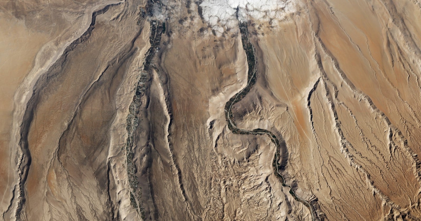
A team led from UCL Earth Sciences, with co-authors at the University of Bristol and the University of Oregon, reports in Science Advances that the shape of a volcanic sheet can be read as a constraint on the mountains it buried. Their case study is the Cardones ignimbrite of northern Chile, erupted 21.9 million years ago, and the number they get out of it is a ceiling: before the eruption, rock in that part of the Central Andes was being pushed upward at no more than 0.26 kilometres per million years.
The logic is geometric and unusually simple for a result about deep time. Assuming the source of the deposit stood higher than the ground it engulfed, a landscape cannot be completely covered by a sheet whose own surface slopes more gently than the landscape’s overall, range-scale slope. So if the sheet is flat, the range it swallowed can have risen no more steeply across its width.
More than a thousand cubic kilometres of rock
An ignimbrite is what a pyroclastic density current leaves behind: a matrix of volcanic ash packed with pumice and rock fragments, dumped by a ground-hugging flow of gas and debris rather than settled out of the sky. The largest of them are often carried more than 100 kilometres from their source and spread out into what volcanologists call low aspect ratio ignimbrites, sheets that bury topography under a gently inclined plane instead of filling valleys.
The Cardones is one of the better examples. It is the largest unit of the Oxaya Formation, a series of gently west-dipping ignimbrites laid down during an early Miocene volcanic flare-up on the western margin of the Central Andes, and the paper puts its volume at more than 1,260 cubic kilometres. Its source is thought to have been the nearby Lauca Caldera.
Byron Adams, the paper’s lead author, reached for Pompeii in UCL’s announcement of the work, scaled up from a town to a landscape. “Instead of covering a town, hot mixtures of volcanic ash, rock fragments, and gas swept across an entire landscape, engulfing the terrain beneath them,” he said.
A sheet cannot cover a range that slopes more steeply than it does
The key observation is that the Cardones originally had a relatively uniform surface slope of 1.5 degrees, give or take 0.3 degrees, an estimate that already accounts for the folding and tilting the sheet has undergone since. That reconstructed surface is the datum.
From there the argument runs through three cases. Either the ignimbrite surface is steeper than the buried landscape, which is what a deposit that thins away from its vent would be expected to produce, with higher ridges and peaks left protruding. Or it is gentler, which would require the sheet to thicken with distance from the source and is implausible over long runs. Or the two slopes are roughly equal, which is the limiting case where the deposit only just tops the highest ground.
The conclusion the authors draw is that a landscape can only be completely buried if its range-scale slope is equal to or less than the initial slope of the sheet. For the Cardones, that caps the buried terrain at about 1.5 degrees across the range.
A ceiling averaged over at least fourteen million years
The number needs its qualifiers restored before it travels. It is not an instantaneous uplift rate at a moment 22 million years ago, and it is a rate for rock being carried upward through the crust rather than for the surface itself gaining height. It is an average over however long the landscape took to reach the low-relief state it was in when the ash arrived, and it is an upper limit on that average. Nothing in the method says uplift was 0.26 kilometres per million years. It says uplift cannot have been faster and still left something flat enough to bury.
The averaging window is long. The paper puts the landscape response time at a minimum of roughly 14 million years for one plausible pairing of uplift rate and erodibility, a term that folds in climate, rock type and the plumbing of the channel itself. Steady rates could have persisted longer than that.
The comparison with other techniques needs the same care. The abstract describes the result as comparable with independent thermochronometric and geothermobarometric constraints, and low-temperature thermochronometry on this margin does give time-averaged rates below 0.2 kilometres per million years since about 50 million years ago. But the authors also state that their model-derived rates cannot be directly compared with those figures, because the two integrate over fundamentally different timescales. They still draw an inference from the overlap, reading the consistency as a sign of a relatively steady tectonic history since the Incaic orogeny. Agreement between numbers integrated over different windows is suggestive rather than confirming, on the reading taken here.
Five hundred and sixty synthetic mountain ranges
Turning a slope into an uplift rate takes a model of how rivers cut mountains down while tectonics pushes them up. The team used the classical stream-power description of river incision, in which channel steepness rises with rock uplift rate and falls with the erodibility of the bedrock, and ran it inside the open-source Landlab toolkit.
They generated 560 synthetic landscapes, sweeping rock uplift from 0.1 to 2 kilometres per million years and erodibility across three orders of magnitude, and let each one run until erosion balanced uplift. Across that set, range-scale slope turned out to track channel steepness linearly. They then built millions of randomised one-dimensional river profiles with knickpoints in them to check the awkward case, and found that any more complex profile sitting beneath the steady-state one has a lower mean steepness. The steady-state landscape is therefore the steepest permissible answer, which is what makes the result a genuine upper bound rather than a best guess.
Pinning the number down also required an estimate of erodibility. The authors argue for a low value on several grounds. The Central Andes were already arid by Miocene time. The deposits are still sitting on ridges and canyon walls some 22 million years on, with knickpoints in the western Andes at least 11 million years old. Feeding erodibility of 1 x 10⁻⁹ to 1 x 10⁻⁸ per metre per year into a landscape capped at 1.5 degrees yields rock uplift below 0.26 kilometres per million years.
The paper does not measure erodibility at the site. It adopts a range, drawing on scaling relationships, the region’s Miocene aridity and published estimates from this margin and elsewhere. Erodibility can vary by several orders of magnitude between rivers even when the exponents are held fixed, though by only about one order when the effect of rock type is isolated, which is why the authors work with a band rather than a single value. They call that band a conservative upper bound because modern erosion rates in the region are exceptionally low, so any erodibility inferred from present-day data would imply lower uplift rates still. The model also leaves out hillslope processes by design, on the grounds that fluvial relief typically makes up at least 80 per cent of range-scale relief in unglaciated ranges, so its outputs for relief and channel steepness are likely to be maxima.
The case for a slow and steady range
The wider argument the number feeds into is an old one about when the Andes actually rose. Adams put the two positions this way in UCL’s announcement: “There is debate over whether the Andes grew slowly and steadily over 40 or 50 million years or whether they rose extremely slowly and then popped up more recently, in the last six to 10 million years. Our findings, which cover a large part of the middle of that history, support the slow but steady hypothesis.”
The paper puts it more narrowly. Its discussion draws the steady-history inference noted earlier and says that agreement confirms that the Miocene-Pliocene Quechua orogeny was mostly limited to Peru and did not measurably affect northern Chile. Its conclusion is scoped to the Oligocene-Miocene window it models, which it reads as consistent with a period of relatively slow subduction zone convergence. It does not frame the question as a contest between two hypotheses.
There is a second, stranger implication the authors raise, which is that ignimbrite burial is selective about what it preserves. Their analysis suggests big sheets like this can only form over subdued terrain, so the landscapes they preserve are systematically the calm ones, shaped during periods when uplift was slow or spatially uniform enough for rivers to level things out. Frances Cooper, a co-author also at UCL Earth Sciences, said in the same announcement that the method should travel. “The same approach could be applied to volcanic deposits elsewhere in the world, helping us reconstruct landscapes buried for millions of years,” she said.
The sheet is still there, dipping gently west, cut open in places by the Lluta River. Nobody can dig down to the landscape it drowned. The most anyone can say about it now is how steep, averaged across the range, it was not allowed to be.