

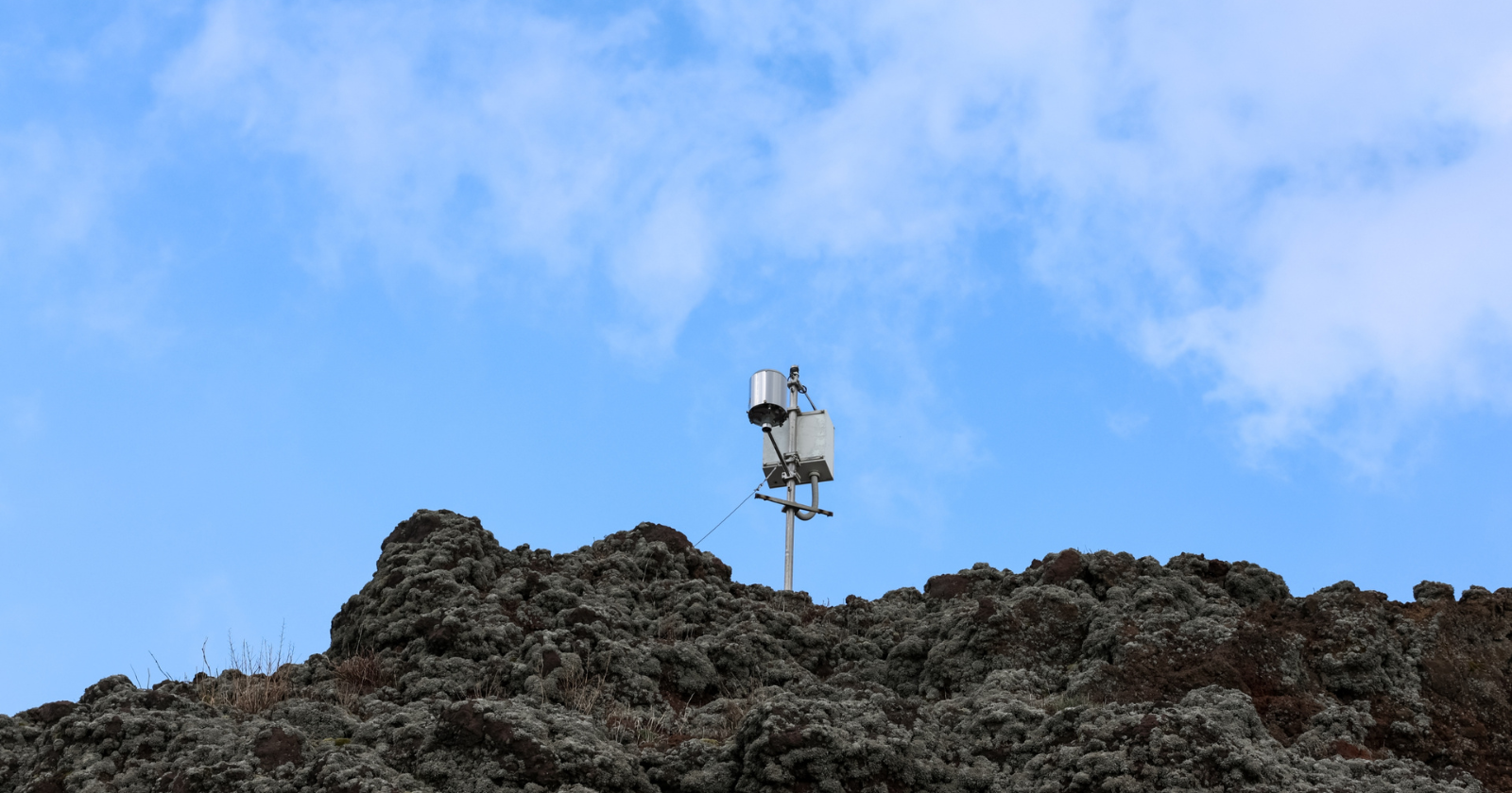
Scientists spent two months in 2023 laying more than 1,800 seismic sensors across the summit of Kilauea, one of the densest seismic surveys ever run on a volcano. The project, led by the US Geological Survey’s Hawaiian Volcano Observatory (HVO) with several university partners, aimed to build the clearest picture yet of the rock and magma sitting beneath a caldera that has collapsed, refilled and erupted repeatedly over the past decade.
The numbers, drawn from an account of the project published in Eos, the magazine of the American Geophysical Union, and from HVO’s own updates, are large. The field team deployed 1,815 individual sensor nodes, recorded close to 35,000 earthquakes within 30 kilometres of the summit during the deployment, and ended up with almost 200 million separate waveform recordings to sort through.
That’s an unusual amount of data to gather from a single mountain in one field season.
How the array actually worked
Most of the sensors, 1,580 of them, were three-component nodes borrowed from the PASSCAL instrument pool run by the Incorporated Research Institutions for Seismology (IRIS). Another 83 were SmartSolo units and 152 came from Geophysical Technology Inc. According to HVO, field crews began placing the nodes on 17 April 2023 and kept them recording continuously into June, blanketing the summit caldera, known by its Hawaiian name Kaluapele, and the surrounding rift zones in a way no previous Kilauea survey had managed. Much of that ground is fresh lava rock or steep crater wall, so field crews carried nodes in by hand and on foot across terrain that ordinary hikers are kept well away from.
Within 5 kilometres of the centre of Kaluapele, the network picked up more than 8,500 shallow earthquakes. A further 25,000-plus were recorded further out, taking the total across the 30-kilometre study area to roughly 35,000. In May, researchers added an active-source layer to the passive listening: a 34-tonne vibroseis truck nicknamed T-Rex, brought over from the University of Texas at Austin, sent controlled seismic pulses into the ground at several hundred sites so the team could compare how those signals travelled compared with natural earthquake waves.
Processing a dataset that size is its own undertaking. HVO’s partners on the project included the University of Miami, Rensselaer Polytechnic Institute and the University of Hawaii at Hilo, and the resulting earthquake catalogue has already been released publicly through the USGS data system, even as the deeper structural modelling continues.
Why a survey like this matters for a volcano this visited
Kilauea sits inside Hawaii Volcanoes National Park, and the summit area, with its overlooks onto Halemaumau crater, is the park’s main drawcard. Visitation is often quoted at around a million people a year, but the National Park Service’s own figures put it higher: 1,620,294 recorded visits in 2023, the same year as the seismic survey, a rise of about 2.5 percent on 2022 and roughly 27.5 percent above 2008 numbers. That count is for the whole park rather than the summit precincts alone, but the caldera rim is where the bulk of that traffic goes, so the volcano the sensors were listening to is one a lot of people stand on top of most days of the year.
HVO already runs a permanent network of seismometers, tiltmeters, GPS stations and gas sensors on Kilauea, and uses that combination to track unrest and decide when trails and overlooks need to close. What the 2023 array adds is depth. A permanent network built for monitoring is good at telling scientists when something is happening; a dense temporary array like this one is built to help work out where, in three dimensions, magma is actually stored and how it moves between the summit reservoir and the volcano’s rift zones. Kaluapele collapsed dramatically in 2018 during a lower rift eruption, then refilled with lava over several eruptive episodes from late 2020 onward, and researchers want to know whether the plumbing underneath has changed shape as a result.
Much of what HVO currently knows about the depth of Kilauea’s magma comes from indirect methods: ground deformation measured by GPS and tilt instruments, and geochemical analysis of gas bubbles trapped in crystals from erupted rock. That work already points to two main storage zones, a shallow chamber under Halemaumau crater at roughly 1 to 2 kilometres depth, and a deeper one under the south part of the caldera at around 3 to 5 kilometres, according to HVO’s own public updates. A dense seismic array offers a more direct way to check that picture, because earthquake waves travel differently through molten and solid rock, and change speed and shape as they cross the edges of a magma body.
What the data can and can’t tell us yet
What this project has and hasn’t delivered so far is worth spelling out. The 1,815 sensors produced an unusually rich raw dataset and an earthquake catalogue, both useful on their own. But turning 200 million waveforms into an actual three-dimensional map of the crust, the kind of tomographic model that would show the size and depth of magma bodies, takes far longer than the recording itself did.
That modelling is still underway.
As of the most recent public reporting on the project, the detailed structural results had not yet appeared as a peer-reviewed paper, so any claims about exactly what shape Kilauea’s plumbing has turned out to be should be treated as provisional. A dense seismic survey like this is also, by nature, a snapshot: it describes the volcano’s structure during a specific two-month window in 2023, not a forecast of what it will do next. HVO has been careful in its own updates to frame the project as imaging work that will feed into hazard assessments over time, rather than a tool that predicts eruptions on its own.
That gap doesn’t make the dataset less useful. It just means the actual picture of what’s under Kilauea’s summit is still being assembled from those 200 million recordings, one waveform at a time.