

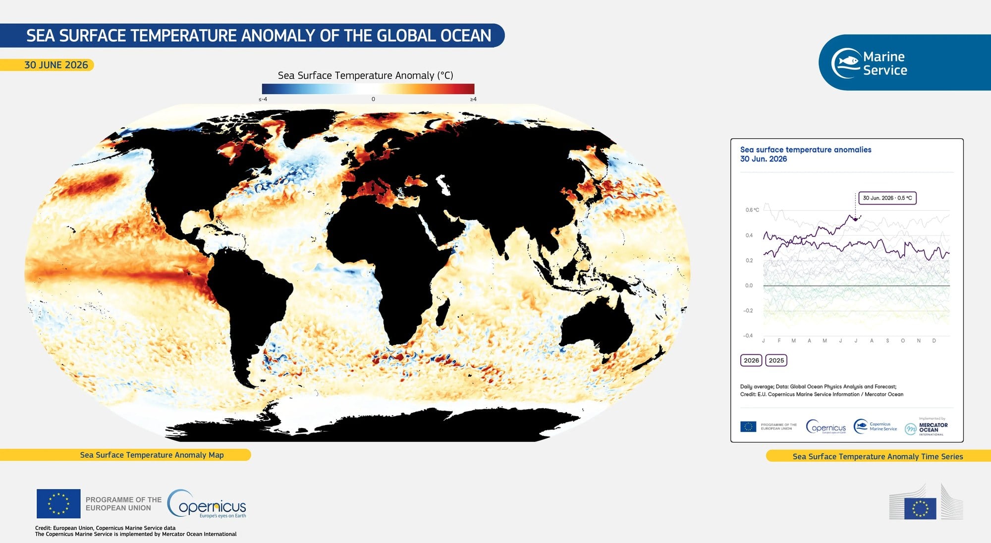
The world’s oceans are hotter than instruments have ever recorded them, the Associated Press reports, with the European Union’s Copernicus climate service announcing over the weekend that the global average sea surface temperature reached 21.1 degrees Celsius (70 degrees Fahrenheit) on Friday and Saturday — narrowly above the previous daily record set in March 2024 — as a still-strengthening El Niño and decades of fossil-fuel warming press on the same body of water at the same time.
The scale of that overlap, and why researchers are watching the calendar as closely as the thermometer, is laid out in the Associated Press video report drawing on the Copernicus announcement.
A record set in the wrong month
The number itself is a small margin — a fraction of a degree over a mark set less than eighteen months earlier — but the date is what has drawn attention from the scientists quoted by AP. Global sea surface temperature is not a flat line through the year. It has a seasonal shape, driven mostly by the Southern Hemisphere, where ocean covers far more of the planet’s surface than land does. The global average normally tops out in March or April, at the tail of the southern summer, then eases off as the southern ocean tips into autumn and winter.
This record was set in August. That is the trough end of the cycle, the part of the year when the global figure is supposed to be well below its annual high. Samantha Burgess, strategic climate lead at Copernicus, told AP that because the peak of the seasonal curve is still months away, the oceans are likely to keep warming from here — plausibly until El Niño itself reaches full strength, which she and other forecasters expect sometime between November and January.
That leaves an unusual gap between the record and the mechanism most likely to extend it. An August high in a March-peaking system is not the end of a warming stretch; it is a reading taken partway up. Copernicus, which builds its estimates from satellite observations, buoy and ship data and model reanalysis, publishes the global daily figure continuously, so the run-up will be visible in near-real time rather than confirmed in retrospect.
The record was reported internationally over the weekend, with Al Jazeera noting the intensifying El Niño alongside the temperature figure.
Two heat sources, one ocean
What makes the current reading difficult to file under a single cause is that two distinct processes are adding warmth to the same water on very different timescales, and they happen to be doing it together.
The first is the long-run trend. Burgess told AP that warming driven by the burning of coal, oil and gas has raised ocean temperatures by 0.8 degrees Celsius (1.4 degrees Fahrenheit) over the long term. The ocean absorbs the large majority of the extra heat trapped in the climate system, which is why sea surface temperature is treated as one of the steadier indicators available — it moves slowly, it integrates, and it does not swing with a single weather system.
The second is cyclical. El Niño is a natural redistribution of heat across the tropical Pacific, in which weakened trade winds allow warm surface water to spread eastward and suppress the cold upwelling that normally runs along the coast of South America. It comes and goes on a rough three-to-seven-year rhythm, it raises the global average temperature while it lasts, and it fades. AP describes the current event as a supersized El Niño that is still growing, with forecasters expecting it to be exceptionally strong at its peak — an expectation, not an observation, and one that will only be settled when the peak arrives.
Neither driver would produce this figure alone. Stacked, the slow floor and the fast spike arrive on the same water in the same month, and the record sits on top of both.
What scientists say is at stake
The consequences flagged in the AP account run from chemistry to coastlines. Warmer seawater holds less dissolved oxygen and grows more acidic, a combination that squeezes the habitable range for marine species already living near their thermal limits. Warmer surface water also feeds the atmosphere above it: storms drawing on it tend to carry more rain, and higher sea levels combined with stronger systems mean larger storm surge when those systems make landfall. Coastal communities feel the shift at night, when heat held in nearby water keeps overnight temperatures from dropping as far as they otherwise would.
Fisheries are the sharpest near-term concern raised by the researchers AP spoke with. Boris Worm and John Bruno both warned about stress on marine life under sustained heat, and the Peruvian anchovy fishery — one of the largest single-species catches in the world, and one that depends on the cold upwelling El Niño shuts down — typically collapses during these events. That is a documented pattern in past El Niños rather than a forecast for this one.
Coral sits on a narrower margin still. Bruno’s framing, as reported by AP, is that the amount of heat-sensitive coral alive today is roughly one-fifth of 1990s levels, which leaves a reduced base to absorb another heat-stress season.
What Copernicus has published is a daily average that crossed a threshold in the wrong month, with the seasonal peak and the El Niño peak both still ahead. The scientists quoted by AP are describing risks, not verdicts. The next several months of the same data series will show whether the August figure was the high mark or the first one.