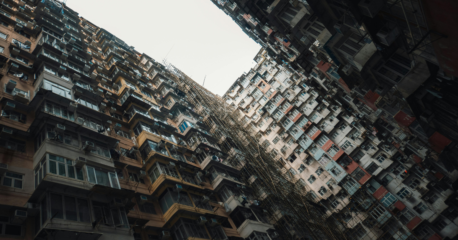
You could have walked the full length of Kowloon Walled City in under three minutes, if the alleys had run in straight lines. They did not. The block measured 210 metres by 120 metres, about 2.6 hectares, and by the late 1980s it held somewhere between 33,000 and 50,000 people inside roughly 300 interconnected buildings that no architect ever drew.
It sat in Kowloon City, a short walk from an active international airport, and it existed because of a paperwork gap.
A legal accident, then a building site
The Convention for the Extension of Hong Kong Territory of 1898 leased the New Territories to Britain for 99 years, and China retained the small Qing garrison city at Kowloon as an enclave. What followed was less shared administration than a mutual reluctance to administer it at all. British authorities largely declined to enforce their codes inside the boundary, and Chinese authorities were in no position to enforce theirs. Refugees arrived in numbers after the Second World War, and the site began to fill.
The wall itself did not survive. Its granite was pulled down during the Japanese occupation and used in the expansion of Kai Tak Airport, which left a walled city with no wall and a boundary that existed mainly on paper and in the minds of the people building inside it.
Building without a building code
Construction accelerated through the 1960s and 1970s. Rather than clear sites, builders added storeys on top of what already stood, sometimes extending a taller neighbour out over a shorter one. Residents cut through party walls to reach adjoining staircases. On the upper levels, corridors were joined until it was possible to cross the block from one side to the other without returning to ground level, and difficult to tell where one owner’s building ended and the next began.
An infographic compiled by the South China Morning Post, reproduced by ArchDaily, put most of the block’s 350-odd buildings at between 10 and 14 storeys, a typical flat around 23 square metres, and the alleys between structures often just one to two metres wide. At ground level the lanes were lit by fluorescent tubes because daylight did not reach them. Pipes leaked overhead, so people carried umbrellas indoors.
Water came from a small number of municipal standpipes supplemented by wells, pumped up to tanks on the roofs. Electrical supply was frequently tapped rather than metered, and the cabling grew across walkways and through floors as access points were cut off and remade.
Why the ceiling was 14 storeys
The one rule the builders consistently respected was not a building rule at all. Kai Tak Airport lay about 800 metres to the south, and the block sat under the approach. Going higher meant interfering with aircraft, which would have forced a response from the colonial government that nobody inside had any interest in provoking.
So the density went sideways and inward instead of up.
The roofs became the closest thing the place had to open ground: water tanks, television antennas, washing lines, ladders bridging one building to the next, and children flying kites within sight of descending airliners.
The density figure, and what it rests on
The number that gets quoted almost everywhere traces back to a Hong Kong government survey in 1987, which put the population at roughly 33,000. Divided across 2.6 hectares, that works out to somewhere near 1.25 million people per square kilometre. Estimates of 50,000 residents circulate widely and would push the figure higher, but they rest on looser ground than the survey does.
The Post put the block at around 3.25 million people per square mile against a figure of roughly 17,000 for Hong Kong as a whole. That figure belongs to a settlement someone actually went in and counted, which puts it in different company from most historical claims about crowded places.
The record needs a second correction, this one about crime. The enclave was run in part by triad operations through the 1950s and 1960s, and a sustained police campaign in the 1970s reduced that considerably. By 1983 the district police commander was describing the crime rate as under control. The photographers Greg Girard and Ian Lambot, who worked inside the block between 1986 and 1992 for City of Darkness, spent much of the later editions of that book arguing against the version of the place that had hardened into legend, and in favour of what residents described: cramped, improvised, and ordinary.
What is left
The Hong Kong government announced the demolition on 14 January 1987. Compensation ran to about HK$2.7 billion, roughly US$350 million at the time, and residents who refused the terms were removed between November 1991 and July 1992. Demolition began on 23 March 1993 and finished in April 1994.
Kowloon Walled City Park opened on the site in December 1995, a 31,000 square metre garden laid out in the Jiangnan style of the early Qing dynasty and now maintained by the Leisure and Cultural Services Department. The yamen building and the remnants of the Old South Gate were declared monuments in 1996. Excavation during the clearance turned up flagstone paving, foundations, cannons and two granite plaques carved with the characters for South Gate and Kowloon Walled City.
The park’s permanent exhibition includes a bronze model of the block at 1:200 and a wall bearing a cross-section drawing of the structure as it stood. That drawing is the closest thing to a plan the place ever had, and it was made after the fact.