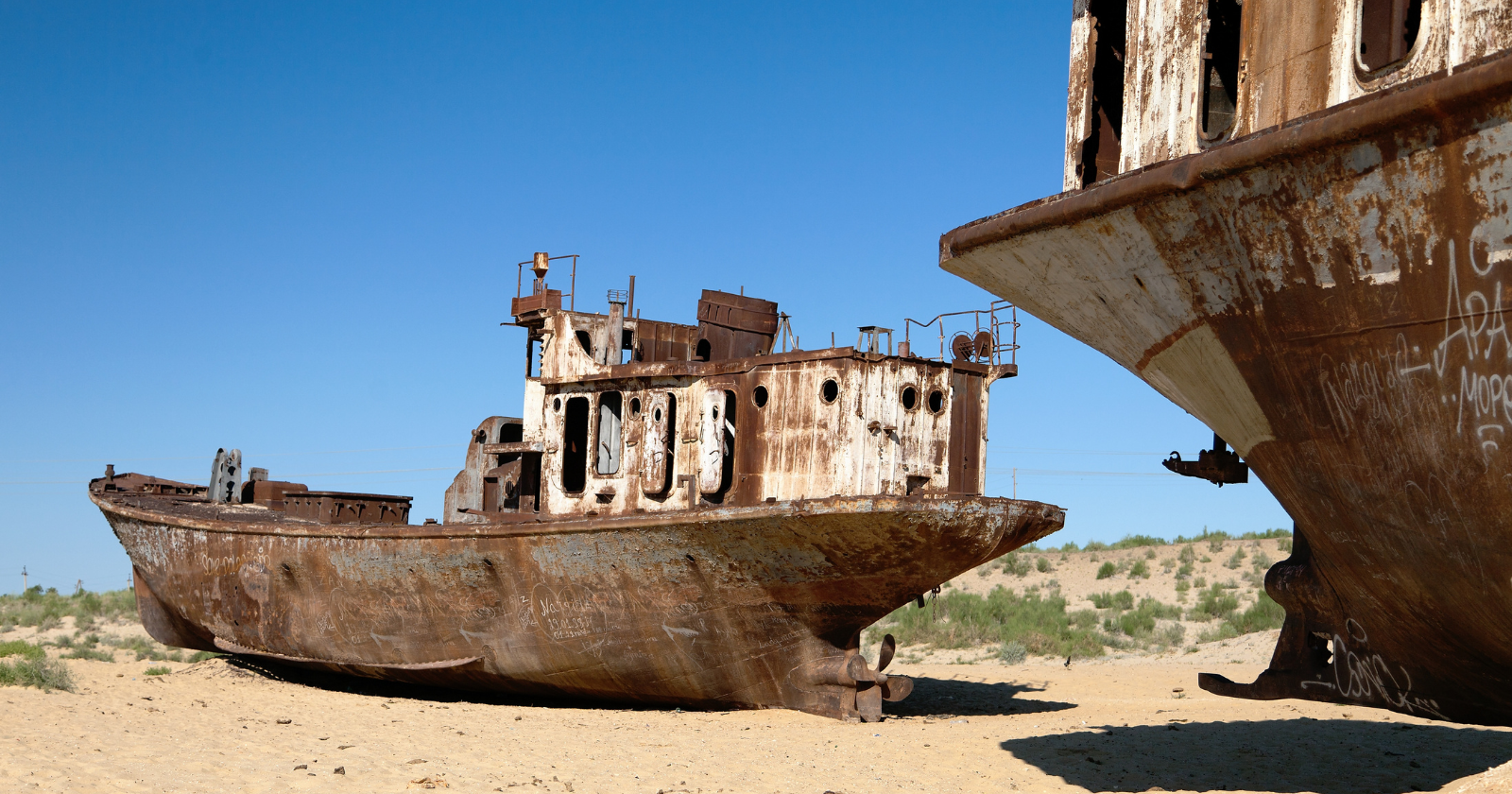
A row of rusting fishing trawlers sits on cracked sand outside Moynaq, in the far west of Uzbekistan, bows still aimed at a horizon that has not held water in decades. Camels pick their way between the hulls. Kids climb the wheelhouses. The nearest shoreline sits more than 100 kilometres away, across a salt flat that used to be seabed.
Moynaq was a port town with a cannery and a fleet.
Then the water left.
How to drain a sea on purpose
Despite the name, the Aral was a lake, a vast saline one straddling what is now the border between Kazakhstan and Uzbekistan, fourth largest on the planet, fed by two rivers running down off the mountains of Central Asia. In the 1950s and 1960s, Soviet planners diverted both of them, the Amu Darya and the Syr Darya, to irrigate cotton across the surrounding desert, a sequence tracked in satellite imagery by NASA’s Earth Observatory.
The cotton part worked. Uzbekistan became one of the world’s biggest exporters of it. Those canals leaked famously, and the lake they had starved began to drop. By 2000 it had split into a northern and a southern basin, and the southern basin had split again into two lobes.
The summer a whole lobe vanished
In August 2014, the eastern lobe of the South Aral stopped existing. Images from NASA’s Terra satellite showed dry ground where the previous summer’s shallows had been. Philip Micklin, a geographer emeritus at Western Michigan University who has followed the lake for decades, told the Earth Observatory that it was probably the first complete drying in 600 years, the last one caused by a medieval diversion of the same river.
Less rain and snow in the Pamir Mountains did some of the work that year. Irrigation withdrawals did the rest.
What replaced the water
The exposed floor has its own name now. The Aralkum is a desert of roughly 60,000 square kilometres made from sediment that spent decades collecting salt, along with the pesticide and fertiliser runoff that washed down the rivers and crystallised there. When the wind gets up, all of that goes airborne and lands on farmland, houses and lungs across Karakalpakstan and neighbouring Khorezm.
A World Bank assessment puts the yearly cost to Karakalpakstan alone at $44.2 million, around 2.1 per cent of what the region produces, with the twenty-year bill running past $844 million if nothing changes.
The island that stopped being an island
Out in the middle of the old lake sat Vozrozhdeniye Island, which for much of the twentieth century served as the Soviet Union’s open-air proving ground for biological weapons.
Plague, anthrax, smallpox, tularemia and botulinum toxin were all released there in field trials, per the Nuclear Threat Initiative, which notes the location was chosen partly because sparse desert shorelines and a ring of water kept unauthorised visitors away. Large quantities of stockpiled anthrax spores were shipped in and buried during the late 1980s.
Then that ring evaporated and the island became a peninsula anyone could drive to. American and Uzbek teams went in during the early 2000s to destroy what was still viable in the burial pits.
The corner that came back
Kazakhstan, holding the northern tip, decided to save the piece it could reach. In 2005 it completed the Kok-Aral dam, a 13 kilometre barrier across the channel joining north to south, built largely with World Bank money. The logic was blunt. Stop northern water bleeding away into a basin already written off, and see what happens.
What happened beat the forecasts. By 2008 the volume of the North Aral had risen by 68 per cent, salinity had halved and fish production had more than tripled, the World Bank reported. The fishermen came home.
Planting a forest on the seabed
South of the dam, the plan changed from refilling the lake to covering it. Uzbekistan’s Forestry Agency has been putting saxaul, a scrubby desert shrub that grips loose sand and shrugs off salt, straight into the dry bed. Around 1.7 million hectares have gone in over five years, as reported by Mongabay, with seed dropped from aircraft and saplings planted behind tractors.
Survival depends almost entirely on rain, and rain in Karakalpakstan has been miserable. Turaxon Ziyotov, a scientist at the Forest Research Institute in Tashkent, told Mongabay that a wet year carries 50 to 70 per cent of saplings through, while a dry one drops it closer to 30.
Nobody working on any of this pretends the sea is coming back. That water grows cotton now, and no government upstream is volunteering to hand it over. What is being assembled instead is a managed compromise, one small lake in the north propped up by a dam, and in the south a forest going in along the outline of a coastline that drowned in reverse.
Which turns the Aral into something closer to a prototype than a warning, because several other inland seas are trending the same direction and somebody is going to want the manual.