The Ocean Discovery League compiled records of approximately 44,000 deep-sea dives for a study published in Science Advances conducted between 1958 and the early 2020s. The dives were carried out by crewed submersibles, remotely operated vehicles, and autonomous underwater vehicles equipped with cameras, across dozens of institutions, flagged to multiple countries. When the League used this dataset to calculate the total area of seafloor that has been directly observed by a camera-bearing vehicle, the result was less than 0.001 per cent of the ocean floor below 200 metres depth.
The area amounts to roughly 2,100 square kilometres. For comparison, the state of Rhode Island covers about 4,000 square kilometres. Six decades of deep-sea exploration, by some of the best-equipped oceanographic programmes in the world, have produced direct visual coverage of the seafloor equivalent to a single small state.
The deep ocean covers approximately 335 million square kilometres.
What direct observation means, and what it does not
The figure requires some care in interpretation, because the deep ocean is not unknown in a simple sense. Acoustic mapping, particularly multibeam sonar, has produced detailed topographic charts of significant portions of the seafloor. The Nippon Foundation-GEBCO Seabed 2030 project, an ongoing international effort, aims to map the entire ocean floor at resolutions suitable for identifying major geological features; current estimates place mapped coverage at roughly 27 per cent of the total area. By some measures, we have higher-resolution topographic data for the surfaces of Mars and the Moon than for Earth’s own ocean floor, though that comparison depends on the resolution threshold used and is contested by some oceanographers.
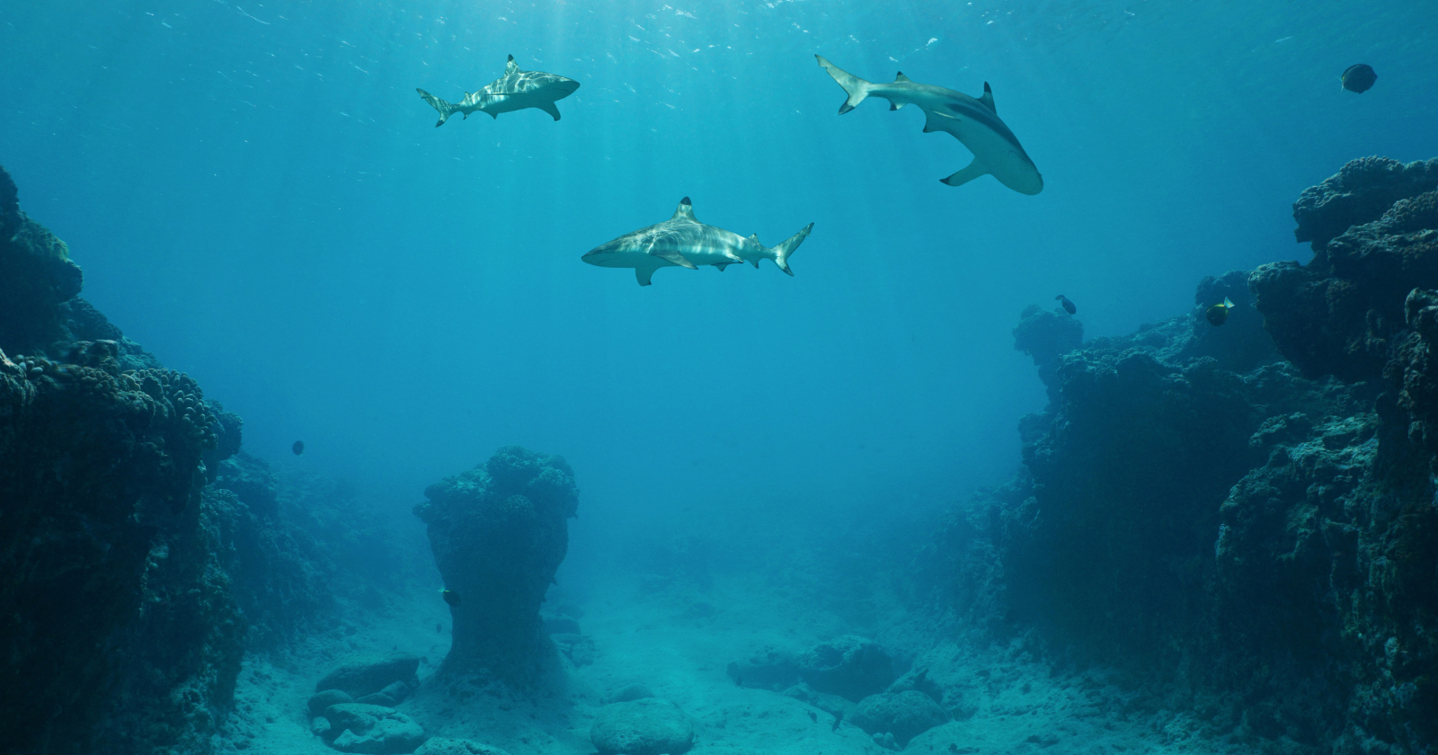
Sonar tells you the shape of the bottom. It does not tell you what lives there. It does not reveal the composition of the substrate at close range, the structure of biological communities on the seafloor, the chemical processes occurring at hydrothermal vents, or the condition and diversity of organisms across different sites. For that kind of knowledge, a vehicle has to get close enough to look.
The Ocean Discovery League dataset measures only this second type of knowledge: the area of seafloor that has been filmed or photographed from a vehicle operating near the bottom. By that definition, the proportion observed is less than 0.001 per cent. This is the specific gap the dataset establishes.
Where the dives went
The approximately 44,000 dives in the dataset are not evenly distributed across the ocean. The analysis shows strong concentrations in the waters around the United States, Japan, and New Zealand, which together with France and Germany account for 97 per cent of all recorded dives. Much of the southern hemisphere and the central Pacific, which together represent a substantial fraction of the global deep ocean, has rarely or never been visited by a camera-equipped vehicle.
Depth distribution is also uneven. A disproportionate share of dives targeted waters between 200 and 2,000 metres, the upper portion of the deep zone. The hadal environment, the ocean trenches below 6,000 metres, remains the least observed of all, despite representing some of the most geologically and biologically distinctive terrain on the planet.
This geographic and depth concentration reflects the practical constraints of deep-sea exploration: where research vessels operate, which institutions have submersibles capable of reaching target depths, and which regions have received sustained scientific interest. It is not a random sample of the ocean.
The comparison with space exploration
The disparity between ocean and space exploration funding has been raised many times, and the Ocean Discovery League’s dataset frames its findings partly against this contrast. NASA’s annual budget has run to roughly 20 to 25 billion US dollars in recent years. The budget dedicated to systematic deep-sea exploration globally is a fraction of that figure.
The comparison has real limits. Space exploration serves scientific, commercial, and strategic objectives that cannot be straightforwardly compared with ocean science. Satellite infrastructure, planetary science, and Earth observation systems generated through space programmes benefit oceanography directly: sea-surface temperature data, altimetry for measuring currents, and biological productivity mapping all depend on orbital assets. The budget comparison obscures these linkages.
The point the dataset makes is narrower: that direct visual survey of the deep ocean has been slow, geographically patchy, and concentrated in a small number of well-resourced institutions, and that after six decades the coverage remains at a fraction of a per cent. Whether that constitutes an appropriate allocation of scientific resources is a policy question the League’s data cannot answer. What the data can establish is the baseline: how much has actually been seen, and how much has not.
What to watch
The Ocean Discovery League has argued that the solution to limited coverage lies in distributed exploration: more, smaller, lower-cost vehicles deployed from a broader base of institutions, rather than a small number of large research vessels and deep-rated submersibles. The economics of remotely operated vehicles have shifted enough in the past decade that capable systems are now accessible to research universities and smaller oceanographic institutions that could not previously have operated them.
Whether distributed deployment produces systematic coverage at meaningful scale is an open question. Approximately 44,000 dives across sixty years represent an enormous cumulative effort; the remaining area is not a minor gap. The dataset’s value, as the League frames it, is establishing a rigorous baseline rather than offering an easy remedy. Before this analysis, the scale of the gap was estimated. Now it is measured.