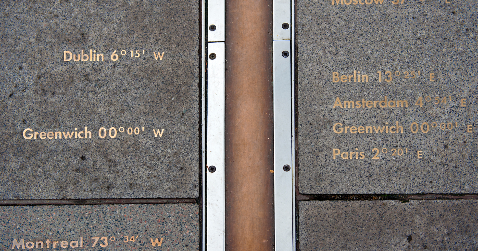
There is a brass strip embedded in the flagstones of the courtyard behind the Royal Observatory in Greenwich, southeast London, that runs north to south for about twenty metres. Every tourist who visits the observatory takes a photograph of themselves standing with one foot on either side of it. That’s the whole point of the visit. The brass strip marks the Prime Meridian of the World, which is by international convention the line of zero degrees longitude, the line from which every point on Earth measures its east-west position, and the boundary between the eastern and western hemispheres of the planet. Roughly a million people stand on it every year.
There is, however, a small logistical problem. The line is in the wrong place. Zero degrees longitude, as measured by the GPS satellite in the phone in each tourist’s pocket, actually runs about 102 metres east of the brass strip. The tourists standing on the historic marker have both feet in the eastern hemisphere. Nobody has bothered to move the brass strip because the question of what to do about the discrepancy turns out to be more complicated than it first appears.
How they measured the meridian in the first place
The Airy Transit Circle, which is the telescope that established the position of the Greenwich Meridian in the mid-nineteenth century, was installed in 1850 by the seventh Astronomer Royal, Sir George Airy. It was a large fixed telescope capable of pointing only along a single north-south vertical arc. Its purpose was to observe the exact moment when particular stars crossed the local meridian directly overhead each night. From those observations, the observatory’s astronomers could establish local time to within a fraction of a second and could serve as the master timekeeping reference for the entire British Empire. In 1884, at the International Meridian Conference held in Washington DC, twenty-two of the twenty-five participating nations voted to formally adopt the meridian passing through the centre of the Airy Transit Circle as the Prime Meridian of the World.
According to a 2015 University of Virginia press release detailing the research of astronomer Ken Seidelmann and his colleagues at the U.S. Naval Observatory, the National Geospatial-Intelligence Agency, and Analytical Graphics Inc., the problem with Airy’s method was not that the telescope was inaccurate. The telescope was extraordinarily accurate for its time. The problem was that the reference direction it used to define what “straight up” meant on the Earth’s surface was not quite the same reference direction that a modern GPS satellite uses. Airy’s astronomers established local vertical using a photographic zenith tube, which was essentially a telescope pointed at the sky through a basin of liquid mercury on the observatory floor. The reflection of a star in the perfectly flat surface of the mercury basin gave them a physical reference for a truly vertical line at the observatory. That line was then used to define the position of the meridian.
The trouble is that a basin of mercury on the floor at Greenwich does not point at the geometric centre of the Earth. It points at whatever direction the local gravitational field is pulling downwards. The local gravitational field is not the same everywhere on the surface of the planet. It is subtly deflected by variations in the density of the underlying rock, by nearby mountains, and by the general fact that the Earth is not a perfect sphere. At Greenwich, the local field is deflected about 5.3 arcseconds east of the direction that would point straight to the true geometric centre. That is a tiny angle. Multiplied across the distance from the surface to the centre of the planet, it works out to a horizontal displacement of about 102 metres.
How GPS changed the answer
The shift didn’t happen when GPS was invented. It happened in 1984, when the Bureau International de l’Heure in Paris, which was then responsible for maintaining the global timekeeping and coordinate reference systems, decided to switch from measuring longitudes based on local astronomical observations to measuring them based on geometric distances from a satellite-determined centre of the Earth. According to Space.com’s 2016 explanation by science journalist Nola Taylor Tillman, drawing on interviews with Seidelmann and on the underlying paper published in the Journal of Geodesy, the Bureau faced a choice at that moment. They could either preserve the historical longitudes and let the time zones shift by a few seconds to match the new coordinate system, or they could preserve the time zones and let the longitudes shift by about 100 metres to match. They chose the second option. A discontinuity in international timekeeping would have been catastrophic for navigation, communications, financial systems, and every other clock-dependent activity on the planet.
The consequence was that from 1984 onwards, the coordinate system used by every satellite navigation instrument built afterwards was subtly offset from the coordinate system used by every historic observatory built beforehand. When GPS receivers started to become commercially available in the 1990s, and then ubiquitous in the 2000s, the discrepancy at Greenwich became directly visible to any tourist who bothered to check. You could stand on the brass strip and watch the coordinates on your phone read something like 0.00151° west rather than 0.00000°. You could walk east through the courtyard, past the observatory buildings and across the park, and about 102 metres later the coordinates would tick over to zero. Marek Kukula, the public astronomer at the Royal Observatory, has said in interviews that visitors regularly and helpfully point this out to the staff, apparently under the impression that nobody at the observatory has noticed.
The Seidelmann paper additionally investigated whether the shift was unique to Greenwich or applied globally. What they found was that the offset varied from observatory to observatory around the world, meaning that the direction and magnitude of the shift depended on the local gravitational conditions at each site. The scientific community’s response was to acknowledge the discrepancies, preserve the historical markers as historical markers, and accept that on the current coordinate system, zero longitude runs where the satellites say it runs. Tourists continue to take their photographs on the brass strip because it’s more culturally satisfying than standing in a random spot in a park 102 metres to the east that looks exactly like every other patch of grass. The observatory continues to sell tickets on the strength of a line that hasn’t actually marked the prime meridian for more than forty years.