| . |  |
. |
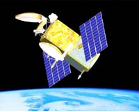
Pasadena CA (SPX) Apr 12, 2006 NASA has signed an agreement with other U.S. and international agencies to launch the Ocean Surface Topography Mission in 2008. The satellite, named Jason-2, will increase our understanding of ocean circulation and improve climate forecasts and measurements of global sea-level change. The three- to five-year mission will extend the ocean topography measurements collected since 1992, first by Topex/Poseidon and now by Jason. NASA is cooperating with the National Oceanic and Atmospheric Administration, France's Centre National d'Etudes Spatiales and the European Organisation for the Exploitation of Meteorological Satellites on this mission. "This agreement substantially advances the continuation of a long-term record of sea-level measurements based on satellite measurements of sea level height, which are needed to understand ocean circulation and its long-term climate effects," said Eric Lindstrom, NASA's Ocean Surface Topography Mission program scientist. The mission will also study how ocean circulation varies from season to season, from year to year and from decade to decade. It will improve the measure of global sea-level change and models of tides in the open ocean. Operational organizations and researchers will use the data in marine meteorology and sea-state forecasting, operational oceanography, seasonal forecasting, climate and ocean monitoring and Earth and climate research. NASA will provide several of the mission's science instruments, including an advanced microwave radiometer, laser retroreflector array and global positioning system payload receiver package. NASA will also provide launch services on a Boeing Delta II rocket. The National Oceanic and Atmospheric Administration will provide a satellite-control center, stations for commanding the spacecraft and acquiring data, data processing, and the infrastructure for archiving and distributing mission data. After the satellite's launch and an engineering assessment, Centre National d'Etudes Spatiales will hand over management of the satellite to them. Centre National d'Etudes Spatiales will provide a Proteus satellite platform and payload module. They will also provide several of the science instruments, including a Poseidon-3 dual-frequency radar altimeter and the Doppler Orbitography and Radiopositioning Integrated by Satellite orbit-determination system. In addition, they will provide a satellite command and control center, data processing and infrastructure for archiving and distributing mission data. The European Organisation for the Exploitation of Meteorological Satellites will provide a site and infrastructure for the European Earth terminal, which will be integrated into the organization's ground segment infrastructure. They will also provide data processing and an infrastructure for archiving and distributing mission data. The agreement was signed April 10. Related Links Ocean Surface Topography Mission
 Greenbelt MD (SPX) Apr 12, 2006
In the 1950s, oil exploration in Libya turned up another valuable resource: water. Huge aquifers, underground deposits of sand and rock that also contain water, lurked underneath the scorching sands. |
|
| The content herein, unless otherwise known to be public domain, are Copyright 1995-2006 - SpaceDaily.AFP and UPI Wire Stories are copyright Agence France-Presse and United Press International. ESA PortalReports are copyright European Space Agency. All NASA sourced material is public domain. Additionalcopyrights may apply in whole or part to other bona fide parties. Advertising does not imply endorsement,agreement or approval of any opinions, statements or information provided by SpaceDaily on any Web page published or hosted by SpaceDaily. Privacy Statement |